Area Overview for S63 9GG
Photos of S63 9GG
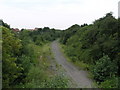
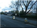
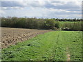
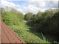
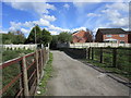
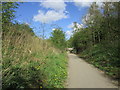
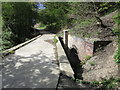
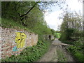
36 photos from this area
Area Information
Key information about the S63 9GG including its size, population, and administrative classification.
- Area Type
- Postcode
- Area Size
- 1.9 hectares
- Population
- 1898
- Population Density
- 1859 people/km²
House Prices in S63 9GG
27
Properties
£169,981
Average Sold Price
£96,000
Lowest Price
£350,000
Highest Price
Showing 27 properties
| Address | Type | Beds | Baths | Last Sale Price | Last Sale Date | |
|---|---|---|---|---|---|---|
| 28 Rosegreave, Goldthorpe, Barnsley, S63 9GG | Detached | 4 | 2 | £255,000 | Aug 2025 | |
| 18 Rosegreave, Goldthorpe, Barnsley, S63 9GG | house | 3 | 1 | £167,500 | Jan 2025 | |
| 23 Rosegreave, Goldthorpe, Barnsley, S63 9GG | house | 4 | 2 | £151,000 | Aug 2024 | |
| 30 Rosegreave, Goldthorpe, Barnsley, S63 9GG | Detached | 5 | 4 | £350,000 | Jul 2024 | |
| 36 Rosegreave, Goldthorpe, Barnsley, S63 9GG | Semi-detached | 4 | 2 | £155,000 | Jan 2024 | |
| 19 Rosegreave, Goldthorpe, Barnsley, S63 9GG | Detached | 4 | 3 | £255,000 | Jul 2023 | |
| 10 Rosegreave, Goldthorpe, Barnsley, S63 9GG | Detached | 4 | 2 | £217,500 | May 2021 | |
| 25 Rosegreave, Goldthorpe, Barnsley, S63 9GG | Semi-detached | 4 | 2 | £144,000 | Aug 2020 | |
| 6 Rosegreave, Goldthorpe, Barnsley, S63 9GG | Detached | 4 | 1 | £194,000 | Aug 2019 | |
| 24 Rosegreave, Goldthorpe, Barnsley, S63 9GG | Detached | 4 | 2 | £172,500 | Jul 2019 |
Page 1 of 3
Energy Efficiency in S63 9GG
Amenities
Schools
| Rank | School | Type | Entry gender | Ages |
|---|
Explore more schools in this area
Go to Schools tabDemographics
Household Size
Two person
most common
Accommodation Type
Houses
most common
Tenure
63
majority
Ethnic Group
White
most common
Religion
N/A
most common
Household Composition
N/A
most common
Age
47
median
Adults (30-64 years)
most common
Household Deprivation
N/A
with no deprivation
NS-SEC
20
in Lower managerial occupations
Explore more demographic insights in this area
Go to Demographics tabPlanning
Planning Constraints
- Flood RiskPremium
- Ramsar Wetland SitesPremium
- Area of Outstanding Natural BeautyPremium
- Protected Nature ReservePremium
- Protected WoodlandPremium