Area Overview for S63 8NF
Photos of S63 8NF
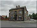

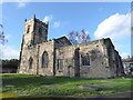

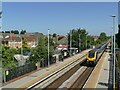
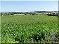
30 photos from this area
Area Information
Key information about the S63 8NF including its size, population, and administrative classification.
- Area Type
- Postcode
- Area Size
- 2.1 hectares
- Population
- 2263
- Population Density
- 1690 people/km²
House Prices in S63 8NF
55
Properties
£94,133
Average Sold Price
£36,750
Lowest Price
£190,000
Highest Price
Showing 55 properties
| Address | Type | Beds | Baths | Last Sale Price | Last Sale Date | |
|---|---|---|---|---|---|---|
| 21 Watermead, Bolton Upon Dearne, Barnsley, S63 8NF | Semi-detached | 3 | 1 | £150,000 | Aug 2025 | |
| 33 Watermead, Bolton Upon Dearne, Barnsley, S63 8NF | house | - | - | £190,000 | Apr 2023 | |
| 61 Watermead, Bolton Upon Dearne, Barnsley, S63 8NF | house | - | - | £90,000 | Oct 2022 | |
| 10 Watermead, Bolton Upon Dearne, Barnsley, S63 8NF | Bungalow | 2 | 1 | £147,000 | Sep 2022 | |
| 26 Watermead, Bolton Upon Dearne, Barnsley, S63 8NF | Retail | 3 | 1 | £157,000 | Aug 2022 | |
| 28 Watermead, Bolton Upon Dearne, Barnsley, S63 8NF | Retail | 2 | 1 | £116,000 | Apr 2022 | |
| 29 Watermead, Bolton Upon Dearne, Barnsley, S63 8NF | Semi-detached | 3 | 1 | £123,000 | Mar 2021 | |
| 50 Watermead, Bolton Upon Dearne, Barnsley, S63 8NF | Detached | - | - | £110,000 | Oct 2015 | |
| 31 Watermead, Bolton Upon Dearne, Barnsley, S63 8NF | house | - | - | £132,500 | Apr 2015 | |
| 3 Watermead, Bolton Upon Dearne, Barnsley, S63 8NF | Semi-detached | 3 | - | £92,500 | Sep 2014 |
Page 1 of 6
Energy Efficiency in S63 8NF
Amenities
Schools
| Rank | School | Type | Entry gender | Ages |
|---|
Explore more schools in this area
Go to Schools tabDemographics
Household Size
Two person
most common
Accommodation Type
Houses
most common
Tenure
81
majority
Ethnic Group
White
most common
Religion
N/A
most common
Household Composition
N/A
most common
Age
47
median
Adults (30-64 years)
most common
Household Deprivation
N/A
with no deprivation
NS-SEC
28
in Lower managerial occupations
Explore more demographic insights in this area
Go to Demographics tabPlanning
Planning Constraints
- Flood RiskPremium
- Ramsar Wetland SitesPremium
- Area of Outstanding Natural BeautyPremium
- Protected Nature ReservePremium
- Protected WoodlandPremium