Area Overview for S63 6RD
Photos of S63 6RD
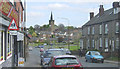

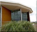
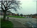
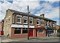


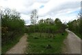
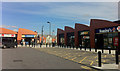
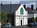
28 photos from this area
Area Information
Key information about the S63 6RD including its size, population, and administrative classification.
- Area Type
- Postcode
- Area Size
- 3830 m²
- Population
- 1425
- Population Density
- 1477 people/km²
House Prices in S63 6RD
21
Properties
£71,563
Average Sold Price
£21,500
Lowest Price
£120,000
Highest Price
Showing 21 properties
| Address | Type | Beds | Baths | Last Sale Price | Last Sale Date | |
|---|---|---|---|---|---|---|
| 21 Princess Street, West Melton, Rotherham, S63 6RD | Terraced | 3 | 1 | £76,000 | Mar 2024 | |
| 39 Princess Street, West Melton, Rotherham, S63 6RD | Terraced | 2 | 1 | £100,000 | Jun 2023 | |
| 13 Princess Street, West Melton, Rotherham, S63 6RD | Retail | 2 | 1 | £110,000 | Mar 2022 | |
| 1 Princess Street, West Melton, Rotherham, S63 6RD | Terraced | 3 | 1 | £120,000 | Apr 2012 | |
| 35 Princess Street, West Melton, Rotherham, S63 6RD | Terraced | - | - | £76,000 | Sep 2006 | |
| 33 Princess Street, West Melton, Rotherham, S63 6RD | house | 3 | - | £34,000 | May 2003 | |
| 37 Princess Street, West Melton, Rotherham, S63 6RD | house | 2 | - | £21,500 | Nov 2001 | |
| 19 Princess Street, West Melton, Rotherham, S63 6RD | Terraced | - | - | £35,000 | Apr 1999 | |
| Social Eyes, Former Princess Street Methodist Church, Princess Street, West Melton, Rotherham, S63 6RD | community_day_centre | - | - | - | - | |
| 17 Princess Street, West Melton, Rotherham, S63 6RD | Terraced | - | - | - | - |
Page 1 of 3
Energy Efficiency in S63 6RD
Amenities
Schools
| Rank | School | Type | Entry gender | Ages |
|---|
Explore more schools in this area
Go to Schools tabDemographics
Household Size
Two person
most common
Accommodation Type
Houses
most common
Tenure
77
majority
Ethnic Group
White
most common
Religion
N/A
most common
Household Composition
N/A
most common
Age
47
median
Adults (30-64 years)
most common
Household Deprivation
N/A
with no deprivation
NS-SEC
28
in Lower managerial occupations
Explore more demographic insights in this area
Go to Demographics tabPlanning
Planning Constraints
- Flood RiskPremium
- Ramsar Wetland SitesPremium
- Area of Outstanding Natural BeautyPremium
- Protected Nature ReservePremium
- Protected WoodlandPremium