Area Overview for S63 0FS
Photos of S63 0FS
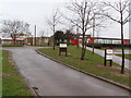
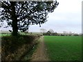
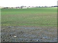
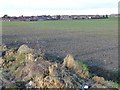
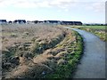
21 photos from this area
Area Information
Key information about the S63 0FS including its size, population, and administrative classification.
- Area Type
- Postcode
- Area Size
- 5942 m²
- Population
- 1693
- Population Density
- 2903 people/km²
House Prices in S63 0FS
64
Properties
£185,328
Average Sold Price
£158,995
Lowest Price
£235,995
Highest Price
Showing 64 properties
| Address | Type | Beds | Baths | Last Sale Price | Last Sale Date | |
|---|---|---|---|---|---|---|
| 83 Bluebell Way, Thurnscoe, Barnsley, S63 0FS | house | - | - | £235,995 | Jan 2025 | |
| 65 Bluebell Way, Thurnscoe, Barnsley, S63 0FS | house | - | - | £209,995 | Jan 2025 | |
| 75 Bluebell Way, Thurnscoe, Barnsley, S63 0FS | house | - | - | £191,995 | Jan 2025 | |
| 71 Bluebell Way, Thurnscoe, Barnsley, S63 0FS | house | - | - | £169,995 | Dec 2024 | |
| 73 Bluebell Way, Thurnscoe, Barnsley, S63 0FS | house | - | - | £167,995 | Dec 2024 | |
| 23 Bluebell Way, Thurnscoe, Barnsley, S63 0FS | house | - | - | £179,995 | Feb 2024 | |
| 21 Bluebell Way, Thurnscoe, Barnsley, S63 0FS | house | - | - | £162,995 | Feb 2024 | |
| 19 Bluebell Way, Thurnscoe, Barnsley, S63 0FS | Semi-detached | 2 | 1 | £158,995 | Jan 2024 | |
| 9 Bluebell Way, Thurnscoe, Barnsley, S63 0FS | Detached | 3 | 2 | £189,995 | Jan 2024 | |
| 127 Bluebell Way, Thurnscoe, Barnsley, S63 0FS | Detached | 4 | 2 | - | - |
Page 1 of 7
Energy Efficiency in S63 0FS
Amenities
Schools
| Rank | School | Type | Entry gender | Ages |
|---|
Explore more schools in this area
Go to Schools tabDemographics
Household Size
One person
most common
Accommodation Type
Houses
most common
Tenure
44
majority
Ethnic Group
White
most common
Religion
N/A
most common
Household Composition
N/A
most common
Age
47
median
Adults (30-64 years)
most common
Household Deprivation
N/A
with no deprivation
NS-SEC
18
in Lower managerial occupations
Explore more demographic insights in this area
Go to Demographics tabPlanning
Planning Constraints
- Flood RiskPremium
- Ramsar Wetland SitesPremium
- Area of Outstanding Natural BeautyPremium
- Protected Nature ReservePremium
- Protected WoodlandPremium