Area Overview for S62 7TN
Photos of S62 7TN
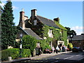
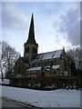

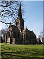
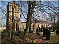
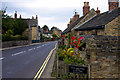
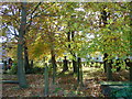
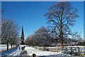
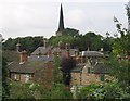
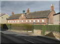
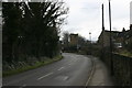
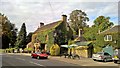
100 photos from this area
Area Information
Key information about the S62 7TN including its size, population, and administrative classification.
- Area Type
- Postcode
- Area Size
- 9.3 hectares
- Population
- 1397
- Population Density
- 63 people/km²
House Prices in S62 7TN
61
Properties
£87,500
Average Sold Price
£87,500
Lowest Price
£87,500
Highest Price
Showing 61 properties
| Address | Type | Beds | Baths | Last Sale Price | Last Sale Date | |
|---|---|---|---|---|---|---|
| 105A Main Street, Wentworth, Rotherham, S62 7TN | Cottage | 2 | 1 | £87,500 | Jun 2003 | |
| Carlton House, 70 Main Street, Wentworth, Rotherham, S62 7TN | Detached | - | - | - | - | |
| 79 Main Street, Wentworth, Rotherham, S62 7TN | house | - | - | - | - | |
| Wingham Wool, Store At, Carlton House, 70 Main Street, Wentworth, Rotherham, S62 7TN | warehouse | - | - | - | - | |
| Accomodation At, 34 Main Street, Wentworth, Rotherham, S62 7TN | Detached | - | - | - | - | |
| 63 Main Street, Wentworth, Rotherham, S62 7TN | house | - | - | - | - | |
| 107 Main Street, Wentworth, Rotherham, S62 7TN | house | - | - | - | - | |
| 101 Main Street, Wentworth, Rotherham, S62 7TN | house | - | - | - | - | |
| Greenfield View, 38B Main Street, Wentworth, Rotherham, S62 7TN | Maisonette | - | - | - | - | |
| 52 Main Street, Wentworth, Rotherham, S62 7TN | house | - | - | - | - |
Page 1 of 7
Energy Efficiency in S62 7TN
Amenities
Schools
| Rank | School | Type | Entry gender | Ages |
|---|
Explore more schools in this area
Go to Schools tabDemographics
Household Size
Two person
most common
Accommodation Type
Houses
most common
Tenure
54
majority
Ethnic Group
White
most common
Religion
N/A
most common
Household Composition
N/A
most common
Age
47
median
Adults (30-64 years)
most common
Household Deprivation
N/A
with no deprivation
NS-SEC
36
in Lower managerial occupations
Explore more demographic insights in this area
Go to Demographics tabPlanning
Planning Constraints
- Flood RiskPremium
- Ramsar Wetland SitesPremium
- Area of Outstanding Natural BeautyPremium
- Protected Nature ReservePremium
- Protected WoodlandPremium