Area Overview for S62 7DT
Photos of S62 7DT
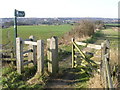
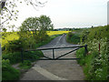
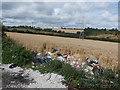
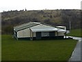
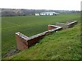


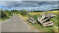
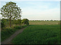
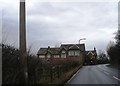
19 photos from this area
Area Information
Key information about the S62 7DT including its size, population, and administrative classification.
- Area Type
- Postcode
- Area Size
- 44.0 hectares
- Population
- 1467
- Population Density
- 2419 people/km²
House Prices in S62 7DT
22
Properties
£170,067
Average Sold Price
£54,000
Lowest Price
£450,000
Highest Price
Showing 22 properties
| Address | Type | Beds | Baths | Last Sale Price | Last Sale Date | |
|---|---|---|---|---|---|---|
| 120 Haugh Road, Rawmarsh, Rotherham, S62 7DT | Terraced | 3 | 1 | £175,000 | Jul 2025 | |
| 108 Haugh Road, Rawmarsh, Rotherham, S62 7DT | Bungalow | 6 | 2 | £450,000 | Sep 2024 | |
| 90 Haugh Road, Rawmarsh, Rotherham, S62 7DT | Detached | 3 | 1 | £255,000 | Nov 2023 | |
| 116 Haugh Road, Rawmarsh, Rotherham, S62 7DT | Semi-detached | 3 | 1 | £202,000 | Aug 2023 | |
| 92 Haugh Road, Rawmarsh, Rotherham, S62 7DT | Bungalow | 2 | 1 | £210,000 | Dec 2020 | |
| 102 Haugh Road, Rawmarsh, Rotherham, S62 7DT | Bungalow | - | - | £182,500 | Jul 2017 | |
| 86 Haugh Road, Rawmarsh, Rotherham, S62 7DT | house | 3 | 1 | £115,000 | Aug 2011 | |
| 106 Haugh Road, Rawmarsh, Rotherham, S62 7DT | house | - | - | £190,000 | Feb 2011 | |
| 98 Haugh Road, Rawmarsh, Rotherham, S62 7DT | Detached | 3 | - | £222,000 | Oct 2007 | |
| 88 Haugh Road, Rawmarsh, Rotherham, S62 7DT | Detached | - | - | £175,000 | Jul 2007 |
Page 1 of 3
Energy Efficiency in S62 7DT
Amenities
Schools
| Rank | School | Type | Entry gender | Ages |
|---|
Explore more schools in this area
Go to Schools tabDemographics
Household Size
Family (3-5 people)
most common
Accommodation Type
Houses
most common
Tenure
52
majority
Ethnic Group
White
most common
Religion
N/A
most common
Household Composition
N/A
most common
Age
47
median
Adults (30-64 years)
most common
Household Deprivation
N/A
with no deprivation
NS-SEC
16
in Lower managerial occupations
Explore more demographic insights in this area
Go to Demographics tabPlanning
Planning Constraints
- Flood RiskPremium
- Ramsar Wetland SitesPremium
- Area of Outstanding Natural BeautyPremium
- Protected Nature ReservePremium
- Protected WoodlandPremium