Area Overview for S62 6YT
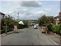
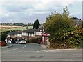
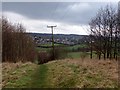
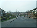
Photos of S62 6YT


Area Information
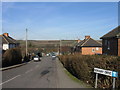
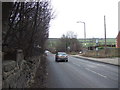
S62 6YT represents a small residential cluster within Rotherham, England, home to a population of 1157 people. This specific postcode area offers a contained living environment where residents coexist within close proximity to one another. The locality serves as a quiet residential zone, distinct from the larger urban sprawl surrounding it. Living in S62 6YT means choosing a neighbourhood defined by its manageable size and established character. You will find that daily life centres around local routines and neighbourhood familiarity rather than navigating vast metropolitan distances. The area functions as a self-contained community unit where neighbours interact regularly and local services are within easy reach. This small footprint ensures that everything from daily shopping to station commutes remains accessible without significant travel time. The residential cluster maintains a consistent identity, separate from the high-density zones further away. Families and long-term residents appreciate the stability this environment provides.
- Area Type
- Postcode
- Area Size
- Not available
- Population
- 1157
- Population Density
- 453 people/km²
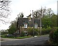
S62 6YT operates primarily as an owner-occupied market rather than a rental hub. With 75% home ownership rates, the housing stock is dominated by individuals who have invested in their local properties. The predominant accommodation type consists of houses, distinguishing this area from urban flats or(condominium-style developments seen in other parts of Rotherham. Buying here means joining a community where nearly three-quarters of neighbours hold title deeds to their residences. This high ownership percentage suggests properties are often larger and更适合 long-term living rather than short-term letting arrangements. Buyers looking at homes in S62 6YT will find an environment geared towards stability rather than turnover. The presence of houses as the primary dwelling type supports families requiring gardens and private space. Transaction volumes likely reflect this steady nature, with sales occurring at a measured pace rather than in waves of short-term moves. For purchasers entering this market, the expectation should be dealing with owners who plan to remain in the area for years.
House Prices in S62 6YT
No properties found in this postcode.
Energy Efficiency in S62 6YT
Residents of S62 6YT benefit from a practical network of amenities within immediate practical reach. Supermarket options include Co-op Greasborough, Asda Parkgate, and Farmfoods Rawmarsh for daily shopping requirements. Metro transport links connect you to Parkgate, Rotherham Platform Both Directions, and Meadowhall South. Rail access extends to Rotherham Central Railway Station, Meadowhall Railway Station, and Medowhall Railway Station for longer-distance travel. These five retail outlets provide comprehensive grocery and convenience needs without requiring long daily commutes. The five metro services ensure efficient travel to key business districts and shopping centres. Travelers can reach Rotherham Central Railway Station or Meadowhall Railway Station to expand their national transport options. This amenity density allows you to manage weekly errands locally while maintaining access to broader urban services when required. The combination of nearby retail parks and train stations creates a convenient lifestyle balance. You can settle into a quiet home while keeping major facilities just minutes away.
Amenities
Schools
| Rank | School | Type | Entry gender | Ages |
|---|
Explore more schools in this area
Go to Schools tabDemographics
The community in S62 6YT displays a clear demographic profile focused on mature households. The median age sits at 47 years, confirming that adults between the ages of 30 and 64 form the most common age range in the locality. This age distribution aligns with areas populated by families with older children and established homeowners rather than young professional renters. Home ownership stands at 75%, indicating a strong sense of local permanence and investment by residents. Most accommodation consists of houses, which supports the presence of larger families and multi-generational living arrangements. The predominant ethnic group is White, reflecting the majority cultural makeup of the neighbourhood. With 75% of residents owning their homes, the area lacks a significant transient rental population. This static population structure contributes to a stable social environment where community bonds tend to be stronger. The absence of a large student or young professional demographic shapes social activities and local business demands in predictable ways.
Household Size
Accommodation Type
Tenure
Ethnic Group
Religion
Household Composition
Age
Household Deprivation
NS-SEC
Explore more demographic insights in this area
Go to Demographics tabPlanning
Planning Constraints
- Flood RiskPremium
- Ramsar Wetland SitesPremium
- Area of Outstanding Natural BeautyPremium
- Protected Nature ReservePremium
- Protected WoodlandPremium