Area Overview for S62 6LE
Photos of S62 6LE
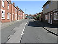

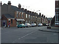
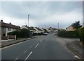
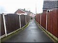
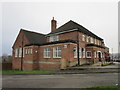
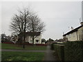
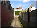
32 photos from this area
Area Information
Key information about the S62 6LE including its size, population, and administrative classification.
- Area Type
- Postcode
- Area Size
- 1.3 hectares
- Population
- 1542
- Population Density
- 1404 people/km²
House Prices in S62 6LE
38
Properties
£128,150
Average Sold Price
£42,500
Lowest Price
£245,000
Highest Price
Showing 38 properties
| Address | Type | Beds | Baths | Last Sale Price | Last Sale Date | |
|---|---|---|---|---|---|---|
| 154 Green Lane, Rawmarsh, Rotherham, S62 6LE | Bungalow | 4 | 1 | £245,000 | Sep 2023 | |
| 146 Green Lane, Rawmarsh, Rotherham, S62 6LE | Semi-detached | 3 | 2 | £220,000 | Apr 2023 | |
| 126 Green Lane, Rawmarsh, Rotherham, S62 6LE | house | - | - | £82,000 | May 2022 | |
| 162 GREEN LANE, Rawmarsh, Rotherham, S62 6LE | Semi-detached | - | - | £168,000 | Dec 2019 | |
| 132 Green Lane, Rawmarsh, Rotherham, S62 6LE | Semi-detached | 4 | - | £105,000 | Aug 2016 | |
| 142 Green Lane, Rawmarsh, Rotherham, S62 6LE | Semi-detached | 5 | - | £150,000 | Nov 2013 | |
| 150 Green Lane, Rawmarsh, Rotherham, S62 6LE | Bungalow | 2 | - | £117,000 | May 2013 | |
| 160 Green Lane, Rawmarsh, Rotherham, S62 6LE | Bungalow | 4 | 1 | £108,000 | Sep 2006 | |
| 156 Green Lane, Rawmarsh, Rotherham, S62 6LE | Detached | - | - | £42,500 | Mar 1998 | |
| 152 Green Lane, Rawmarsh, Rotherham, S62 6LE | Bungalow | - | - | £44,000 | Jul 1996 |
Page 1 of 4
Energy Efficiency in S62 6LE
Amenities
Schools
| Rank | School | Type | Entry gender | Ages |
|---|
Explore more schools in this area
Go to Schools tabDemographics
Household Size
Two person
most common
Accommodation Type
Houses
most common
Tenure
52
majority
Ethnic Group
White
most common
Religion
N/A
most common
Household Composition
N/A
most common
Age
47
median
Adults (30-64 years)
most common
Household Deprivation
N/A
with no deprivation
NS-SEC
21
in Lower managerial occupations
Explore more demographic insights in this area
Go to Demographics tabPlanning
Planning Constraints
- Flood RiskPremium
- Ramsar Wetland SitesPremium
- Area of Outstanding Natural BeautyPremium
- Protected Nature ReservePremium
- Protected WoodlandPremium