Area Overview for S61 4BN
Photos of S61 4BN
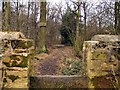
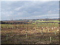
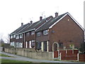
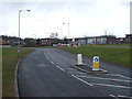
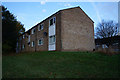
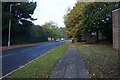
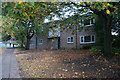
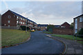
22 photos from this area
Area Information
Key information about the S61 4BN including its size, population, and administrative classification.
- Area Type
- Postcode
- Area Size
- 6952 m²
- Population
- 1394
- Population Density
- 3488 people/km²
House Prices in S61 4BN
26
Properties
£97,579
Average Sold Price
£37,000
Lowest Price
£172,000
Highest Price
Showing 26 properties
| Address | Type | Beds | Baths | Last Sale Price | Last Sale Date | |
|---|---|---|---|---|---|---|
| 38 Nidderdale Road, Wingfield, Rotherham, S61 4BN | Flat | - | - | £37,000 | Jan 2023 | |
| 66 Nidderdale Road, Wingfield, Rotherham, S61 4BN | house | - | - | £120,000 | Aug 2021 | |
| 28 Nidderdale Road, Wingfield, Rotherham, S61 4BN | house | 3 | 1 | £109,000 | Jul 2021 | |
| 62 Nidderdale Road, Wingfield, Rotherham, S61 4BN | Semi-detached | 3 | - | £98,000 | Dec 2016 | |
| 64 Nidderdale Road, Wingfield, Rotherham, S61 4BN | house | - | - | £85,000 | Dec 2015 | |
| 46 Nidderdale Road, Wingfield, Rotherham, S61 4BN | Semi-detached | 3 | 1 | £97,500 | Dec 2014 | |
| 68 Nidderdale Road, Wingfield, Rotherham, S61 4BN | Semi-detached | 3 | - | £107,000 | Feb 2014 | |
| 72 Nidderdale Road, Wingfield, Rotherham, S61 4BN | house | - | - | £125,000 | Aug 2008 | |
| 36 Nidderdale Road, Wingfield, Rotherham, S61 4BN | Terraced | - | - | £172,000 | Feb 2008 | |
| 52 Nidderdale Road, Wingfield, Rotherham, S61 4BN | house | - | - | £98,000 | Feb 2007 |
Page 1 of 3
Energy Efficiency in S61 4BN
Amenities
Schools
| Rank | School | Type | Entry gender | Ages |
|---|
Explore more schools in this area
Go to Schools tabDemographics
Household Size
One person
most common
Accommodation Type
Houses
most common
Tenure
38
majority
Ethnic Group
White
most common
Religion
N/A
most common
Household Composition
N/A
most common
Age
47
median
Adults (30-64 years)
most common
Household Deprivation
N/A
with no deprivation
NS-SEC
16
in Lower managerial occupations
Explore more demographic insights in this area
Go to Demographics tabPlanning
Planning Constraints
- Flood RiskPremium
- Ramsar Wetland SitesPremium
- Area of Outstanding Natural BeautyPremium
- Protected Nature ReservePremium
- Protected WoodlandPremium