Area Overview for S61 2QS
Photos of S61 2QS
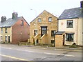
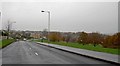
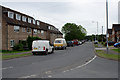
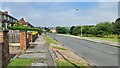
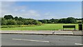
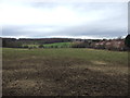
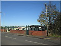
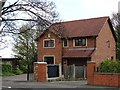


14 photos from this area
Area Information
Key information about the S61 2QS including its size, population, and administrative classification.
- Area Type
- Postcode
- Area Size
- 1.9 hectares
- Population
- 1261
- Population Density
- 1538 people/km²
House Prices in S61 2QS
35
Properties
£204,300
Average Sold Price
£72,500
Lowest Price
£380,000
Highest Price
Showing 35 properties
| Address | Type | Beds | Baths | Last Sale Price | Last Sale Date | |
|---|---|---|---|---|---|---|
| 3 Windsor Road, Thorpe Hesley, Rotherham, S61 2QS | Detached | 4 | 2 | £370,000 | Jun 2024 | |
| 12 Windsor Road, Thorpe Hesley, Rotherham, S61 2QS | Detached | 3 | 2 | £380,000 | Dec 2020 | |
| 22 Windsor Road, Thorpe Hesley, Rotherham, S61 2QS | Detached | 4 | - | £280,000 | Mar 2015 | |
| 29 Windsor Road, Thorpe Hesley, Rotherham, S61 2QS | house | 3 | 1 | £193,000 | Dec 2014 | |
| 2A Windsor Road, Thorpe Hesley, Rotherham, S61 2QS | Flat | - | - | £120,000 | Jul 2012 | |
| 1 Windsor Road, Thorpe Hesley, Rotherham, S61 2QS | house | - | - | £198,750 | Nov 2011 | |
| 35 Windsor Road, Thorpe Hesley, Rotherham, S61 2QS | house | - | - | £185,000 | Mar 2011 | |
| 4 Windsor Road, Thorpe Hesley, Rotherham, S61 2QS | house | - | - | £196,000 | Jul 2010 | |
| 37 Windsor Road, Thorpe Hesley, Rotherham, S61 2QS | house | - | - | £190,000 | Jun 2010 | |
| 7 Windsor Road, Thorpe Hesley, Rotherham, S61 2QS | house | - | - | £185,000 | Feb 2008 |
Page 1 of 4
Energy Efficiency in S61 2QS
Amenities
Schools
| Rank | School | Type | Entry gender | Ages |
|---|
Explore more schools in this area
Go to Schools tabDemographics
Household Size
Two person
most common
Accommodation Type
Houses
most common
Tenure
72
majority
Ethnic Group
White
most common
Religion
N/A
most common
Household Composition
N/A
most common
Age
47
median
Adults (30-64 years)
most common
Household Deprivation
N/A
with no deprivation
NS-SEC
27
in Lower managerial occupations
Explore more demographic insights in this area
Go to Demographics tabPlanning
Planning Constraints
- Flood RiskPremium
- Ramsar Wetland SitesPremium
- Area of Outstanding Natural BeautyPremium
- Protected Nature ReservePremium
- Protected WoodlandPremium