Area Overview for S61 1HD
Photos of S61 1HD
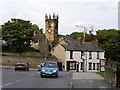
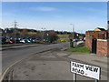
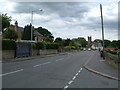
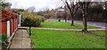
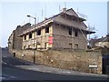
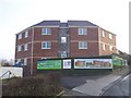
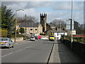
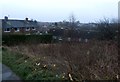
22 photos from this area
Area Information
Key information about the S61 1HD including its size, population, and administrative classification.
- Area Type
- Postcode
- Area Size
- 8660 m²
- Population
- 1461
- Population Density
- 4584 people/km²
House Prices in S61 1HD
20
Properties
£167,358
Average Sold Price
£131,750
Lowest Price
£282,000
Highest Price
Showing 20 properties
| Address | Type | Beds | Baths | Last Sale Price | Last Sale Date | |
|---|---|---|---|---|---|---|
| 347 Kimberworth Road, Bradgate, Rotherham, S61 1HD | Semi-detached | 4 | 1 | £282,000 | Jan 2023 | |
| 357 Kimberworth Road, Bradgate, Rotherham, S61 1HD | Semi-detached | 3 | 1 | £202,000 | May 2022 | |
| 351 Kimberworth Road, Bradgate, Rotherham, S61 1HD | house | - | - | £161,500 | May 2022 | |
| 333 Kimberworth Road, Bradgate, Rotherham, S61 1HD | Semi-detached | 4 | - | £137,000 | Sep 2019 | |
| 325 Kimberworth Road, Bradgate, Rotherham, S61 1HD | Semi-detached | 3 | 1 | £147,500 | Aug 2018 | |
| 345 Kimberworth Road, Bradgate, Rotherham, S61 1HD | Semi-detached | 4 | 1 | £175,000 | Nov 2017 | |
| 335 Kimberworth Road, Bradgate, Rotherham, S61 1HD | house | - | - | £131,750 | Nov 2017 | |
| 353 Kimberworth Road, Bradgate, Rotherham, S61 1HD | house | - | - | £175,000 | Aug 2017 | |
| 343 Kimberworth Road, Bradgate, Rotherham, S61 1HD | Semi-detached | 4 | - | £150,000 | Sep 2016 | |
| 341 Kimberworth Road, Bradgate, Rotherham, S61 1HD | Semi-detached | 3 | - | £143,000 | Feb 2015 |
Page 1 of 2
Energy Efficiency in S61 1HD
Amenities
Schools
| Rank | School | Type | Entry gender | Ages |
|---|
Explore more schools in this area
Go to Schools tabDemographics
Household Size
Two person
most common
Accommodation Type
Houses
most common
Tenure
86
majority
Ethnic Group
White
most common
Religion
N/A
most common
Household Composition
N/A
most common
Age
47
median
Adults (30-64 years)
most common
Household Deprivation
N/A
with no deprivation
NS-SEC
24
in Lower managerial occupations
Explore more demographic insights in this area
Go to Demographics tabPlanning
Planning Constraints
- Flood RiskPremium
- Ramsar Wetland SitesPremium
- Area of Outstanding Natural BeautyPremium
- Protected Nature ReservePremium
- Protected WoodlandPremium