Area Overview for S61 1AL
Photos of S61 1AL
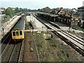

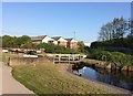

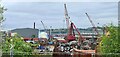


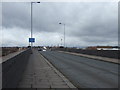

45 photos from this area
Area Information
Key information about the S61 1AL including its size, population, and administrative classification.
- Area Type
- Postcode
- Area Size
- 7850 m²
- Population
- 1931
- Population Density
- 4053 people/km²
House Prices in S61 1AL
16
Properties
£70,577
Average Sold Price
£50,000
Lowest Price
£111,000
Highest Price
Showing 16 properties
| Address | Type | Beds | Baths | Last Sale Price | Last Sale Date | |
|---|---|---|---|---|---|---|
| 21 Ferham Park Avenue, Holmes, Rotherham, S61 1AL | house | - | - | £111,000 | Aug 2023 | |
| 17 Ferham Park Avenue, Holmes, Rotherham, S61 1AL | house | 3 | - | £69,000 | Mar 2023 | |
| 23 Ferham Park Avenue, Holmes, Rotherham, S61 1AL | house | - | - | £85,000 | May 2022 | |
| 25 Ferham Park Avenue, Holmes, Rotherham, S61 1AL | house | - | - | £85,000 | Feb 2022 | |
| 13 Ferham Park Avenue, Holmes, Rotherham, S61 1AL | Terraced | 2 | 1 | £60,000 | Feb 2022 | |
| 19 Ferham Park Avenue, Holmes, Rotherham, S61 1AL | house | - | - | £80,000 | Jan 2022 | |
| 31 Ferham Park Avenue, Holmes, Rotherham, S61 1AL | Terraced | 2 | - | £72,000 | May 2021 | |
| 35 Ferham Park Avenue, Holmes, Rotherham, S61 1AL | Terraced | 2 | 1 | £68,000 | Mar 2021 | |
| 15 Ferham Park Avenue, Holmes, Rotherham, S61 1AL | Terraced | 2 | 1 | £57,500 | Nov 2020 | |
| 33 Ferham Park Avenue, Holmes, Rotherham, S61 1AL | house | - | - | £50,000 | Dec 2018 |
Page 1 of 2
Energy Efficiency in S61 1AL
Amenities
Schools
| Rank | School | Type | Entry gender | Ages |
|---|
Explore more schools in this area
Go to Schools tabDemographics
Household Size
Family (3-5 people)
most common
Accommodation Type
Houses
most common
Tenure
30
majority
Ethnic Group
White
most common
Religion
N/A
most common
Household Composition
N/A
most common
Age
22
median
Adults (30-64 years)
most common
Household Deprivation
N/A
with no deprivation
NS-SEC
9
in Lower managerial occupations
Explore more demographic insights in this area
Go to Demographics tabPlanning
Planning Constraints
- Flood RiskPremium
- Ramsar Wetland SitesPremium
- Area of Outstanding Natural BeautyPremium
- Protected Nature ReservePremium
- Protected WoodlandPremium