Area Overview for S60 8AX
Photos of S60 8AX

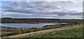
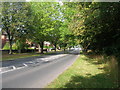
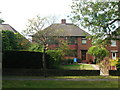
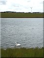

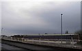
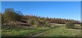
16 photos from this area
Area Information
Key information about the S60 8AX including its size, population, and administrative classification.
- Area Type
- Postcode
- Area Size
- 73.0 hectares
- Population
- 1507
- Population Density
- 847 people/km²
House Prices in S60 8AX
16
Properties
£269,748
Average Sold Price
£35,000
Lowest Price
£450,000
Highest Price
Showing 16 properties
| Address | Type | Beds | Baths | Last Sale Price | Last Sale Date | |
|---|---|---|---|---|---|---|
| 21 Rivelin Way, Waverley, Rotherham, S60 8AX | Detached | 4 | 2 | £450,000 | Sep 2025 | |
| First Floor, 27 Rivelin Way, Waverley, Rotherham, S60 8AX | Flat | - | - | £40,000 | Jan 2025 | |
| 9 Rivelin Way, Waverley, Rotherham, S60 8AX | Detached | 4 | 2 | £355,000 | Sep 2024 | |
| First Floor, 29 Rivelin Way, Waverley, Rotherham, S60 8AX | Flat | 2 | 2 | £40,000 | Mar 2023 | |
| 5 Rivelin Way, Waverley, Rotherham, S60 8AX | house | - | - | £285,000 | Feb 2021 | |
| 15 Rivelin Way, Waverley, Rotherham, S60 8AX | Detached | 5 | 3 | £372,500 | Apr 2019 | |
| Second Floor, 31 Rivelin Way, Waverley, Rotherham, S60 8AX | Flat | - | - | £35,000 | May 2018 | |
| 19 Rivelin Way, Waverley, Rotherham, S60 8AX | house | 4 | 2 | £334,995 | Dec 2016 | |
| Ground Floor, 23 Rivelin Way, Waverley, Rotherham, S60 8AX | Flat | - | - | £402,000 | Dec 2016 | |
| 17 Rivelin Way, Waverley, Rotherham, S60 8AX | house | - | - | £292,995 | Nov 2016 |
Page 1 of 2
Energy Efficiency in S60 8AX
Amenities
Schools
| Rank | School | Type | Entry gender | Ages |
|---|
Explore more schools in this area
Go to Schools tabDemographics
Household Size
Family (3-5 people)
most common
Accommodation Type
Houses
most common
Tenure
90
majority
Ethnic Group
White
most common
Religion
N/A
most common
Household Composition
N/A
most common
Age
47
median
Adults (30-64 years)
most common
Household Deprivation
N/A
with no deprivation
NS-SEC
42
in Lower managerial occupations
Explore more demographic insights in this area
Go to Demographics tabPlanning
Planning Constraints
- Flood RiskPremium
- Ramsar Wetland SitesPremium
- Area of Outstanding Natural BeautyPremium
- Protected Nature ReservePremium
- Protected WoodlandPremium