Area Overview for S60 8AL
Photos of S60 8AL
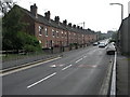
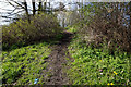
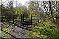
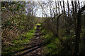
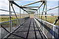
48 photos from this area
Area Information
Key information about the S60 8AL including its size, population, and administrative classification.
- Area Type
- Postcode
- Area Size
- 2.1 hectares
- Population
- 1580
- Population Density
- 7659 people/km²
House Prices in S60 8AL
68
Properties
£244,310
Average Sold Price
£131,000
Lowest Price
£525,000
Highest Price
Showing 68 properties
| Address | Type | Beds | Baths | Last Sale Price | Last Sale Date | |
|---|---|---|---|---|---|---|
| 168 Highfield Lane, Orgreave, Rotherham, S60 8AL | Terraced | 3 | 3 | £230,000 | Dec 2025 | |
| 186 Highfield Lane, Orgreave, Rotherham, S60 8AL | Terraced | 3 | 2 | £170,000 | Sep 2024 | |
| 105 Highfield Lane, Orgreave, Rotherham, S60 8AL | Semi-detached | 3 | 2 | £260,000 | Jun 2024 | |
| 172 Highfield Lane, Orgreave, Rotherham, S60 8AL | Semi-detached | 3 | 2 | £245,000 | Feb 2024 | |
| 136 Highfield Lane, Orgreave, Rotherham, S60 8AL | Terraced | 2 | 2 | £245,000 | May 2023 | |
| 182 Highfield Lane, Orgreave, Rotherham, S60 8AL | Flat | 2 | 1 | £165,500 | Sep 2022 | |
| 162 Highfield Lane, Orgreave, Rotherham, S60 8AL | house | 3 | 1 | £219,000 | Aug 2022 | |
| 101 Highfield Lane, Orgreave, Rotherham, S60 8AL | Semi-detached | 3 | 2 | £230,000 | Aug 2022 | |
| 121 Highfield Lane, Orgreave, Rotherham, S60 8AL | Retail | 4 | 2 | £305,000 | Aug 2022 | |
| 85 Highfield Lane, Orgreave, Rotherham, S60 8AL | Semi-detached | 4 | 3 | £275,000 | Aug 2022 |
Page 1 of 7
Energy Efficiency in S60 8AL
Amenities
Schools
| Rank | School | Type | Entry gender | Ages |
|---|
Explore more schools in this area
Go to Schools tabDemographics
Household Size
Family (3-5 people)
most common
Accommodation Type
Houses
most common
Tenure
85
majority
Ethnic Group
White
most common
Religion
N/A
most common
Household Composition
N/A
most common
Age
47
median
Adults (30-64 years)
most common
Household Deprivation
N/A
with no deprivation
NS-SEC
56
in Lower managerial occupations
Explore more demographic insights in this area
Go to Demographics tabPlanning
Planning Constraints
- Flood RiskPremium
- Ramsar Wetland SitesPremium
- Area of Outstanding Natural BeautyPremium
- Protected Nature ReservePremium
- Protected WoodlandPremium