Area Overview for S60 5FZ
Photos of S60 5FZ

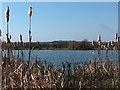
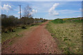
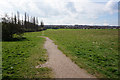


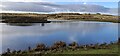


18 photos from this area
Area Information
Key information about the S60 5FZ including its size, population, and administrative classification.
- Area Type
- Postcode
- Area Size
- 14.7 hectares
- Population
- 1067
- Population Density
- 424 people/km²
House Prices in S60 5FZ
26
Properties
£388,962
Average Sold Price
£266,995
Lowest Price
£447,995
Highest Price
Showing 26 properties
| Address | Type | Beds | Baths | Last Sale Price | Last Sale Date | |
|---|---|---|---|---|---|---|
| 6 Coal Way, Treeton, Rotherham, S60 5FZ | house | - | - | £437,500 | Oct 2025 | |
| 15 Coal Way, Treeton, Rotherham, S60 5FZ | house | - | - | £433,995 | May 2024 | |
| 23 Coal Way, Treeton, Rotherham, S60 5FZ | house | - | - | £278,995 | May 2024 | |
| 13 Coal Way, Treeton, Rotherham, S60 5FZ | house | - | - | £373,995 | Apr 2024 | |
| 17 Coal Way, Treeton, Rotherham, S60 5FZ | house | - | - | £444,995 | Apr 2024 | |
| 7 Coal Way, Treeton, Rotherham, S60 5FZ | Detached | 4 | 3 | £370,995 | Apr 2024 | |
| 25 Coal Way, Treeton, Rotherham, S60 5FZ | house | - | - | £266,995 | Mar 2024 | |
| 26 Coal Way, Treeton, Rotherham, S60 5FZ | house | - | - | £447,995 | Nov 2023 | |
| 18 Coal Way, Treeton, Rotherham, S60 5FZ | house | - | - | £377,995 | Sep 2023 | |
| 20 Coal Way, Treeton, Rotherham, S60 5FZ | house | - | - | £379,995 | Sep 2023 |
Page 1 of 3
Energy Efficiency in S60 5FZ
Amenities
Schools
| Rank | School | Type | Entry gender | Ages |
|---|
Explore more schools in this area
Go to Schools tabDemographics
Household Size
Family (3-5 people)
most common
Accommodation Type
Houses
most common
Tenure
76
majority
Ethnic Group
White
most common
Religion
N/A
most common
Household Composition
N/A
most common
Age
47
median
Adults (30-64 years)
most common
Household Deprivation
N/A
with no deprivation
NS-SEC
33
in Lower managerial occupations
Explore more demographic insights in this area
Go to Demographics tabPlanning
Planning Constraints
- Flood RiskPremium
- Ramsar Wetland SitesPremium
- Area of Outstanding Natural BeautyPremium
- Protected Nature ReservePremium
- Protected WoodlandPremium