Area Overview for S60 5DJ
Photos of S60 5DJ
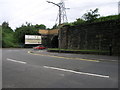


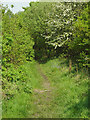
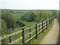
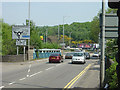


37 photos from this area
Area Information
Key information about the S60 5DJ including its size, population, and administrative classification.
- Area Type
- Postcode
- Area Size
- 1.2 hectares
- Population
- 1716
- Population Density
- 5379 people/km²
House Prices in S60 5DJ
54
Properties
£65,705
Average Sold Price
£16,000
Lowest Price
£100,000
Highest Price
Showing 54 properties
| Address | Type | Beds | Baths | Last Sale Price | Last Sale Date | |
|---|---|---|---|---|---|---|
| 48 Ellis Street, Brinsworth, Rotherham, S60 5DJ | house | - | - | £75,000 | Jul 2023 | |
| 76 Ellis Street, Brinsworth, Rotherham, S60 5DJ | Terraced | 3 | 1 | £95,000 | Jun 2023 | |
| 70 Ellis Street, Brinsworth, Rotherham, S60 5DJ | Terraced | 3 | 1 | £80,000 | Jun 2023 | |
| 16 Ellis Street, Brinsworth, Rotherham, S60 5DJ | Terraced | 3 | - | £80,600 | Jun 2022 | |
| 34 Ellis Street, Brinsworth, Rotherham, S60 5DJ | house | - | - | £90,000 | Nov 2021 | |
| 58 Ellis Street, Brinsworth, Rotherham, S60 5DJ | house | 3 | - | £100,000 | Sep 2020 | |
| 80 Ellis Street, Brinsworth, Rotherham, S60 5DJ | Terraced | 3 | 3 | £79,500 | May 2020 | |
| 78 Ellis Street, Brinsworth, Rotherham, S60 5DJ | Terraced | 3 | 1 | £66,500 | Mar 2020 | |
| 24 Ellis Street, Brinsworth, Rotherham, S60 5DJ | Terraced | 2 | 1 | £72,500 | May 2019 | |
| 72 Ellis Street, Brinsworth, Rotherham, S60 5DJ | Terraced | 3 | 1 | £82,500 | Mar 2019 |
Page 1 of 6
Energy Efficiency in S60 5DJ
Amenities
Schools
| Rank | School | Type | Entry gender | Ages |
|---|
Explore more schools in this area
Go to Schools tabDemographics
Household Size
Family (3-5 people)
most common
Accommodation Type
Houses
most common
Tenure
60
majority
Ethnic Group
White
most common
Religion
N/A
most common
Household Composition
N/A
most common
Age
47
median
Adults (30-64 years)
most common
Household Deprivation
N/A
with no deprivation
NS-SEC
20
in Lower managerial occupations
Explore more demographic insights in this area
Go to Demographics tabPlanning
Planning Constraints
- Flood RiskPremium
- Ramsar Wetland SitesPremium
- Area of Outstanding Natural BeautyPremium
- Protected Nature ReservePremium
- Protected WoodlandPremium