Area Overview for S60 4NQ
Photos of S60 4NQ


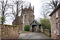

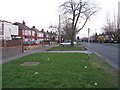
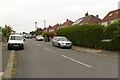
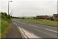
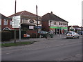
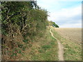
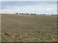


23 photos from this area
Area Information
Key information about the S60 4NQ including its size, population, and administrative classification.
- Area Type
- Postcode
- Area Size
- 5.0 hectares
- Population
- 2343
- Population Density
- 265 people/km²
House Prices in S60 4NQ
18
Properties
£284,110
Average Sold Price
£130,000
Lowest Price
£660,000
Highest Price
Showing 18 properties
| Address | Type | Beds | Baths | Last Sale Price | Last Sale Date | |
|---|---|---|---|---|---|---|
| 14 Moorhouse Lane, Whiston, Rotherham, S60 4NQ | Detached | 4 | 1 | £660,000 | Mar 2025 | |
| 7 Moorhouse Lane, Whiston, Rotherham, S60 4NQ | Semi-detached | 3 | 1 | £255,000 | Feb 2025 | |
| 3 Moorhouse Lane, Whiston, Rotherham, S60 4NQ | Semi-detached | 3 | 1 | £200,000 | May 2023 | |
| 4 Moorhouse Lane, Whiston, Rotherham, S60 4NQ | house | - | - | £180,000 | Oct 2022 | |
| 2 Moorhouse Lane, Whiston, Rotherham, S60 4NQ | Detached | 3 | - | £319,315 | Oct 2017 | |
| 1A Moorhouse Lane, Whiston, Rotherham, S60 4NQ | Detached | 5 | - | £430,000 | Dec 2016 | |
| 11 Moorhouse Lane, Whiston, Rotherham, S60 4NQ | house | - | - | £380,000 | Jun 2016 | |
| 10 Moorhouse Lane, Whiston, Rotherham, S60 4NQ | house | - | - | £135,000 | Jan 2011 | |
| Willowbrook, Moorhouse Lane, Whiston, Rotherham, S60 4NQ | Detached | - | - | £335,000 | Feb 2005 | |
| Delft Cottage, Moorhouse Lane, Whiston, Rotherham, S60 4NQ | house | - | - | £250,000 | Oct 2002 |
Page 1 of 2
Energy Efficiency in S60 4NQ
Amenities
Schools
| Rank | School | Type | Entry gender | Ages |
|---|
Explore more schools in this area
Go to Schools tabDemographics
Household Size
Two person
most common
Accommodation Type
Houses
most common
Tenure
73
majority
Ethnic Group
White
most common
Religion
N/A
most common
Household Composition
N/A
most common
Age
47
median
Adults (30-64 years)
most common
Household Deprivation
N/A
with no deprivation
NS-SEC
33
in Lower managerial occupations
Explore more demographic insights in this area
Go to Demographics tabPlanning
Planning Constraints
- Flood RiskPremium
- Ramsar Wetland SitesPremium
- Area of Outstanding Natural BeautyPremium
- Protected Nature ReservePremium
- Protected WoodlandPremium