Area Overview for S60 4DA
Photos of S60 4DA
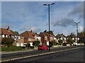
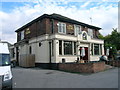
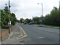
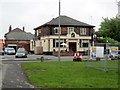
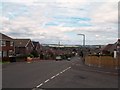
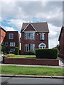
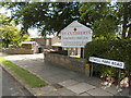
22 photos from this area
Area Information
Key information about the S60 4DA including its size, population, and administrative classification.
- Area Type
- Postcode
- Area Size
- 2.3 hectares
- Population
- 1769
- Population Density
- 4510 people/km²
House Prices in S60 4DA
54
Properties
£151,026
Average Sold Price
£21,000
Lowest Price
£265,000
Highest Price
Showing 54 properties
| Address | Type | Beds | Baths | Last Sale Price | Last Sale Date | |
|---|---|---|---|---|---|---|
| 72 Sheep Cote Road, Brecks, Rotherham, S60 4DA | Semi-detached | 3 | 1 | £230,000 | Jun 2024 | |
| 64 Sheep Cote Road, Brecks, Rotherham, S60 4DA | Semi-detached | 4 | 1 | £265,000 | Feb 2024 | |
| 84 Sheep Cote Road, Brecks, Rotherham, S60 4DA | Semi-detached | 2 | 1 | £179,000 | Jan 2024 | |
| 78 Sheep Cote Road, Brecks, Rotherham, S60 4DA | Semi-detached | 3 | 2 | £230,000 | May 2023 | |
| 98 Sheep Cote Road, Brecks, Rotherham, S60 4DA | house | - | - | £200,000 | Sep 2021 | |
| 100 Sheep Cote Road, Brecks, Rotherham, S60 4DA | Semi-detached | 3 | 1 | £203,000 | Sep 2021 | |
| 10 Sheep Cote Road, Brecks, Rotherham, S60 4DA | Semi-detached | 2 | 1 | £211,000 | Aug 2021 | |
| 36 Sheep Cote Road, Brecks, Rotherham, S60 4DA | Semi-detached | 2 | 1 | £171,000 | Dec 2020 | |
| 76 Sheep Cote Road, Brecks, Rotherham, S60 4DA | Semi-detached | 4 | 3 | £193,000 | Feb 2020 | |
| 26 Sheep Cote Road, Brecks, Rotherham, S60 4DA | Semi-detached | 2 | 1 | £170,000 | Jul 2018 |
Page 1 of 6
Energy Efficiency in S60 4DA
Amenities
Schools
| Rank | School | Type | Entry gender | Ages |
|---|
Explore more schools in this area
Go to Schools tabDemographics
Household Size
Two person
most common
Accommodation Type
Houses
most common
Tenure
91
majority
Ethnic Group
White
most common
Religion
N/A
most common
Household Composition
N/A
most common
Age
47
median
Adults (30-64 years)
most common
Household Deprivation
N/A
with no deprivation
NS-SEC
35
in Lower managerial occupations
Explore more demographic insights in this area
Go to Demographics tabPlanning
Planning Constraints
- Flood RiskPremium
- Ramsar Wetland SitesPremium
- Area of Outstanding Natural BeautyPremium
- Protected Nature ReservePremium
- Protected WoodlandPremium