Area Overview for S60 3PP
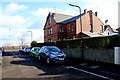
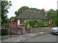
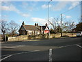
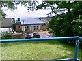
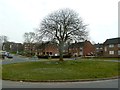
Photos of S60 3PP


Area Information
Living in S60 3PP means settling into a compact residential cluster spanning just 2.4 hectares. This postcode covers a small, focused area where daily life revolves close to home. The neighbourhood houses 1,691 residents, creating a tight-knit environment that feels distinct from broader urban sprawls. Because the land is limited, homes in S60 3PP are clustered closely together, fostering a sense of intimacy for those who value proximity to neighbours. The population density of 69,434 people per square kilometre indicates significant concentration within this specific postcode boundary. You will find that the area is dominated by houses rather than other accommodation types. This layout suits individuals or families seeking a settled environment away from high-rise living. While statistics show a high population density for such a small footprint, the community manages to maintain a residential feel. Buyers considering this location should appreciate the scale of the area. It is large enough to offer essential services in reach but small enough to feel exclusive. This distinctive size makes S60 3PP a specific choice for those who understand the value of a defined residential zone.
- Area Type
- Postcode
- Area Size
- 2.4 hectares
- Population
- 1691
- Population Density
- 4758 people/km²
The property market in S60 3PP is defined by a predominance of houses and a specific split in ownership models. Statistically, 42% of residents own their homes, which suggests a strong presence of owner-occupiers alongside a significant rental sector. This balance indicates a property range that caters to both those seeking to build equity and those requiring flexible accommodation. The accommodation type data confirms that houses are the primary dwelling style in this small 2.4-hectare zone. For buyers searching for homes in S60 3PP, this means most properties will have the characteristics of domestic residential houses rather than flats or maisonettes. A 42% ownership rate often implies a market where sellers focus on the upkeep and value of individual family homes. The limited size of the postcode means inventory levels may be low compared to larger wards, potentially making each specific listing highly competitive. You need to act quickly if you spot a suitable house here, as the density of housing in such a small area means competition for quality stock can be intense. The market does not show signs of being a purely investment-led rental zone, which usually correlates with higher ownership figures. Instead, it reflects a functional local housing stock serving the current residents.
House Prices in S60 3PP
Showing 25 properties
| Address | Type | Beds | Baths | Last Sale Price | Last Sale Date | |
|---|---|---|---|---|---|---|
| 52 Wickersley Road, Broom, Rotherham, S60 3PP | Semi-detached | 5 | 2 | £325,000 | Nov 2025 | |
| 86 Wickersley Road, Broom, Rotherham, S60 3PP | Semi-detached | 4 | 3 | £380,000 | Jun 2023 | |
| 72 Wickersley Road, Broom, Rotherham, S60 3PP | Detached | 3 | 2 | £375,000 | Jan 2023 | |
| 62 Wickersley Road, Broom, Rotherham, S60 3PP | Detached | 3 | 1 | £300,000 | Aug 2021 | |
| 76 Wickersley Road, Broom, Rotherham, S60 3PP | Detached | 4 | 1 | £285,000 | Jul 2016 | |
| 84 Wickersley Road, Broom, Rotherham, S60 3PP | house | - | - | £220,000 | Aug 2015 | |
| 68 Wickersley Road, Broom, Rotherham, S60 3PP | Detached | 3 | - | £182,500 | Feb 2013 | |
| 98 Wickersley Road, Broom, Rotherham, S60 3PP | Detached | - | - | £275,000 | Sep 2007 | |
| 70 Wickersley Road, Broom, Rotherham, S60 3PP | Detached | 4 | 2 | £157,500 | Sep 2002 | |
| 64 Wickersley Road, Broom, Rotherham, S60 3PP | Semi-detached | - | - | £74,950 | Jan 2002 |
Energy Efficiency in S60 3PP
Daily life in S60 3PP is supported by a ring of amenities located within practical reach of residents. Five retail outlets serve the neighbourhood, including Co-op Worry, M&S Rotherham, and Tesco Rotherham Bawtry. These supermarkets provide comprehensive shopping needs without requiring a long drive. You can handle most weekly grocery shopping and general retail tasks nearby. Five railway stations sit close by, offering Rotherham Central Railway Station and Meadowhall Railway Station as key interchange points. Metro services connect you to Rotherham Platform Both Directions, Parkgate, and Meadowhall South for quicker journeys into town centres. The convergence of retail and rail transport means you have options for both daily errands and weekend outings close to home. Living in S60 3PP grants you access to these services while remaining in a quiet residential setting. The area functions well for those who need large supermarket chains without needing to visit city centres. The variety of transport nodes ensures that travel delays are minimal. This proximity to major retail hubs and train networks simplifies the logistics of running a household. You enjoy urban convenience without the immediate pressures of a central district.
Amenities
Schools
Families living in S60 3PP have access to three specific schools registered in the immediate vicinity. Herringthorpe Infant School holds an outstanding Ofsted rating and serves as a primary education provider for younger children. Similarly, Herringthorpe Junior School also carries an outstanding Ofsted rating, covering the secondary primary age range. This institution operates as an academy and completes the local provision for primary education. The presence of both an infant and a junior school with top-tier ratings means you can oversee your child's education without leaving the local area for the early years. Having two consecutive primary stages, both rated outstanding by Ofsted, offers continuity of care within the same educational ethos. This concentration of high-performing primary education within walking or short driving distance of S60 3PP is a significant advantage for parents. You do not need to commute to larger towns for primary schooling. The data confirms that the nearest educational facilities meet the highest regulatory standards for quality. This specific mix of schools supports families who prioritise academic excellence and stability in their child's learning journey.
| Rank | School | Type | Entry gender | Ages |
|---|
Explore more schools in this area
Go to Schools tabDemographics
The community in S60 3PP reflects a mature and established local population. The median age stands at 47 years, with the most common age range falling between 30 and 64 years. This demographic profile suggests the area attracts long-term residents rather than a transient workforce. Home ownership is present in 42% of households, indicating a balance between owner-occupiers and renters. The vast majority of accommodation consists of houses, aligning with the preferences of the local age profile. White residents form the predominant ethnic group within this neighbourhood. These figures combine to create a stable social fabric where families likely prioritise stability and established communities. A median age of 47 years often correlates with households that have grown older children or empty nesters. The 42% home ownership rate suggests that nearly half the residents have bought into the property, while the remainder may rent or share ownership. This mix supports local businesses through steady spending power. You will find a community defined by its middle-aged core and traditional housing stock. The demographic data paints a clear picture of a settled area with specific generational interests and needs.
Household Size
Accommodation Type
Tenure
Ethnic Group
Religion
Household Composition
Age
Household Deprivation
NS-SEC
Explore more demographic insights in this area
Go to Demographics tabPlanning
Planning Constraints
- Flood RiskPremium
- Ramsar Wetland SitesPremium
- Area of Outstanding Natural BeautyPremium
- Protected Nature ReservePremium
- Protected WoodlandPremium