Area Overview for S60 3LN
Photos of S60 3LN
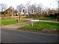
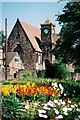
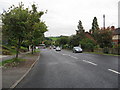

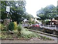
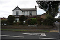
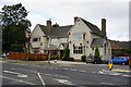
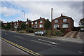
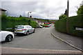

28 photos from this area
Area Information
Key information about the S60 3LN including its size, population, and administrative classification.
- Area Type
- Postcode
- Area Size
- 9613 m²
- Population
- 2034
- Population Density
- 4038 people/km²
House Prices in S60 3LN
23
Properties
£142,965
Average Sold Price
£59,100
Lowest Price
£250,000
Highest Price
Showing 23 properties
| Address | Type | Beds | Baths | Last Sale Price | Last Sale Date | |
|---|---|---|---|---|---|---|
| 81 Grange Road, Moorgate, Rotherham, S60 3LN | house | - | - | £205,000 | Apr 2024 | |
| 111 Grange Road, Moorgate, Rotherham, S60 3LN | Semi-detached | 3 | - | £245,000 | Aug 2021 | |
| 87 Grange Road, Moorgate, Rotherham, S60 3LN | house | - | - | £250,000 | Jan 2021 | |
| 93 Grange Road, Moorgate, Rotherham, S60 3LN | house | - | - | £163,500 | Mar 2018 | |
| 109 Grange Road, Moorgate, Rotherham, S60 3LN | Semi-detached | 3 | - | £157,000 | Jan 2014 | |
| 95 Grange Road, Moorgate, Rotherham, S60 3LN | Semi-detached | - | - | £165,000 | Apr 2007 | |
| 99 Grange Road, Moorgate, Rotherham, S60 3LN | Detached | 4 | - | £230,000 | Jun 2005 | |
| 97 Grange Road, Moorgate, Rotherham, S60 3LN | house | - | - | £94,950 | Mar 2002 | |
| 115 Grange Road, Moorgate, Rotherham, S60 3LN | Semi-detached | - | - | £79,000 | Sep 2001 | |
| 91 Grange Road, Moorgate, Rotherham, S60 3LN | Semi-detached | - | - | £75,000 | Oct 2000 |
Page 1 of 3
Energy Efficiency in S60 3LN
Amenities
Schools
| Rank | School | Type | Entry gender | Ages |
|---|
Explore more schools in this area
Go to Schools tabDemographics
Household Size
Family (3-5 people)
most common
Accommodation Type
Houses
most common
Tenure
82
majority
Ethnic Group
White
most common
Religion
N/A
most common
Household Composition
N/A
most common
Age
47
median
Adults (30-64 years)
most common
Household Deprivation
N/A
with no deprivation
NS-SEC
35
in Lower managerial occupations
Explore more demographic insights in this area
Go to Demographics tabPlanning
Planning Constraints
- Flood RiskPremium
- Ramsar Wetland SitesPremium
- Area of Outstanding Natural BeautyPremium
- Protected Nature ReservePremium
- Protected WoodlandPremium