Area Overview for S60 2LL
Photos of S60 2LL


Area Information
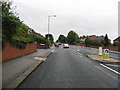
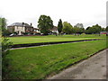
S60 2LL is a small residential cluster within the S60 postcode area of England, hosting a population of 2,249 people. The area is relatively compact, with a population density of 1,483 people per square kilometre, creating a concentrated living environment. This density means daily life revolves around the immediate vicinity, with essential services and transport links located in close practical reach for most residents. Living in S60 2LL involves navigating a built environment where proximity defines convenience. The layout supports a mix of commercial activity and residential living, characterised by high urbanisation rates typical for inner-city clusters. You will find that the area caters specifically to smaller household units rather than sprawling households with large gardens. The location sits firmly within the Sheffield and Rotherham region, benefiting from established transport networks that connect it to wider South Yorkshire. For anyone considering homes in S60 2LL, understanding this tight-knit, high-density nature is key to assessing whether the area suits your lifestyle needs. The compact size ensures that walks to shops or stations are short, but it also means less scope for expansive green space within the immediate neighbourhood boundaries.
- Area Type
- Postcode
- Area Size
- Not available
- Population
- 2249
- Population Density
- 1483 people/km²
The housing stock in S60 2LL is defined by its specific accommodation type, with flats forming the primary form of residence. This unit type predominate throughout the cluster, catering to the mobile workforce and smaller households that have made S60 2LL their base. With just 19% of homes being owner-occupied, the market is driven heavily by the private rental sector. Investors and landlords hold the majority of the stock, meaning you will encounter a high volume of rental properties rather than vacant owner-occupied family homes. This market structure indicates that buyers looking for S60 2LL will primarily be searching for owned freehold or leasehold flats, rather than attached or detached houses. The small population of 2,249 supports a limited but intense property market where available stock changes rapidly. For those seeking homes in S60 2LL, the lack of owner-occupiers suggests high demand from the private sector and potential challenges in securing aligned tenants in a rental context. The property value dynamics are likely influenced by the proximity to major transport hubs and retail sites, typical for urban flat markets. Understanding that this is a flat-dominated zone is essential for anyone evaluating the investment potential or living costs associated with this postcode.
House Prices in S60 2LL
No properties found in this postcode.
Energy Efficiency in S60 2LL
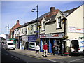
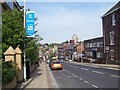
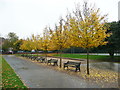
Living in S60 2LL offers immediate access to essential retail and transport facilities within practical reach. You can shop at Morissons Daily, Heron Rotherham, and Tesco Rotherham, all located nearby. These supermarkets cover your weekly grocery needs alongside other daily shopping requirements. Public transport accessibility is a major strength, with Rotherham Central Railway Station, Meadowhall Railway Station, and Medowhall Railway Station all situated close by. The tram network also passes through the area via Rotherham Platform Both Directions, Parkgate, and Meadowhall South. This mix of rail and metro makes commuting easy for those working outside the immediate city. The density of amenities around S60 2LL ensures that you rarely need to travel far for basics. Whether you are grabbing lunch, catching a train, or doing a quick shop, the locations provided cover the daily rhythm of life. This connectivity reduces car dependency, making the area convenient for pedestrians and cyclists heading to work or leisure destinations. The presence of both retail and transport hubs creates a self-sufficient environment where most daily needs are met locally.
Amenities
Schools
Education options for families residing in or near S60 2LL are represented primarily by the high school sector, rather than a wide range of primary institutions. The nearest educational facility listed is RNN Group, which operates as a sixth-form college. This institution serves older students, typically those aged 16 to 19, offering further education or advanced studies before university entry. The absence of primary or secondary school data in the immediate vicinity means that younger children may commute from elsewhere or attend schools not listed in this specific local dataset. For parents considering schools near S60 2LL, the presence of RNN Group indicates access to higher education pathways without the immediate need for nearby infant or junior campuses. You might find that this area acts as a residential zone for professionals with children already in school elsewhere, or those planning to move to areas with younger school clusters in the near future. The limited school infrastructure highlights the residential and commuter nature of S60 2LL, where daily life facilitates travel to education hubs in neighbouring towns.
| Rank | School | Type | Entry gender | Ages |
|---|
Explore more schools in this area
Go to Schools tabDemographics
The community profile in S60 2LL reflects a mature demographic structure centred on adults between 30 and 64 years old. The median age across the area stands at 47 years, indicating a resident base that is well-established rather than young families moving in for the first time. With only 19% of residents owning their homes, the area functions primarily as a rental market where tenants do not build long-term equity in their immediate surroundings. This low home ownership rate suggests a high turnover of occupants and a community less anchored by deep-rooted generations. The predominant ethnic group is White, forming the cultural backbone of the local population. Accommodation in S60 2LL is dominated by flats, aligning with the needs of smaller households and the area's high-density layout. The concentration of adults in this age bracket, combined with the lack of owner-occupiers, creates a transient social atmosphere. You can expect a neighbourhood where long-term neighbours are less common than in suburban districts. The high density of 1,483 people per square kilometre further reinforces the urban feel, fostering a more anonymous environment compared to village centres or detached home settlements.
Household Size
Accommodation Type
Tenure
Ethnic Group
Religion
Household Composition
Age
Household Deprivation
NS-SEC
Explore more demographic insights in this area
Go to Demographics tabPlanning
Planning Constraints
- Flood RiskPremium
- Ramsar Wetland SitesPremium
- Area of Outstanding Natural BeautyPremium
- Protected Nature ReservePremium
- Protected WoodlandPremium