Area Overview for S60 2AU
Photos of S60 2AU
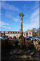
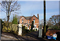
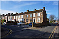
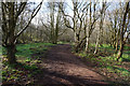
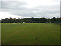
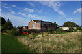
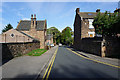
32 photos from this area
Area Information
Key information about the S60 2AU including its size, population, and administrative classification.
- Area Type
- Postcode
- Area Size
- 7306 m²
- Population
- 1983
- Population Density
- 3655 people/km²
House Prices in S60 2AU
8
Properties
£297,083
Average Sold Price
£79,000
Lowest Price
£605,000
Highest Price
Showing 8 properties
| Address | Type | Beds | Baths | Last Sale Price | Last Sale Date | |
|---|---|---|---|---|---|---|
| 43 Moorgate Road, Moorgate, Rotherham, S60 2AU | house | - | - | £490,000 | Jun 2021 | |
| 43A Moorgate Road, Moorgate, Rotherham, S60 2AU | Detached | 3 | - | £150,000 | Jul 2013 | |
| 66 Moorgate Road, Moorgate, Rotherham, S60 2AU | Detached | - | - | £605,000 | Aug 2007 | |
| 64 Moorgate Road, Moorgate, Rotherham, S60 2AU | Detached | - | - | £377,500 | Aug 2007 | |
| 62 Moorgate Road, Moorgate, Rotherham, S60 2AU | Semi-detached | 3 | 1 | £79,000 | Mar 1998 | |
| 58 Moorgate Road, Moorgate, Rotherham, S60 2AU | Detached | 4 | 1 | £81,000 | Nov 1996 | |
| 60 Moorgate Road, Moorgate, Rotherham, S60 2AU | Retail | 3 | 1 | - | - | |
| 56 Moorgate Road, Moorgate, Rotherham, S60 2AU | house | - | - | - | - |
Energy Efficiency in S60 2AU
Amenities
Schools
| Rank | School | Type | Entry gender | Ages |
|---|
Explore more schools in this area
Go to Schools tabDemographics
Household Size
Family (3-5 people)
most common
Accommodation Type
Houses
most common
Tenure
24
majority
Ethnic Group
White
most common
Religion
N/A
most common
Household Composition
N/A
most common
Age
47
median
Adults (30-64 years)
most common
Household Deprivation
N/A
with no deprivation
NS-SEC
13
in Lower managerial occupations
Explore more demographic insights in this area
Go to Demographics tabPlanning
Planning Constraints
- Flood RiskPremium
- Ramsar Wetland SitesPremium
- Area of Outstanding Natural BeautyPremium
- Protected Nature ReservePremium
- Protected WoodlandPremium