Area Overview for S6 6LB
Photos of S6 6LB
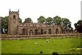
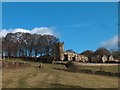
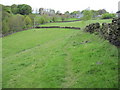
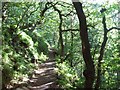
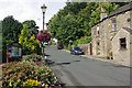

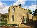
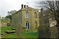
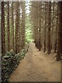
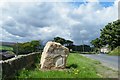
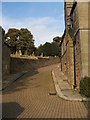

103 photos from this area
Area Information
Key information about the S6 6LB including its size, population, and administrative classification.
- Area Type
- Postcode
- Area Size
- 1.2 km²
- Population
- 1804
- Population Density
- 15 people/km²
House Prices in S6 6LB
59
Properties
£197,169
Average Sold Price
£55,000
Lowest Price
£575,000
Highest Price
Showing 59 properties
| Address | Type | Beds | Baths | Last Sale Price | Last Sale Date | |
|---|---|---|---|---|---|---|
| 17 Mill Lee Road, Sheffield, S6 6LB | Semi-detached | 2 | 1 | £282,500 | Feb 2025 | |
| Sunny Bank, Fair House Lane, Sheffield, S6 6LB | Detached | 4 | 2 | £575,000 | May 2019 | |
| 3 Dale Croft, Sheffield, S6 6LB | house | - | - | £150,000 | Feb 2013 | |
| 1, Burnside Cottages, Woodfall Lane, Sheffield, S6 6LB | house | - | - | £135,700 | May 2012 | |
| 2, Burnside Cottages, Woodfall Lane, Sheffield, S6 6LB | house | - | - | £150,000 | Jun 2011 | |
| 3, Cross Row Cottages, Woodfall Lane, Sheffield, S6 6LB | house | - | - | £170,000 | Jun 2010 | |
| 1, Cross Row Cottages, Woodfall Lane, Sheffield, S6 6LB | Cottage | 1 | 1 | £115,000 | Jul 2003 | |
| Filter Cottage, Mill Lee Road, Sheffield, S6 6LB | Cottage | 3 | 1 | £150,000 | Mar 2003 | |
| Agden Dam House, Windy Bank, Sheffield, S6 6LB | house | - | - | £180,000 | Oct 2000 | |
| 2, Cross Row Cottages, Woodfall Lane, Sheffield, S6 6LB | house | 1 | 1 | £55,000 | Jan 1999 |
Page 1 of 6
Energy Efficiency in S6 6LB
Amenities
Schools
| Rank | School | Type | Entry gender | Ages |
|---|
Explore more schools in this area
Go to Schools tabDemographics
Household Size
Two person
most common
Accommodation Type
Houses
most common
Tenure
78
majority
Ethnic Group
White
most common
Religion
N/A
most common
Household Composition
N/A
most common
Age
47
median
Adults (30-64 years)
most common
Household Deprivation
N/A
with no deprivation
NS-SEC
45
in Lower managerial occupations
Explore more demographic insights in this area
Go to Demographics tabPlanning
Planning Constraints
- Flood RiskPremium
- Ramsar Wetland SitesPremium
- Area of Outstanding Natural BeautyPremium
- Protected Nature ReservePremium