Area Overview for S6 5FT
Photos of S6 5FT
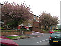
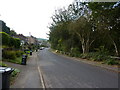
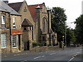
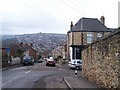
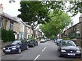
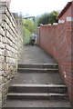
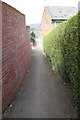
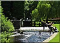
75 photos from this area
Area Information
Key information about the S6 5FT including its size, population, and administrative classification.
- Area Type
- Postcode
- Area Size
- 6314 m²
- Population
- 1434
- Population Density
- 2876 people/km²
House Prices in S6 5FT
28
Properties
£143,279
Average Sold Price
£42,000
Lowest Price
£400,000
Highest Price
Showing 28 properties
| Address | Type | Beds | Baths | Last Sale Price | Last Sale Date | |
|---|---|---|---|---|---|---|
| 257 Stannington Road, Sheffield, S6 5FT | Terraced | 2 | 1 | £205,000 | Apr 2024 | |
| 261 Stannington Road, Sheffield, S6 5FT | Terraced | 4 | 2 | £400,000 | Nov 2023 | |
| 245 Stannington Road, Sheffield, S6 5FT | Semi-detached | 3 | - | £220,000 | Oct 2021 | |
| 213 Stannington Road, Sheffield, S6 5FT | Detached | 3 | 1 | £270,000 | Jun 2021 | |
| 209 Stannington Road, Sheffield, S6 5FT | Terraced | 3 | 1 | £105,000 | Mar 2020 | |
| 205 Stannington Road, Sheffield, S6 5FT | Terraced | 3 | 1 | £130,000 | Feb 2020 | |
| 251 Stannington Road, Sheffield, S6 5FT | house | - | - | £120,000 | Oct 2018 | |
| 189 Stannington Road, Sheffield, S6 5FT | Terraced | 3 | 1 | £175,000 | Aug 2018 | |
| 179 Stannington Road, Sheffield, S6 5FT | Terraced | 2 | - | £137,000 | Dec 2016 | |
| 191 Stannington Road, Sheffield, S6 5FT | Terraced | 2 | 1 | £125,000 | Sep 2016 |
Page 1 of 3
Energy Efficiency in S6 5FT
Amenities
Schools
| Rank | School | Type | Entry gender | Ages |
|---|
Explore more schools in this area
Go to Schools tabDemographics
Household Size
Two person
most common
Accommodation Type
Houses
most common
Tenure
77
majority
Ethnic Group
White
most common
Religion
N/A
most common
Household Composition
N/A
most common
Age
47
median
Adults (30-64 years)
most common
Household Deprivation
N/A
with no deprivation
NS-SEC
39
in Lower managerial occupations
Explore more demographic insights in this area
Go to Demographics tabPlanning
Planning Constraints
- Flood RiskPremium
- Ramsar Wetland SitesPremium
- Area of Outstanding Natural BeautyPremium
- Protected Nature ReservePremium
- Protected WoodlandPremium