Area Overview for S6 4QL
Photos of S6 4QL
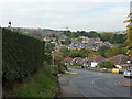
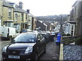
100 photos from this area
Area Information
Key information about the S6 4QL including its size, population, and administrative classification.
- Area Type
- Postcode
- Area Size
- 6054 m²
- Population
- 1505
- Population Density
- 9843 people/km²
House Prices in S6 4QL
44
Properties
£103,638
Average Sold Price
£26,300
Lowest Price
£195,000
Highest Price
Showing 44 properties
| Address | Type | Beds | Baths | Last Sale Price | Last Sale Date | |
|---|---|---|---|---|---|---|
| 20 Findon Street, Sheffield, S6 4QL | Terraced | 2 | 1 | £185,000 | Sep 2024 | |
| 43 Findon Street, Sheffield, S6 4QL | Terraced | 3 | 1 | £195,000 | Nov 2023 | |
| 34 Findon Street, Sheffield, S6 4QL | Terraced | 3 | 1 | £180,000 | Nov 2021 | |
| 9 Findon Street, Sheffield, S6 4QL | house | - | - | £112,000 | Feb 2021 | |
| 28 Findon Street, Sheffield, S6 4QL | Terraced | 3 | 1 | £162,000 | Dec 2020 | |
| 39 Findon Street, Sheffield, S6 4QL | Terraced | 3 | - | £140,000 | Jun 2019 | |
| 19 Findon Street, Sheffield, S6 4QL | house | - | - | £166,500 | Jul 2018 | |
| 26 Findon Street, Sheffield, S6 4QL | Terraced | 3 | 1 | £146,000 | Jun 2018 | |
| 18 Findon Street, Sheffield, S6 4QL | Terraced | 3 | 1 | £150,000 | Feb 2018 | |
| 30 Findon Street, Sheffield, S6 4QL | house | - | - | £115,000 | Jan 2017 |
Page 1 of 5
Energy Efficiency in S6 4QL
Amenities
Schools
| Rank | School | Type | Entry gender | Ages |
|---|
Explore more schools in this area
Go to Schools tabDemographics
Household Size
Two person
most common
Accommodation Type
Houses
most common
Tenure
71
majority
Ethnic Group
White
most common
Religion
N/A
most common
Household Composition
N/A
most common
Age
47
median
Adults (30-64 years)
most common
Household Deprivation
N/A
with no deprivation
NS-SEC
39
in Lower managerial occupations
Explore more demographic insights in this area
Go to Demographics tabPlanning
Planning Constraints
- Flood RiskPremium
- Ramsar Wetland SitesPremium
- Area of Outstanding Natural BeautyPremium
- Protected Nature ReservePremium
- Protected WoodlandPremium