Area Overview for S6 4BD
Photos of S6 4BD
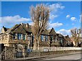
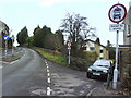
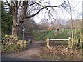
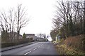
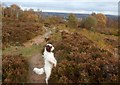
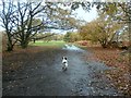
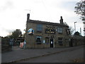
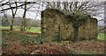
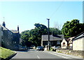
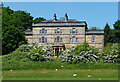
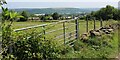
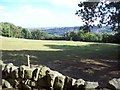
64 photos from this area
Area Information
Key information about the S6 4BD including its size, population, and administrative classification.
- Area Type
- Postcode
- Area Size
- 8.3 hectares
- Population
- 1599
- Population Density
- 3538 people/km²
House Prices in S6 4BD
53
Properties
£213,382
Average Sold Price
£55,000
Lowest Price
£390,000
Highest Price
Showing 53 properties
| Address | Type | Beds | Baths | Last Sale Price | Last Sale Date | |
|---|---|---|---|---|---|---|
| 307 Worrall Road, Worrall, Sheffield, S6 4BD | Cottage | 2 | 1 | £220,000 | Jul 2025 | |
| 72 Worrall Road, Worrall, Sheffield, S6 4BD | house | - | - | £234,000 | Mar 2023 | |
| 321 Worrall Road, Worrall, Sheffield, S6 4BD | Terraced | 3 | 1 | £217,500 | Jul 2022 | |
| 281 Worrall Road, Worrall, Sheffield, S6 4BD | house | - | - | £177,000 | Aug 2021 | |
| 215 Worrall Road, Worrall, Sheffield, S6 4BD | Bungalow | 4 | 3 | £380,000 | Jun 2020 | |
| 259 Worrall Road, Worrall, Sheffield, S6 4BD | Terraced | 2 | 1 | £104,000 | Mar 2019 | |
| 260 Worrall Road, Worrall, Sheffield, S6 4BD | Detached | - | - | £240,000 | Apr 2017 | |
| 68 Worrall Road, Worrall, Sheffield, S6 4BD | Bungalow | 3 | 1 | £390,000 | Feb 2017 | |
| 257 Worrall Road, Worrall, Sheffield, S6 4BD | house | 2 | - | £139,950 | May 2010 | |
| 326 Worrall Road, Worrall, Sheffield, S6 4BD | Semi-detached | - | - | £179,950 | Jul 2006 |
Page 1 of 6
Energy Efficiency in S6 4BD
Amenities
Schools
| Rank | School | Type | Entry gender | Ages |
|---|
Explore more schools in this area
Go to Schools tabDemographics
Household Size
Family (3-5 people)
most common
Accommodation Type
Houses
most common
Tenure
71
majority
Ethnic Group
White
most common
Religion
N/A
most common
Household Composition
N/A
most common
Age
47
median
Adults (30-64 years)
most common
Household Deprivation
N/A
with no deprivation
NS-SEC
44
in Lower managerial occupations
Explore more demographic insights in this area
Go to Demographics tabPlanning
Planning Constraints
- Flood RiskPremium
- Ramsar Wetland SitesPremium
- Area of Outstanding Natural BeautyPremium
- Protected Nature ReservePremium
- Protected WoodlandPremium