Area Overview for S6 3BN
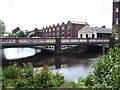
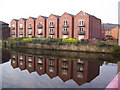
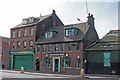
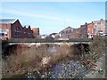
Photos of S6 3BN
Area Information
Living in postcode S6 3BN offers a specific residential experience distinct from the wider Sheffield landscape. This cluster covers 4160 square metres and holds a population of 1664 people. You will find a tight-knit environment where neighbours know each other within a compact footprint. The area functions as a standalone residential unit rather than a sprawling suburb. Daily life here revolves around two streets or a few key junctions that define the local rhythm. Residents deal with the town centre vagaries of Sheffield without being right in the heart of the industrial sprawl. The small scale means you notice local changes quickly. You walk across the small distance to reach the edge of the next district. This postcode represents a very specific slice of Sheffield where historical housing patterns meet modern demands. You might argue it is more of a cluster than a traditional neighbourhood. Yet it provides a clear address for those seeking shelter from the high density city centre. The area size of 4160 m² means you have defined boundaries that separate you from surrounding developments. You move through this space with a sense of locality that larger postcodes cannot always replicate.
- Area Type
- Postcode
- Area Size
- 4160 m²
- Population
- 1664
- Population Density
- 2959 people/km²
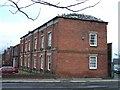
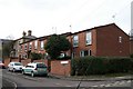
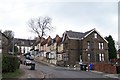
Homes in S6 3BN consist entirely of houses according to the classification data. You will not encounter blocks of flats or purpose-built apartments in this specific postal code. The housing stock presents a traditional domestic environment rather than a modern urban high-rise setting. Only 30 percent of residents own their home outright or with a mortgage. This proportion leaves a dominant section of the market reliant on private or social renting. You must consider buying in a location where tenancy is the norm for the majority of occupants. This situation often drives up rental demand and affects local stability. The small area size of 4160 square metres limits the total number of dwellings. Supply remains restricted because the physical footprint cannot expand significantly. Buyers looking for a full-time family home here face a tight inventory. You might see few listings available at any given moment. The absence of flats means family groups seeking multiple bedrooms have limited options. Investors may find the low ownership rate attractive for rental yield potential. However, you cannot expect the transient vibe of a student flat district. The housing character remains consistent with traditional Sheffield independent homes. This consistency defines the property market in this postcode strip.
House Prices in S6 3BN
Showing 2 properties
| Address | Type | Beds | Baths | Last Sale Price | Last Sale Date | |
|---|---|---|---|---|---|---|
| Spar, Penistone Road Filling Station, Penistone Road, Owlerton, Sheffield, S6 3BN | shop | - | - | - | - | |
| Bath Steel Works, Penistone Road, Owlerton, Sheffield, S6 3BN | Industrial | - | - | - | - |
Energy Efficiency in S6 3BN
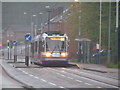
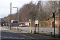
Residents of S6 3BN have practical access to key amenities within a short distance. Local shopping options include Spar, Tesco Sheffield and Iceland Sheffield. You can stock up on groceries or grab a quick meal at the Iceland store. Tesco Sheffield provides a larger selection for household needs without a long journey. Metro transport is served by five main lines connecting the area to Sheffield. Infirmary Road and Shalesmoor to Middlewood/Malin Br stops bring you close to the city core. Five rail services operate nearby to facilitate longer commutes. You catch trains at Sheffield Railway Station for business trips or leisure visits. Alternatives exist at Darnall Railway Station and Medowhall Railway Station for direct routes. These stations connect you to the wider region including M1 access and South Yorkshire hubs. Shopping, public transport and rail hubs cluster around your immediate postcode. You do not need a car for basic errands if you schedule your visits around timetables. Retail and transport nodes create a convenient walkable perimeter around S6 3BN.
Amenities
Schools
Schools near S6 3BN provide early education for the local family demographic. Upper Thorpe Nursery and First School sits directly within the catchment considerations for this area. This institution serves as a primary school option for young children living nearby. The focus here is on early years foundation stage learning rather than secondary education. You will need to travel further for GCSE preparation or A-level qualifications. The proximity of this single primary school suggests a specific educational corridor for residents. Families with toddlers or infants will value the short walk to this school gate. Secondary options require commuting to larger campuses outside the immediate vicinity. The absence of secondary schools listed indicates a clear separation in educational stages. You navigate the system by attending this primary hub for the first years of schooling. Transport links become more critical once children need to commute across town. The specific name Upper Thorpe Nursery and First School anchors the family identity of the area. It serves as the main focal point for child education within S6 3BN boundaries. Parents rely on this single facility for their youngest residents.
| Rank | School | Type | Entry gender | Ages |
|---|
Explore more schools in this area
Go to Schools tabDemographics
The community in S6 3BN reflects a mature and stable population profile. The median age is 47 years old. Most residents fall into the adult age range between 30 and 64 years. This demographic skew suggests a neighbourhood dominated by families with grown children or empty nesters. You will not find a high concentration of teenagers or young children at play in the streets. Ownership rates stand at 30 percent in this area. This figure indicates a significant rental component alongside the homes for sale. Three out of ten households have purchased their properties while the remaining seven out of ten are tenants. The accommodation type is exclusively houses. You will not find flats or bungalows mixed into this specific cluster according to the available records. The ethnic group composition is predominantly White. Living here you engage with a community that mirrors the wider demographics of South Yorkshire. The combination of house ownership and adult age creates a quiet atmosphere. You deal with residents who have settled into their homes rather than young professionals moving frequently. The low ownership rate suggests many adults pay rent rather than mortgages. This dynamic influences local spending and school choices for the smaller cohort of families.
Household Size
Accommodation Type
Tenure
Ethnic Group
Religion
Household Composition
Age
Household Deprivation
NS-SEC
Explore more demographic insights in this area
Go to Demographics tabPlanning
Planning Constraints
- Flood RiskPremium
- Ramsar Wetland SitesPremium
- Area of Outstanding Natural BeautyPremium
- Protected Nature ReservePremium
- Protected WoodlandPremium