Area Overview for S6 3AD
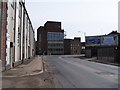
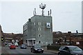
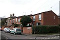
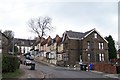
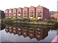
Photos of S6 3AD


Area Information
S6 3AD is a specific postcode area covering a small residential cluster located in Sheffield, England. With a population of 2,103 residents, this area functions as a tightly knit neighbourhood rather than a sprawling district. Living in S6 3AD means navigating a compact environment where daily routines are defined by proximity to local transport hubs and shopping centres. The area sits within the broader city infrastructure yet maintains distinct identity as a hub for younger adults. You will find a community deeply integrated into the wider Sheffield network, relying heavily on the surrounding rail links and major retail outlets for broader needs. The compact nature of this postcode cluster simplifies local logistics, allowing residents to manage their daily lives without needing to travel far for essential services. This makes the location particularly attractive for those seeking a straightforward urban living experience without the sprawl of outer suburbs. The area represents a practical choice for individuals prioritising efficient access to the city centre and major transport corridors over spacious detached housing or extensive green belt surroundings.
- Area Type
- Postcode
- Area Size
- Not available
- Population
- 2103
- Population Density
- 7645 people/km²
The property market in S6 3AD reflects a clear shift towards rental living rather than long-term homeownership. With just 17% of homes owned outright, this postcode area operates primarily as a rental market. The accommodation type is almost exclusively flats, which suits the lifestyle needs of the 22-year-old median resident but limits appeal to buyers seeking detached properties or gardens. This structure means you might find better deals on houses in surrounding postcodes while remaining centrally located in S6 3AD. Most people living here are tenants occupying flats, which often appeals to students and young workers moving to Sheffield for education or employment. If you are looking to purchase, consider that the scarcity of owner-occupied homes suggests the immediate vicinity may lack the stability of established owner-bartered communities. The prevalence of flats indicates a housing stock designed for density and efficiency rather than space and privacy. Understanding that 83% of residents are not full homeowners helps frame what you can realistically expect when searching for properties within this specific cluster.
House Prices in S6 3AD
No properties found in this postcode.
Energy Efficiency in S6 3AD
Daily life in S6 3AD benefits from immediate access to significant retail and transport hubs within practical reach of every resident. You have just five notable rail options nearby, including Sheffield Railway Station, Darnall Railway Station, and Medowhall Railway Station, ensuring quick access to the wider region. Shopping convenience is equally strong, with five major retailers located in close proximity, such as the Asda Sheffield depot, the Spar outlet, and the large Tesco Sheffield supermarket on the main road. These venues allow you to stock up on groceries or pick up essentials without driving far from your flat. Five metro lines or bus routes also serve the area, notably the Shalesmoor line and services connecting Middlewood, Malin Br, and the Infirmary Road corridor. This network means you can reach Sheffield city centre or visit the Malin Centre for leisure easily. The combination of major supermarkets and frequent public transport makes this a convenient choice for those valuing time and accessibility in their daily routine.
Amenities
Schools
| Rank | School | Type | Entry gender | Ages |
|---|
Explore more schools in this area
Go to Schools tabDemographics
The community in S6 3AD is predominantly shaped by young adults aged between 15 and 29 years. This specific age range constitutes the most common demographic, driving the cultural and social character of the neighbourhood. Your analysis of the resident population reveals a median age of just 22 years, indicating a dynamic environment focused on student life, early careers, or young family formation. Only 17% of households in this area own their homes completely, suggesting a market dominated by renters temporarily settled in the location. The overwhelming majority of accommodation consists of flats, which aligns perfectly with the needs of this youthful demographic seeking affordable urban living. While White residents form the predominant ethnic group, the high concentration of young adults often brings diverse influences from universities and workplaces nearby. This profile creates a vibrant but transient community where long-term settlement is less common than in older, established neighbourhoods. Those considering homes in S6 3AD should expect a lively atmosphere driven by university students and young professionals rather than settled retirees or large families seeking traditional detached homes.
Household Size
Accommodation Type
Tenure
Ethnic Group
Religion
Household Composition
Age
Household Deprivation
NS-SEC
Explore more demographic insights in this area
Go to Demographics tabPlanning
Planning Constraints
- Flood RiskPremium
- Ramsar Wetland SitesPremium
- Area of Outstanding Natural BeautyPremium
- Protected Nature ReservePremium
- Protected WoodlandPremium