Area Overview for S6 2UJ
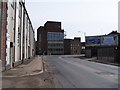
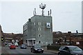
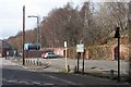
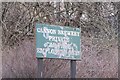
Photos of S6 2UJ


Area Information
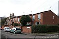
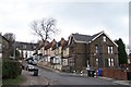
Living in S6 2UJ means occupying a compact residential cluster defined by its specific postcode boundaries. This area spans just 2,023 square metres, creating an intensely concentrated settlement within the Sheffield landscape. You are joining a community of 1,626 residents where proximity defines daily interaction. The geography here is small enough that neighbours often know one another, yet the density creates a tightly knit residential block distinct from the surrounding suburbs. Every decision about your home life revolves around the realities of this narrow footprint. While the total area appears modest on a map, the number of homes accommodates a significant local population. This cluster represents a microcosm of Sheffield's housing stock, where the scale of the locality directly impacts your commute, shopping routes, and social opportunities. Prospective buyers here must accept the constraints of a small landmass while appreciating the advantages of an established residential zone. The area functions as a distinct pocket within the wider neighbourhood, offering immediate access to nearby town centres and transport links without the sprawl of larger districts. Your experience of living here will be shaped by its status as a defined postcode area rather than a traditional parish or village boundary.
- Area Type
- Postcode
- Area Size
- 2023 m²
- Population
- 1626
- Population Density
- 4764 people/km²
You are looking at a property market defined by the dominance of houses within a tightly bounded 2,023 square metre area. With only 34% home ownership rates, this postcode is clearly a rental market first and foremost. This statistic means sellers will find fewer opportunities than in areas with higher owner-occupier percentages, but renters enjoy a stable housing stock designed for families. Since 1,626 people reside here, competition for available rental properties can be fierce if stock is limited by the small physical size of the cluster. You will not encounter any flats or apartments; every home is a house, which dictates the types of mortgages lenders offer and the targeting of estate agents. The low inventory relative to the population size suggests that finding a beam matches your requirements might require patience. Buyers looking for specific features must act quickly because multiple buyers often compete for the same small number of units. The market here operates on the reality of supply and demand in a micro-locale where new builds are unlikely. Your investment decision hinges on the scarcity of these specific houses within the S6 2UJ boundaries.
House Prices in S6 2UJ
Showing 16 properties
| Address | Type | Beds | Baths | Last Sale Price | Last Sale Date | |
|---|---|---|---|---|---|---|
| Flat 9, 89 Langsett Road, Sheffield, S6 2UJ | Flat | 2 | 1 | - | - | |
| Flat 10, 89 Langsett Road, Sheffield, S6 2UJ | Flat | 2 | 1 | - | - | |
| Flat 4, 89 Langsett Road, Sheffield, S6 2UJ | Flat | 2 | 1 | - | - | |
| Flat C, 87 Langsett Road, Sheffield, S6 2UJ | Flat | 1 | - | - | - | |
| Flat B, 87 Langsett Road, Sheffield, S6 2UJ | Flat | - | - | - | - | |
| Flat A, 87 Langsett Road, Sheffield, S6 2UJ | Flat | - | - | - | - | |
| Flat D, 87 Langsett Road, Sheffield, S6 2UJ | house | - | - | - | - | |
| Flat 5, 89 Langsett Road, Sheffield, S6 2UJ | Flat | - | - | - | - | |
| Flat 7, 89 Langsett Road, Sheffield, S6 2UJ | Flat | - | - | - | - | |
| Flat 3, 89 Langsett Road, Sheffield, S6 2UJ | Flat | - | - | - | - |
Energy Efficiency in S6 2UJ
Your daily life in S6 2UJ sustains through practical access to a range of near amenities within walking or short driving distance. You have five retail options immediately available, including Aldi Walkley and Iceland Sheffield, ensuring you can stock your groceries without a lengthy journey. Spar is also on hand for convenience needs. Transport relies heavily on the railway network, with five rail stations identified as accessible points. Sheffield Railway Station, Darnall Railway Station, and Medowhall Railway Station stand out as key hubs for regional travel. You also have five metro stations nearby, including Langsett and Bamforth St to Middlewood/Malin Br, facilitating local transit. These transport nodes mean you are not reliant solely on personal vehicles for commuting to Sheffield city centre or connecting to wider regional transport. The convenience of having major supermarkets and multiple train links within reach defines the character of living here. You can manage your weekly shop and your weekly commute without needing to venture deep into the city. This accessibility ensures that the residential focus of S6 2UJ does not come at the cost of isolation from urban services and amenities.
Amenities
Schools
Families living in S6 2UJ benefit from immediate access to two primary educational institutions nearby. Walkley Junior School serves older children in the primary phase of education, providing a seamless transition for students moving from early years classes. You will also find Walkley Nursery and Infant School, which caters to the earliest stages of childhood development and the first years of formal learning. These two institutions form the backbone of primary education for the local catchment area. The presence of these specific schools means parents do not need to commute long distances to ensure their children attend reputable state-maintained education facilities. Both schools are located at a practical distance, reinforcing the community link between residents and the educational environment. If you are considering this area for your children, the concentration of primary options reduces transport time to and from school gates. This clustering allows for a predictable daily routine centred around these named educational establishments. For those evaluating the area as a potential home base, the availability of these specific school types removes the need to look far beyond the immediate neighbourhood for schooling provisions.
| Rank | School | Type | Entry gender | Ages |
|---|
Explore more schools in this area
Go to Schools tabDemographics
The community within S6 2UJ is characterised by a mature age profile, with a median age of 47 years. Most residents fall into the adult bracket between 30 and 64 years old, suggesting a population composed of established households rather than young families or pensioners. You will find that 34% of the homes sit within your own ownership, while the majority of properties are rented accommodations. This rental dominance often indicates a higher turnover of residents compared to owner-occupied neighbourhoods. The accommodation type is exclusively houses, meaning terraced, semi-detached, or detached structures make up the entire stock. There are no purpose-built flats or apartments within this specific postcode cluster. Ethnically, the area is predominantly white, reflecting the broader demographic trends of the surrounding Sheffield districts. You should expect a community where longevity and stability form the cultural norm, driven by the age structure of the people. The lack of younger children in the primary voting age may affect local policy discussions, though the proximity to schools introduces families into the mix. This demographic picture suggests a shift in household composition typical of urban residential areas in post-industrial England.
Household Size
Accommodation Type
Tenure
Ethnic Group
Religion
Household Composition
Age
Household Deprivation
NS-SEC
Explore more demographic insights in this area
Go to Demographics tabPlanning
Planning Constraints
- Flood RiskPremium
- Ramsar Wetland SitesPremium
- Area of Outstanding Natural BeautyPremium
- Protected Nature ReservePremium
- Protected WoodlandPremium