Area Overview for S6 2PY
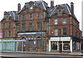
Photos of S6 2PY


Area Information
Living in S6 2PY means residing within a compact residential cluster characterised by its specific postcode definition in England. This small area houses a population of 1,811 people, creating a close-knit neighbourhood rather than a sprawling suburb. The community is tightly focused, which often fosters stronger local connections compared to larger urban districts. Daily life here revolves around proximity; residents do not need to travel far for essential services or regular commutes. The area functions as a distinct residential pocket where the scale of development keeps a balance between privacy and accessibility. You will find that this postcode covers a small section of Sheffield where the built environment prioritises housing density over extensive open spaces. The sheer number of occupants is low enough that you will notice the character of your immediate streets while still having access to wider city facilities nearby. Living in S6 2PY offers a straightforward lifestyle without the noise and congestion typical of major city centres. It is a place defined by practicality, where the primary focus remains on housing and the immediate convenience of nearby transport links. The area's identity is built on function, serving as a quiet but well-connected base for those seeking to establish a home in Sheffield.
- Area Type
- Postcode
- Area Size
- Not available
- Population
- 1811
- Population Density
- 6449 people/km²
The housing market in S6 2PY is defined by a predominance of houses as the main accommodation type. This structural fact shapes the physical landscape, distinguishing it from areas dominated by flats or high-density blocks. However, only 32% of households own their homes, indicating a robust rental sector where tenants make up the majority of occupants. This imbalance between ownership and rental tenure suggests that many residents are either students, professionals on fixed-term contracts, or those still building equity in a competitive market. For buyers looking at homes in S6 2PY, the reliance on rental accommodation implies frequent changes in occupancy and potentially higher turnover rates for existing properties. The presence of houses means there is no shortage of space for families, but the tenant-heavy nature of the market may affect property stability in the short term. You must consider whether a rented section of the street aligns with your long-term plans for the location. The area serves as a residential cluster where people access these homes for varying durations, blending the traditional layout of a house-dominant area with the fluidity of a rental-heavy population.
House Prices in S6 2PY
No properties found in this postcode.
Energy Efficiency in S6 2PY
Residents of S6 2PY benefit from a comprehensive range of amenities located within practical driving distance. For retail needs, you have access to five major supermarkets, including Tesco Kelham, Tesco Sheffield, and Spar. This concentration of grocery stores means you can stock your home with minimal travel. Public transport options are similarly extensive, with five metro lines and five rail lines connecting the neighbourhood to key destinations like Shalesmoor and Darnall. Daily life is supported by these five retail outlets and transport hubs, ensuring convenience is never far away. You can walk or take a short bus ride to Tesco Kelham for local supplies or travel via the Shalesmoor station for broader city access. The presence of these five specific amenities creates a functional lifestyle where essential shopping and commuting are solved quickly. There is no need to venture far into the city to find basic necessities or daily transit. Living in S6 2PY offers a balance of urban convenience and local accessibility, with the necessary infrastructure right at your fingertips. The area supports a self-contained routine backed by reliable commercial and transport services.
Amenities
Schools
Families living in S6 2PY have Astrea Academy Sheffield within practical reach as their nearest educational option. This institution operates as an academy and holds an Ofsted rating of good. The availability of a single named school with a positive rating provides a clear benchmark for families considering this postcode for relocation. Living in S6 2PY allows you to access an education establishment that has met national standards, ensuring a baseline of quality for local children. The immediate vicinity offers this specific educational resource, though the limited school data suggests reliance on this primary option within direct proximity. For parents, the fact that the school is an academy indicates a degree of autonomy in curriculum and governance. The good rating from Ofsted is a crucial piece of information when weighing the suitability of this area for raising a family. While the data highlights only this one institution, its presence confirms that formal education is accessible to residents without needing to travel to distant boroughs. You can rely on this established academy as the core educational anchor for the S6 2PY district.
| Rank | School | Type | Entry gender | Ages |
|---|
Explore more schools in this area
Go to Schools tabDemographics
The community in S6 2PY presents a distinct age profile shaped by its diverse household composition. The median age across this area is 22, indicating a youthful population with significant representation among young adults. Despite the low median, the most common age range consists of adults between 30 and 64 years, suggesting many residents have moved into long-term family homes. This demographic mix creates a neighbourhood where young professionals and established families coexist within the same streets. Home ownership stands at 32%, meaning the majority of residents live in rented accommodation. This statistic highlights a strong student or transient element to the local population, consistent with the low median age. The dominant accommodation type consists of houses, which provides a structural foundation for families even as tenure remains predominantly rental. The predominant ethnic group in this postcode is Asian, adding a specific cultural flavour to the community dynamics. You will find a vibrant mix of backgrounds, yet the data shows a clear skew towards younger demographics owning fewer properties outright. The overall picture suggests an area in transition, where temporary residents share space with long-term adults occupying the existing house stock.
Household Size
Accommodation Type
Tenure
Ethnic Group
Religion
Household Composition
Age
Household Deprivation
NS-SEC
Explore more demographic insights in this area
Go to Demographics tabPlanning
Planning Constraints
- Flood RiskPremium
- Ramsar Wetland SitesPremium
- Area of Outstanding Natural BeautyPremium
- Protected Nature ReservePremium
- Protected WoodlandPremium