Area Overview for S6 2PB
Photos of S6 2PB


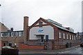
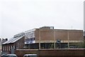
100 photos from this area
Area Information
Key information about the S6 2PB including its size, population, and administrative classification.
- Area Type
- Postcode
- Area Size
- 1.1 hectares
- Population
- 1349
- Population Density
- 3881 people/km²
House Prices in S6 2PB
18
Properties
£128,700
Average Sold Price
£54,950
Lowest Price
£205,000
Highest Price
Showing 18 properties
| Address | Type | Beds | Baths | Last Sale Price | Last Sale Date | |
|---|---|---|---|---|---|---|
| 192 Walkley Lane, Sheffield, S6 2PB | Semi-detached | 3 | 1 | £205,000 | Dec 2024 | |
| 210 Walkley Lane, Sheffield, S6 2PB | Semi-detached | 4 | 1 | £181,000 | Feb 2016 | |
| 194 Walkley Lane, Sheffield, S6 2PB | house | - | - | £145,000 | Mar 2011 | |
| 345 Walkley Lane, Sheffield, S6 2PB | house | - | - | £65,000 | Aug 2004 | |
| 204 Walkley Lane, Sheffield, S6 2PB | Semi-detached | - | - | £125,000 | Jul 2004 | |
| 202 Walkley Lane, Sheffield, S6 2PB | Semi-detached | - | - | £124,950 | Jun 2004 | |
| 196 Walkley Lane, Sheffield, S6 2PB | Semi-detached | - | - | £54,950 | May 1997 | |
| St Johns Youth Centre, Walkley Lane, Sheffield, S6 2PB | commercial | - | - | - | - | |
| St Johns Advice Centre, Walkley Lane, Sheffield, S6 2PB | Office | - | - | - | - | |
| Stewards Flat, La Planta Social Club And Institute, 353-355 Walkley Lane, Sheffield, S6 2PB | Flat | - | - | - | - |
Page 1 of 2
Energy Efficiency in S6 2PB
Amenities
Schools
| Rank | School | Type | Entry gender | Ages |
|---|
Explore more schools in this area
Go to Schools tabDemographics
Household Size
Two person
most common
Accommodation Type
Houses
most common
Tenure
73
majority
Ethnic Group
White
most common
Religion
N/A
most common
Household Composition
N/A
most common
Age
47
median
Adults (30-64 years)
most common
Household Deprivation
N/A
with no deprivation
NS-SEC
38
in Lower managerial occupations
Explore more demographic insights in this area
Go to Demographics tabPlanning
Planning Constraints
- Flood RiskPremium
- Ramsar Wetland SitesPremium
- Area of Outstanding Natural BeautyPremium
- Protected Nature ReservePremium
- Protected WoodlandPremium