Area Overview for S6 1SS
Photos of S6 1SS


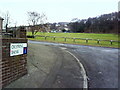
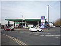
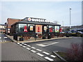
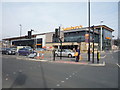

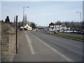
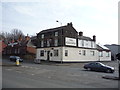
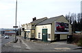
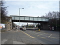
47 photos from this area
Area Information
Key information about the S6 1SS including its size, population, and administrative classification.
- Area Type
- Postcode
- Area Size
- 8013 m²
- Population
- 1689
- Population Density
- 1139 people/km²
House Prices in S6 1SS
23
Properties
£123,079
Average Sold Price
£44,950
Lowest Price
£202,000
Highest Price
Showing 23 properties
| Address | Type | Beds | Baths | Last Sale Price | Last Sale Date | |
|---|---|---|---|---|---|---|
| 41 Leppings Lane, Sheffield, S6 1SS | Terraced | 3 | 1 | £161,000 | Oct 2025 | |
| 61 Leppings Lane, Sheffield, S6 1SS | Terraced | 3 | 1 | £111,000 | Jun 2025 | |
| 63 Leppings Lane, Sheffield, S6 1SS | Terraced | 4 | 2 | £202,000 | Jan 2023 | |
| 21 Leppings Lane, Sheffield, S6 1SS | Terraced | 3 | 1 | £148,000 | Nov 2022 | |
| 45 Leppings Lane, Sheffield, S6 1SS | Terraced | 3 | - | £170,000 | Oct 2022 | |
| 23 Leppings Lane, Sheffield, S6 1SS | house | - | - | £146,000 | Nov 2021 | |
| 43 Leppings Lane, Sheffield, S6 1SS | Terraced | 4 | 1 | £160,000 | Sep 2020 | |
| 67 Leppings Lane, Sheffield, S6 1SS | house | - | - | £125,000 | Dec 2019 | |
| 37 Leppings Lane, Sheffield, S6 1SS | house | - | - | £95,000 | Apr 2005 | |
| 19 Leppings Lane, Sheffield, S6 1SS | house | - | - | £67,000 | Apr 2003 |
Page 1 of 3
Energy Efficiency in S6 1SS
Amenities
Schools
| Rank | School | Type | Entry gender | Ages |
|---|
Explore more schools in this area
Go to Schools tabDemographics
Household Size
One person
most common
Accommodation Type
Houses
most common
Tenure
42
majority
Ethnic Group
White
most common
Religion
N/A
most common
Household Composition
N/A
most common
Age
47
median
Adults (30-64 years)
most common
Household Deprivation
N/A
with no deprivation
NS-SEC
19
in Lower managerial occupations
Explore more demographic insights in this area
Go to Demographics tabPlanning
Planning Constraints
- Flood RiskPremium
- Ramsar Wetland SitesPremium
- Area of Outstanding Natural BeautyPremium
- Protected Nature ReservePremium
- Protected WoodlandPremium