Area Overview for S6 1QD
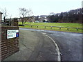
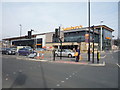
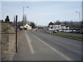
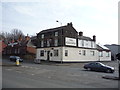
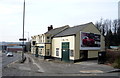
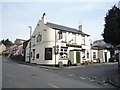
Photos of S6 1QD


Area Information
Living in S6 1QD offers a defined residential experience within a dense, populated cluster. This postcode covers a small residential area in England with a population of 1,689 people. The density is notable, standing at 1,139 people per square kilometre, which creates a compact environment where neighbours are close by. You will find yourself in a setting where home life dominates the immediate surroundings, without the sprawling distances found in larger suburbs. The area functions as a contained community unit rather than a broad district, making local interactions frequent and immediate. Daily commutes often start with knowledge of exactly how far neighbours live, given the tight cluster of homes. This concentration means services are reachable without travelling far, yet the sheer number of residents living in this small footprint suggests a lively, active street life. Potential buyers often appreciate the clarity of boundaries that come with a specific postcode cluster. It is a place where the scale of the neighbourhood is manageable, yet the population numbers indicate a established settlement. You are stepping into a zone where the rhythm of life is set by the proximity of others, balancing privacy with community presence. The distinctiveness of S6 1QD lies in this concentrated residential nature, offering a straightforward environment for those seeking a defined address in Sheffield. The community within S6 1QD is defined by a mature demographic profile, with a median age of 47 years. Most residents fall into the 30 to 64 year age range, indicating a working population alongside established families. Home ownership stands at 42%, a figure that suggests a mixed tenancy landscape alongside significant owner-occupied households. The accommodation type data confirms that houses are the preferred housing style in this postcode. This preference for detached or semi-detached properties aligns with the family-centric age profile of the area. The predominant ethnic group recorded is White, reflecting the traditional makeup of many parts of South Yorkshire. These demographic facts shape the local culture and social dynamics of S6 1QD. The age mix means you will encounter a range of life stages, from young professionals to retirees, all sharing the same streets. The 42% ownership rate implies that a significant portion of the housing stock is available for rent or has been acquired as an investment. This balance creates a community where neighbours are likely involved in various stages of their careers and family lives. You should expect a stable, long-term resident base rather than a transient population. The specific age distribution and housing tenure provide a clear picture of who calls this postcode home. Homes in S6 1QD are primarily houses, forming the backbone of the local housing stock. This focus on house types suggests a market inclined towards larger properties or standalone dwellings rather than high-rise flats. With home ownership standing at 42%, the area presents a blend of owner-occupied addresses and rental properties. This split indicates that the market is not dominated by a single tenure type, offering flexibility for both buyers and landlords. The 42% ownership figure is a key indicator of investment potential and family stability within the neighbourhood. When evaluating properties here, you are looking at a stock that values space and privacy typical of house-based living. The small residential cluster nature of the postcode means the total number of available homes is limited compared to broader districts. This scarcity can influence pricing and turnover rates in the local market. Buyers seeking houses will find S6 1QD a targeted option, while investors monitoring the 42% ownership level can assess the demand for rental units. The data does not suggest a flood of new developments, preserving the existing character of the housing estate. You will encounter a market defined by established stock and a moderate rate of private ownership. This environment suits those who prefer houses over apartments and wish to understand the tenure mix before committing. Schools near S6 1QD specialise in provision for students with additional needs. Beeley Wood First and Middle School serves the younger age bracket within the special education sector. Further along the educational pathway, Beeley Wood Senior School caters to older students requiring specialised support. Both institutions are located in the vicinity of S6 1QD, ensuring that families requiring special educational provisions have immediate access to facilities. The presence of two special schools indicates a dedicated infrastructure for specific learning requirements within the local catchment area. You should contact these establishments directly for admission criteria, as standard primary or secondary schools are not listed for this immediate cluster. The mix of school types means that general education options are handled by different providers in the wider borough. Families moving to S6 1QD will find the educational landscape tailored towards special needs rather than mainstream academies. This configuration is crucial for parents evaluating their options for children with disabilities or learning differences. The specific naming of Beeley Wood schools provides clear points of reference for your research. You are surrounded by educational institutions designed to support diverse learning needs effectively. Digital connectivity in S6 1QD supports modern working lifestyles with robust infrastructure. The fixed broadband score reaches 89 out of 100, indicating a very high quality of internet connection. This level of performance is ideal for working from home or running a home business without technical interruptions. Mobile coverage also scores highly, registering an 85 out of 100 rate across the residential cluster. These strong digital metrics ensure you maintain reliable communication links while living in S6 1QD. You can rely on fast internet speeds for streaming, large file transfers, and video conferencing daily. The absence of significant connectivity issues removes a common barrier to remote employment. Whether you are a freelancer dependent on cloud services or a professional joining online calls, the network performance in this postcode is dependable. The high scores reflect continuous investment in the local fibre and wireless networks. You do not need to worry about signal drops in central areas of S6 1QD. This digital reliability complements the physical transport links available to the wider area, creating a comprehensive commute solution. Retail, metro, and rail options surround S6 1QD, placing you within practical reach of major amenities. You have access to five retail locations nearby, including a Spar, Sainsburys Wadsley, and Asda Sheffield. These supermarkets offer daily necessities and bulk shopping without the need to travel far. The metro network includes five stations, featuring Leppings Lane to Middlewood, Middlewood, and Leppings Lane stops directly in the vicinity. Rail access is equally extensive, with Sheffield Railway Station, Medowhall Railway Station, and Meadowhall Railway Station all noted as nearby options. These transport hubs mean you can connect to the wider region quickly and efficiently. Shopping for groceries involves a short journey to a Spar or Sainsburys, keeping errands convenient. Commuting by train is possible from the local stations, linking you to city centre jobs or leisure destinations. The transport network integrates seamlessly with your daily routine in S6 1QD. You benefit from a choice of supermarkets, buses, and trains without excessive travel times. This accessibility defines the lifestyle of residents in this postcode, supporting both work and leisure needs through proximity to established service providers. Safety assessments for S6 1QD reveal a critical need for caution regarding crime levels. The crime risk rating is marked as Critical, with a score of 22 out of 100. This low score compared to the maximum indicates that crime rates are above the national average. Residents should consider enhanced security measures, such as home alarms or secure entry systems, to mitigate potential risks. While the area passes all environmental safety checks, including zero risk for flooding and no designated Ramsar wetland sites or Areas of Outstanding Natural Beauty, the crime figure demands attention. You are living in an area where vigilance is necessary due to the high relative crime rate. The Environmental Agency and planning constraints confirm the land itself is free from natural hazards like flooding or protected woodlands. However, the human factor presents a challenge, as the crime score of 22 signals a volatile environment compared to other postcodes. When moving to S6 1QD, install secure doors and windows, and neighbours should be aware of their surroundings. The contrast between environmental safety and crime risk highlights that security measures are more important here than in other locations. You must weigh the low flood risk against the imperative to safeguard property against criminal activity. Who typically lives in S6 1QD and what is the community like?The population of S6 1QD is 1,689 with a median age of 47 years. The area is predominantly White, and 42% of households are owner-occupied. Most residents are adults aged 30 to 64 years, creating a community focused on houses rather than flats. What schools are within the catchment area of S6 1QD?Residents in S6 1QD are served by Beeley Wood First and Middle School and Beeley Wood Senior School. Both schools are designated as special schools, catering specifically to students with additional educational needs. There are no standard primary or secondary schools listed for this immediate postcode cluster. How safe is S6 1QD compared to other areas?The crime risk assessment for S6 1QD is rated Critical with a score of 22 out of 100. This indicates crime rates are above average, requiring enhanced security measures. Conversely, the area shows zero flood risk, passes Ramsar wetland checks, and has no protected woodlands or Areas of Outstanding Natural Beauty. What is the quality of internet and mobile coverage?Digital connectivity in S6 1QD is excellent. The fixed broadband score is 89 out of 100, providing high-speed internet suitable for working from home. Mobile network quality scores 85 out of 100, ensuring strong coverage across the residential cluster. These metrics confirm reliable access to the internet for daily digital needs. Where can I shop and travel to from S6 1QD?You have retail access to a Spar, Sainsburys Wadsley, and Asda Sheffield. For transport, five metro stations including Leppings Lane to Middlewood and five rail stations like Sheffield Railway Station are nearby. These amenities keep daily shopping and commuting within practical reach of the postcode.
- Area Type
- Postcode
- Area Size
- Not available
- Population
- 1689
- Population Density
- 1139 people/km²
Homes in S6 1QD are primarily houses, forming the backbone of the local housing stock. This focus on house types suggests a market inclined towards larger properties or standalone dwellings rather than high-rise flats. With home ownership standing at 42%, the area presents a blend of owner-occupied addresses and rental properties. This split indicates that the market is not dominated by a single tenure type, offering flexibility for both buyers and landlords. The 42% ownership figure is a key indicator of investment potential and family stability within the neighbourhood. When evaluating properties here, you are looking at a stock that values space and privacy typical of house-based living. The small residential cluster nature of the postcode means the total number of available homes is limited compared to broader districts. This scarcity can influence pricing and turnover rates in the local market. Buyers seeking houses will find S6 1QD a targeted option, while investors monitoring the 42% ownership level can assess the demand for rental units. The data does not suggest a flood of new developments, preserving the existing character of the housing estate. You will encounter a market defined by established stock and a moderate rate of private ownership. This environment suits those who prefer houses over apartments and wish to understand the tenure mix before committing. Schools near S6 1QD specialise in provision for students with additional needs. Beeley Wood First and Middle School serves the younger age bracket within the special education sector. Further along the educational pathway, Beeley Wood Senior School caters to older students requiring specialised support. Both institutions are located in the vicinity of S6 1QD, ensuring that families requiring special educational provisions have immediate access to facilities. The presence of two special schools indicates a dedicated infrastructure for specific learning requirements within the local catchment area. You should contact these establishments directly for admission criteria, as standard primary or secondary schools are not listed for this immediate cluster. The mix of school types means that general education options are handled by different providers in the wider borough. Families moving to S6 1QD will find the educational landscape tailored towards special needs rather than mainstream academies. This configuration is crucial for parents evaluating their options for children with disabilities or learning differences. The specific naming of Beeley Wood schools provides clear points of reference for your research. You are surrounded by educational institutions designed to support diverse learning needs effectively. Digital connectivity in S6 1QD supports modern working lifestyles with robust infrastructure. The fixed broadband score reaches 89 out of 100, indicating a very high quality of internet connection. This level of performance is ideal for working from home or running a home business without technical interruptions. Mobile coverage also scores highly, registering an 85 out of 100 rate across the residential cluster. These strong digital metrics ensure you maintain reliable communication links while living in S6 1QD. You can rely on fast internet speeds for streaming, large file transfers, and video conferencing daily. The absence of significant connectivity issues removes a common barrier to remote employment. Whether you are a freelancer dependent on cloud services or a professional joining online calls, the network performance in this postcode is dependable. The high scores reflect continuous investment in the local fibre and wireless networks. You do not need to worry about signal drops in central areas of S6 1QD. This digital reliability complements the physical transport links available to the wider area, creating a comprehensive commute solution. Retail, metro, and rail options surround S6 1QD, placing you within practical reach of major amenities. You have access to five retail locations nearby, including a Spar, Sainsburys Wadsley, and Asda Sheffield. These supermarkets offer daily necessities and bulk shopping without the need to travel far. The metro network includes five stations, featuring Leppings Lane to Middlewood, Middlewood, and Leppings Lane stops directly in the vicinity. Rail access is equally extensive, with Sheffield Railway Station, Medowhall Railway Station, and Meadowhall Railway Station all noted as nearby options. These transport hubs mean you can connect to the wider region quickly and efficiently. Shopping for groceries involves a short journey to a Spar or Sainsburys, keeping errands convenient. Commuting by train is possible from the local stations, linking you to city centre jobs or leisure destinations. The transport network integrates seamlessly with your daily routine in S6 1QD. You benefit from a choice of supermarkets, buses, and trains without excessive travel times. This accessibility defines the lifestyle of residents in this postcode, supporting both work and leisure needs through proximity to established service providers. Safety assessments for S6 1QD reveal a critical need for caution regarding crime levels. The crime risk rating is marked as Critical, with a score of 22 out of 100. This low score compared to the maximum indicates that crime rates are above the national average. Residents should consider enhanced security measures, such as home alarms or secure entry systems, to mitigate potential risks. While the area passes all environmental safety checks, including zero risk for flooding and no designated Ramsar wetland sites or Areas of Outstanding Natural Beauty, the crime figure demands attention. You are living in an area where vigilance is necessary due to the high relative crime rate. The Environmental Agency and planning constraints confirm the land itself is free from natural hazards like flooding or protected woodlands. However, the human factor presents a challenge, as the crime score of 22 signals a volatile environment compared to other postcodes. When moving to S6 1QD, install secure doors and windows, and neighbours should be aware of their surroundings. The contrast between environmental safety and crime risk highlights that security measures are more important here than in other locations. You must weigh the low flood risk against the imperative to safeguard property against criminal activity. Who typically lives in S6 1QD and what is the community like?The population of S6 1QD is 1,689 with a median age of 47 years. The area is predominantly White, and 42% of households are owner-occupied. Most residents are adults aged 30 to 64 years, creating a community focused on houses rather than flats. What schools are within the catchment area of S6 1QD?Residents in S6 1QD are served by Beeley Wood First and Middle School and Beeley Wood Senior School. Both schools are designated as special schools, catering specifically to students with additional educational needs. There are no standard primary or secondary schools listed for this immediate postcode cluster. How safe is S6 1QD compared to other areas?The crime risk assessment for S6 1QD is rated Critical with a score of 22 out of 100. This indicates crime rates are above average, requiring enhanced security measures. Conversely, the area shows zero flood risk, passes Ramsar wetland checks, and has no protected woodlands or Areas of Outstanding Natural Beauty. What is the quality of internet and mobile coverage?Digital connectivity in S6 1QD is excellent. The fixed broadband score is 89 out of 100, providing high-speed internet suitable for working from home. Mobile network quality scores 85 out of 100, ensuring strong coverage across the residential cluster. These metrics confirm reliable access to the internet for daily digital needs. Where can I shop and travel to from S6 1QD?You have retail access to a Spar, Sainsburys Wadsley, and Asda Sheffield. For transport, five metro stations including Leppings Lane to Middlewood and five rail stations like Sheffield Railway Station are nearby. These amenities keep daily shopping and commuting within practical reach of the postcode.
House Prices in S6 1QD
No properties found in this postcode.
Energy Efficiency in S6 1QD
Retail, metro, and rail options surround S6 1QD, placing you within practical reach of major amenities. You have access to five retail locations nearby, including a Spar, Sainsburys Wadsley, and Asda Sheffield. These supermarkets offer daily necessities and bulk shopping without the need to travel far. The metro network includes five stations, featuring Leppings Lane to Middlewood, Middlewood, and Leppings Lane stops directly in the vicinity. Rail access is equally extensive, with Sheffield Railway Station, Medowhall Railway Station, and Meadowhall Railway Station all noted as nearby options. These transport hubs mean you can connect to the wider region quickly and efficiently. Shopping for groceries involves a short journey to a Spar or Sainsburys, keeping errands convenient. Commuting by train is possible from the local stations, linking you to city centre jobs or leisure destinations. The transport network integrates seamlessly with your daily routine in S6 1QD. You benefit from a choice of supermarkets, buses, and trains without excessive travel times. This accessibility defines the lifestyle of residents in this postcode, supporting both work and leisure needs through proximity to established service providers. Safety assessments for S6 1QD reveal a critical need for caution regarding crime levels. The crime risk rating is marked as Critical, with a score of 22 out of 100. This low score compared to the maximum indicates that crime rates are above the national average. Residents should consider enhanced security measures, such as home alarms or secure entry systems, to mitigate potential risks. While the area passes all environmental safety checks, including zero risk for flooding and no designated Ramsar wetland sites or Areas of Outstanding Natural Beauty, the crime figure demands attention. You are living in an area where vigilance is necessary due to the high relative crime rate. The Environmental Agency and planning constraints confirm the land itself is free from natural hazards like flooding or protected woodlands. However, the human factor presents a challenge, as the crime score of 22 signals a volatile environment compared to other postcodes. When moving to S6 1QD, install secure doors and windows, and neighbours should be aware of their surroundings. The contrast between environmental safety and crime risk highlights that security measures are more important here than in other locations. You must weigh the low flood risk against the imperative to safeguard property against criminal activity. Who typically lives in S6 1QD and what is the community like?The population of S6 1QD is 1,689 with a median age of 47 years. The area is predominantly White, and 42% of households are owner-occupied. Most residents are adults aged 30 to 64 years, creating a community focused on houses rather than flats. What schools are within the catchment area of S6 1QD?Residents in S6 1QD are served by Beeley Wood First and Middle School and Beeley Wood Senior School. Both schools are designated as special schools, catering specifically to students with additional educational needs. There are no standard primary or secondary schools listed for this immediate postcode cluster. How safe is S6 1QD compared to other areas?The crime risk assessment for S6 1QD is rated Critical with a score of 22 out of 100. This indicates crime rates are above average, requiring enhanced security measures. Conversely, the area shows zero flood risk, passes Ramsar wetland checks, and has no protected woodlands or Areas of Outstanding Natural Beauty. What is the quality of internet and mobile coverage?Digital connectivity in S6 1QD is excellent. The fixed broadband score is 89 out of 100, providing high-speed internet suitable for working from home. Mobile network quality scores 85 out of 100, ensuring strong coverage across the residential cluster. These metrics confirm reliable access to the internet for daily digital needs. Where can I shop and travel to from S6 1QD?You have retail access to a Spar, Sainsburys Wadsley, and Asda Sheffield. For transport, five metro stations including Leppings Lane to Middlewood and five rail stations like Sheffield Railway Station are nearby. These amenities keep daily shopping and commuting within practical reach of the postcode.
Amenities
Schools
Schools near S6 1QD specialise in provision for students with additional needs. Beeley Wood First and Middle School serves the younger age bracket within the special education sector. Further along the educational pathway, Beeley Wood Senior School caters to older students requiring specialised support. Both institutions are located in the vicinity of S6 1QD, ensuring that families requiring special educational provisions have immediate access to facilities. The presence of two special schools indicates a dedicated infrastructure for specific learning requirements within the local catchment area. You should contact these establishments directly for admission criteria, as standard primary or secondary schools are not listed for this immediate cluster. The mix of school types means that general education options are handled by different providers in the wider borough. Families moving to S6 1QD will find the educational landscape tailored towards special needs rather than mainstream academies. This configuration is crucial for parents evaluating their options for children with disabilities or learning differences. The specific naming of Beeley Wood schools provides clear points of reference for your research. You are surrounded by educational institutions designed to support diverse learning needs effectively. Digital connectivity in S6 1QD supports modern working lifestyles with robust infrastructure. The fixed broadband score reaches 89 out of 100, indicating a very high quality of internet connection. This level of performance is ideal for working from home or running a home business without technical interruptions. Mobile coverage also scores highly, registering an 85 out of 100 rate across the residential cluster. These strong digital metrics ensure you maintain reliable communication links while living in S6 1QD. You can rely on fast internet speeds for streaming, large file transfers, and video conferencing daily. The absence of significant connectivity issues removes a common barrier to remote employment. Whether you are a freelancer dependent on cloud services or a professional joining online calls, the network performance in this postcode is dependable. The high scores reflect continuous investment in the local fibre and wireless networks. You do not need to worry about signal drops in central areas of S6 1QD. This digital reliability complements the physical transport links available to the wider area, creating a comprehensive commute solution. Retail, metro, and rail options surround S6 1QD, placing you within practical reach of major amenities. You have access to five retail locations nearby, including a Spar, Sainsburys Wadsley, and Asda Sheffield. These supermarkets offer daily necessities and bulk shopping without the need to travel far. The metro network includes five stations, featuring Leppings Lane to Middlewood, Middlewood, and Leppings Lane stops directly in the vicinity. Rail access is equally extensive, with Sheffield Railway Station, Medowhall Railway Station, and Meadowhall Railway Station all noted as nearby options. These transport hubs mean you can connect to the wider region quickly and efficiently. Shopping for groceries involves a short journey to a Spar or Sainsburys, keeping errands convenient. Commuting by train is possible from the local stations, linking you to city centre jobs or leisure destinations. The transport network integrates seamlessly with your daily routine in S6 1QD. You benefit from a choice of supermarkets, buses, and trains without excessive travel times. This accessibility defines the lifestyle of residents in this postcode, supporting both work and leisure needs through proximity to established service providers. Safety assessments for S6 1QD reveal a critical need for caution regarding crime levels. The crime risk rating is marked as Critical, with a score of 22 out of 100. This low score compared to the maximum indicates that crime rates are above the national average. Residents should consider enhanced security measures, such as home alarms or secure entry systems, to mitigate potential risks. While the area passes all environmental safety checks, including zero risk for flooding and no designated Ramsar wetland sites or Areas of Outstanding Natural Beauty, the crime figure demands attention. You are living in an area where vigilance is necessary due to the high relative crime rate. The Environmental Agency and planning constraints confirm the land itself is free from natural hazards like flooding or protected woodlands. However, the human factor presents a challenge, as the crime score of 22 signals a volatile environment compared to other postcodes. When moving to S6 1QD, install secure doors and windows, and neighbours should be aware of their surroundings. The contrast between environmental safety and crime risk highlights that security measures are more important here than in other locations. You must weigh the low flood risk against the imperative to safeguard property against criminal activity. Who typically lives in S6 1QD and what is the community like?The population of S6 1QD is 1,689 with a median age of 47 years. The area is predominantly White, and 42% of households are owner-occupied. Most residents are adults aged 30 to 64 years, creating a community focused on houses rather than flats. What schools are within the catchment area of S6 1QD?Residents in S6 1QD are served by Beeley Wood First and Middle School and Beeley Wood Senior School. Both schools are designated as special schools, catering specifically to students with additional educational needs. There are no standard primary or secondary schools listed for this immediate postcode cluster. How safe is S6 1QD compared to other areas?The crime risk assessment for S6 1QD is rated Critical with a score of 22 out of 100. This indicates crime rates are above average, requiring enhanced security measures. Conversely, the area shows zero flood risk, passes Ramsar wetland checks, and has no protected woodlands or Areas of Outstanding Natural Beauty. What is the quality of internet and mobile coverage?Digital connectivity in S6 1QD is excellent. The fixed broadband score is 89 out of 100, providing high-speed internet suitable for working from home. Mobile network quality scores 85 out of 100, ensuring strong coverage across the residential cluster. These metrics confirm reliable access to the internet for daily digital needs. Where can I shop and travel to from S6 1QD?You have retail access to a Spar, Sainsburys Wadsley, and Asda Sheffield. For transport, five metro stations including Leppings Lane to Middlewood and five rail stations like Sheffield Railway Station are nearby. These amenities keep daily shopping and commuting within practical reach of the postcode.
| Rank | School | Type | Entry gender | Ages |
|---|
Explore more schools in this area
Go to Schools tabDemographics
The community within S6 1QD is defined by a mature demographic profile, with a median age of 47 years. Most residents fall into the 30 to 64 year age range, indicating a working population alongside established families. Home ownership stands at 42%, a figure that suggests a mixed tenancy landscape alongside significant owner-occupied households. The accommodation type data confirms that houses are the preferred housing style in this postcode. This preference for detached or semi-detached properties aligns with the family-centric age profile of the area. The predominant ethnic group recorded is White, reflecting the traditional makeup of many parts of South Yorkshire. These demographic facts shape the local culture and social dynamics of S6 1QD. The age mix means you will encounter a range of life stages, from young professionals to retirees, all sharing the same streets. The 42% ownership rate implies that a significant portion of the housing stock is available for rent or has been acquired as an investment. This balance creates a community where neighbours are likely involved in various stages of their careers and family lives. You should expect a stable, long-term resident base rather than a transient population. The specific age distribution and housing tenure provide a clear picture of who calls this postcode home. Homes in S6 1QD are primarily houses, forming the backbone of the local housing stock. This focus on house types suggests a market inclined towards larger properties or standalone dwellings rather than high-rise flats. With home ownership standing at 42%, the area presents a blend of owner-occupied addresses and rental properties. This split indicates that the market is not dominated by a single tenure type, offering flexibility for both buyers and landlords. The 42% ownership figure is a key indicator of investment potential and family stability within the neighbourhood. When evaluating properties here, you are looking at a stock that values space and privacy typical of house-based living. The small residential cluster nature of the postcode means the total number of available homes is limited compared to broader districts. This scarcity can influence pricing and turnover rates in the local market. Buyers seeking houses will find S6 1QD a targeted option, while investors monitoring the 42% ownership level can assess the demand for rental units. The data does not suggest a flood of new developments, preserving the existing character of the housing estate. You will encounter a market defined by established stock and a moderate rate of private ownership. This environment suits those who prefer houses over apartments and wish to understand the tenure mix before committing. Schools near S6 1QD specialise in provision for students with additional needs. Beeley Wood First and Middle School serves the younger age bracket within the special education sector. Further along the educational pathway, Beeley Wood Senior School caters to older students requiring specialised support. Both institutions are located in the vicinity of S6 1QD, ensuring that families requiring special educational provisions have immediate access to facilities. The presence of two special schools indicates a dedicated infrastructure for specific learning requirements within the local catchment area. You should contact these establishments directly for admission criteria, as standard primary or secondary schools are not listed for this immediate cluster. The mix of school types means that general education options are handled by different providers in the wider borough. Families moving to S6 1QD will find the educational landscape tailored towards special needs rather than mainstream academies. This configuration is crucial for parents evaluating their options for children with disabilities or learning differences. The specific naming of Beeley Wood schools provides clear points of reference for your research. You are surrounded by educational institutions designed to support diverse learning needs effectively. Digital connectivity in S6 1QD supports modern working lifestyles with robust infrastructure. The fixed broadband score reaches 89 out of 100, indicating a very high quality of internet connection. This level of performance is ideal for working from home or running a home business without technical interruptions. Mobile coverage also scores highly, registering an 85 out of 100 rate across the residential cluster. These strong digital metrics ensure you maintain reliable communication links while living in S6 1QD. You can rely on fast internet speeds for streaming, large file transfers, and video conferencing daily. The absence of significant connectivity issues removes a common barrier to remote employment. Whether you are a freelancer dependent on cloud services or a professional joining online calls, the network performance in this postcode is dependable. The high scores reflect continuous investment in the local fibre and wireless networks. You do not need to worry about signal drops in central areas of S6 1QD. This digital reliability complements the physical transport links available to the wider area, creating a comprehensive commute solution. Retail, metro, and rail options surround S6 1QD, placing you within practical reach of major amenities. You have access to five retail locations nearby, including a Spar, Sainsburys Wadsley, and Asda Sheffield. These supermarkets offer daily necessities and bulk shopping without the need to travel far. The metro network includes five stations, featuring Leppings Lane to Middlewood, Middlewood, and Leppings Lane stops directly in the vicinity. Rail access is equally extensive, with Sheffield Railway Station, Medowhall Railway Station, and Meadowhall Railway Station all noted as nearby options. These transport hubs mean you can connect to the wider region quickly and efficiently. Shopping for groceries involves a short journey to a Spar or Sainsburys, keeping errands convenient. Commuting by train is possible from the local stations, linking you to city centre jobs or leisure destinations. The transport network integrates seamlessly with your daily routine in S6 1QD. You benefit from a choice of supermarkets, buses, and trains without excessive travel times. This accessibility defines the lifestyle of residents in this postcode, supporting both work and leisure needs through proximity to established service providers. Safety assessments for S6 1QD reveal a critical need for caution regarding crime levels. The crime risk rating is marked as Critical, with a score of 22 out of 100. This low score compared to the maximum indicates that crime rates are above the national average. Residents should consider enhanced security measures, such as home alarms or secure entry systems, to mitigate potential risks. While the area passes all environmental safety checks, including zero risk for flooding and no designated Ramsar wetland sites or Areas of Outstanding Natural Beauty, the crime figure demands attention. You are living in an area where vigilance is necessary due to the high relative crime rate. The Environmental Agency and planning constraints confirm the land itself is free from natural hazards like flooding or protected woodlands. However, the human factor presents a challenge, as the crime score of 22 signals a volatile environment compared to other postcodes. When moving to S6 1QD, install secure doors and windows, and neighbours should be aware of their surroundings. The contrast between environmental safety and crime risk highlights that security measures are more important here than in other locations. You must weigh the low flood risk against the imperative to safeguard property against criminal activity. Who typically lives in S6 1QD and what is the community like?The population of S6 1QD is 1,689 with a median age of 47 years. The area is predominantly White, and 42% of households are owner-occupied. Most residents are adults aged 30 to 64 years, creating a community focused on houses rather than flats. What schools are within the catchment area of S6 1QD?Residents in S6 1QD are served by Beeley Wood First and Middle School and Beeley Wood Senior School. Both schools are designated as special schools, catering specifically to students with additional educational needs. There are no standard primary or secondary schools listed for this immediate postcode cluster. How safe is S6 1QD compared to other areas?The crime risk assessment for S6 1QD is rated Critical with a score of 22 out of 100. This indicates crime rates are above average, requiring enhanced security measures. Conversely, the area shows zero flood risk, passes Ramsar wetland checks, and has no protected woodlands or Areas of Outstanding Natural Beauty. What is the quality of internet and mobile coverage?Digital connectivity in S6 1QD is excellent. The fixed broadband score is 89 out of 100, providing high-speed internet suitable for working from home. Mobile network quality scores 85 out of 100, ensuring strong coverage across the residential cluster. These metrics confirm reliable access to the internet for daily digital needs. Where can I shop and travel to from S6 1QD?You have retail access to a Spar, Sainsburys Wadsley, and Asda Sheffield. For transport, five metro stations including Leppings Lane to Middlewood and five rail stations like Sheffield Railway Station are nearby. These amenities keep daily shopping and commuting within practical reach of the postcode.
Household Size
Accommodation Type
Tenure
Ethnic Group
Religion
Household Composition
Age
Household Deprivation
NS-SEC
Explore more demographic insights in this area
Go to Demographics tabPlanning
Planning Constraints
- Flood RiskPremium
- Ramsar Wetland SitesPremium
- Area of Outstanding Natural BeautyPremium
- Protected Nature ReservePremium
- Protected WoodlandPremium