Area Overview for S5 9NG
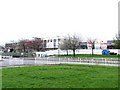
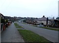
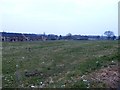
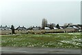
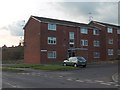
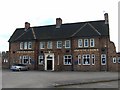
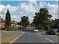
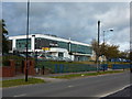
Photos of S5 9NG
Area Information
S5 9NG represents a very specific residential cluster located in England. This postcode covers a tiny footprint of just 4,092 square metres, creating an extremely dense environment for its residents. You will find 1,290 people living within this small space, resulting in a population density of 315,262 people per square kilometre. This figure indicates a setting where space is at a premium and buildings are closely packed. The area functions as a quiet residential pocket rather than a sprawling neighbourhood. Daily life here is defined by close proximity to neighbours within a confined geographic boundary. While the scale is small, its location provides direct access to wider Sheffield amenities. Prospective homebuyers should understand that S5 9NG is a micro-community heavily influenced by the surrounding urban fabric. The high density ensures that you are never far from essential services, though privacy may come at a cost in such a tight quarters.
- Area Type
- Postcode
- Area Size
- 4092 m²
- Population
- 1290
- Population Density
- 3582 people/km²
Understanding the property market in S5 9NG requires looking closely at the available statistics. With 40% home ownership, the area presents a mixed landscape of tenanted and owner-occupied properties. This split is typical for inner-city postal codes where investment portfolios sit alongside lived-in family homes. The accommodation type data confirms that the housing stock consists of houses, yet the extreme population density of 315,262 people per square kilometre suggests these are likely tightly grouped units. Buyers looking at homes in S5 9NG should expect a fluid market where availability depends heavily on the specific postcodes you target within the five-point area. The small size of the cluster at 4,092 square metres means there are limited stock counts, so demand from the surrounding region often dictates local prices. If you are considering purchasing, you are navigating a niche segment where the house designation meets high-density living.
House Prices in S5 9NG
Showing 9 properties
| Address | Type | Beds | Baths | Last Sale Price | Last Sale Date | |
|---|---|---|---|---|---|---|
| 338 Wordsworth Avenue, Sheffield, S5 9NG | house | - | - | - | - | |
| 344 Wordsworth Avenue, Sheffield, S5 9NG | house | - | - | - | - | |
| 342 Wordsworth Avenue, Sheffield, S5 9NG | Terraced | - | - | - | - | |
| 352 Wordsworth Avenue, Sheffield, S5 9NG | house | - | - | - | - | |
| 340 Wordsworth Avenue, Sheffield, S5 9NG | Semi-detached | - | - | - | - | |
| 350 Wordsworth Avenue, Sheffield, S5 9NG | house | - | - | - | - | |
| 336 Wordsworth Avenue, Sheffield, S5 9NG | Semi-detached | - | - | - | - | |
| 346 Wordsworth Avenue, Sheffield, S5 9NG | Terraced | - | - | - | - | |
| 348 Wordsworth Avenue, Sheffield, S5 9NG | house | - | - | - | - |
Energy Efficiency in S5 9NG
Your daily routine in S5 9NG benefits from a short walk to major retail and transport hubs. Within practical reach you will find Farmfoods Parsons, Asda Sheffield, and Heron Parsons for your grocery and shopping needs. These specific venues handle the bulk of daily provisions for residents. Transport options are equally close by, with multiple nearby stops at Middlewood, Leppings Lane to Middlewood, and Leppings Lane. Rail transport connects you further south to Medowhall Railway Station, Meadowhall Railway Station, and Sheffield Railway Station. These stations provide direct access to the wider city and national rail network. You do not need a car to reach these amenities, although convenience is maximised by their proximity. The layout of amenities around S5 9NG ensures that the typical supermarket trip or train commute takes a matter of minutes.
Amenities
Schools
Families considering living in S5 9NG have access to a concentrated range of educational facilities nearby. Local options include Mansel Primary School and Mansel Middle School, both situated to serve the immediate catchment areas. Yewlands School Technology College also serves as a primary option for younger children while Yewlands Academy acts as a secondary provision on the horizon. All of these institutions are clearly mapped to the postcode. However, the data provided does not include Ofsted ratings for any of these schools. Consequently, any decision regarding their quality must rely on external research or local reputation rather than the internal dataset. This mix of primary and academy structures offers a continuous path from early education through to secondary years. You will find you have schools near S5 9NG without needing to travel far into the wider city for basic education needs.
| Rank | School | Type | Entry gender | Ages |
|---|
Explore more schools in this area
Go to Schools tabDemographics
The community in S5 9NG reflects a mature demographic profile aligned with urban retention. The median age is 47 years, and the most common age range for residents is adults aged between 30 and 64 years. This suggests the area attracts either established professionals or long-term residents rather than students or young families seeking entry-level properties. Home ownership stands at exactly 40%, meaning slightly fewer than half of the 1,290 residents own their homes outright. The remaining households likely consist of landlords or private renters operating within the shared residential blocks. Accommodation types are predominantly houses, which contrasts with the high density suggested by the postcode size, implying these are potentially terraced properties or flats linked to the house designation. The predominant ethnic group is White, mirroring a traditional demographic shift often seen in older parts of Sheffield. There is no data on deprivation indices, so the focus remains on these clear structural facts regarding who lives here and how they own their homes.
Household Size
Accommodation Type
Tenure
Ethnic Group
Religion
Household Composition
Age
Household Deprivation
NS-SEC
Explore more demographic insights in this area
Go to Demographics tabPlanning
Planning Constraints
- Flood RiskPremium
- Ramsar Wetland SitesPremium
- Area of Outstanding Natural BeautyPremium
- Protected Nature ReservePremium
- Protected WoodlandPremium