Area Overview for S5 9NA
Photos of S5 9NA


Area Information
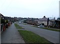
S5 9NA is a compact residential postcode covering exactly 6,413 square metres in England. This small cluster supports a population of 1,829 people, creating a tight-knit neighbourhood where residents live close together. The density is high at 285,191 people per square kilometre, which means services and neighbours are within immediate sight. Life here revolves around a core of households rather than sprawling developments. You will find a community defined by its size and density rather than vast open spaces. The area functions as a self-contained pocket within the wider Sheffield region. Daily routines involve walking short distances to local shops or buses. The location offers a specific type of urban living where convenience comes from proximity. You are part of a defined group of neighbours who share the same immediate surroundings. This postcode represents a focused residential choice for those seeking a specific micro-community. The character of S5 9NA is set by its physical limits and its settled population. Living here means engaging with a small but complete set of local amenities.
- Area Type
- Postcode
- Area Size
- 6413 m²
- Population
- 1829
- Population Density
- 5701 people/km²
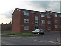
Homes in S5 9NA are predominantly houses, which forms the core of the local housing stock. This accommodation type suits families and individuals seeking a traditional home environment. With 55% of residents owning their property, the area leans heavily towards owner-occupation rather than private renting. This high ownership rate signals a market where people settle down rather than move frequently. You are buying into an estate where neighbours have a vested interest in maintaining property values. The small physical size of the postcode limits the number of available listings at any one time. Potential buyers must act quickly as supply is naturally restricted by the land area. The market reflects the needs of the 47-year-old median age group, likely favouring bungalows or end-terras. Rental options exist but represent a smaller slice of the total market. The concentration of houses offers consistency in building style and garden space. Prices in this micro-area will be influenced heavily by these specific structural facts. Buyers looking for a garden or garage find more alignment here than in high-rise zones. The owner-occupier dominance fosters a community with long-term vision for their properties.
House Prices in S5 9NA
Showing 15 properties
| Address | Type | Beds | Baths | Last Sale Price | Last Sale Date | |
|---|---|---|---|---|---|---|
| 9 Margetson Crescent, Sheffield, S5 9NA | house | 3 | - | £60,000 | May 2012 | |
| 12 Margetson Crescent, Sheffield, S5 9NA | Terraced | 3 | - | - | - | |
| 11 Margetson Crescent, Sheffield, S5 9NA | house | - | - | - | - | |
| 14 Margetson Crescent, Sheffield, S5 9NA | house | - | - | - | - | |
| 18 Margetson Crescent, Sheffield, S5 9NA | house | - | - | - | - | |
| 1 Margetson Crescent, Sheffield, S5 9NA | Semi-detached | - | - | - | - | |
| 6 Margetson Crescent, Sheffield, S5 9NA | Semi-detached | - | - | - | - | |
| 7 Margetson Crescent, Sheffield, S5 9NA | house | - | - | - | - | |
| 5 Margetson Crescent, Sheffield, S5 9NA | house | - | - | - | - | |
| 3 Margetson Crescent, Sheffield, S5 9NA | Semi-detached | - | - | - | - |
Energy Efficiency in S5 9NA
Residents of S5 9NA have practical access to five retail outlets within walking or short driving distance. You can visit Heron Parsons, Morrisons Daily, and Farmfoods Parsons for your weekly groceries and household essentials. These well-known chains provide familiar and accessible shopping options. Transport links include five metro stations, including Middlewood and Leppings Lane to Middlewood, offering frequent bus connections. Rail access is provided by Medowhall Railway Station, Meadowhall Railway Station, and Sheffield Railway Station nearby. This means easy commutes to central Sheffield or broader travel destinations. Meadowhall Railway Station connects you to regional motorways and national networks conveniently. The proximity to these stations supports daily commuting needs without significant travel time increases. You can grab a quick meal and catch a train in a single outing. Retail and transport choices are clustered for efficiency. Living here means your daily errands are covered by established supermarket chains and bus routes. The availability of Metro and Rail options ensures you are not cut off by geography. Your lifestyle includes the ease of stepping outside to a station or shop. These amenities create a functional environment for busy professionals and families alike.
Amenities
Schools
Primary education is well-serviced near S5 9NA with Mansel Primary holding a good Ofsted rating. This school serves local voters and residents who prioritise educational quality for their children. Mansel Primary provides a standard state education within the community reach. Woolley Wood School operates as a special school in the vicinity, catering to specific educational needs. Parson Cross Tertiary College serves as an other type institution, offering vocational or higher-level training options. The presence of a special school indicates the area supports diverse learning requirements. You have access to special provision without needing to travel far outside the borough. The mix of primary, special, and tertiary options covers a wide educational spectrum for families. Primary education is rated good, which is a positive fact for parents reviewing local prospects. These schools form the backbone of local youth development. Their locations are practical for residents within the S5 9NA cluster. The variety ensures that regardless of a child's needs, a nearby institution exists. Families moving here can look at Mansel Primary as their first educational consideration. The proximity of these facilities adds to the convenience of living in this specific postcode.
| Rank | School | Type | Entry gender | Ages |
|---|
Explore more schools in this area
Go to Schools tabDemographics
The community in S5 9NA is dominated by adults aged between 30 and 64 years. The median age for residents is 47 years, indicating a mature and stable population. Home ownership stands at 55%, meaning more than half of the households own their homes outright or with a mortgage. Houses form the primary accommodation type, reflecting the established nature of the build. The predominant ethnic group is White, matching the broader demographic profile of the region. These figures describe a neighbourhood with a clear generational backbone. You will likely meet neighbours who have lived in the area for many years. The balance between owners and tenants creates a relatively steady housing sector. There is limited young family turnover compared to other districts with lower median ages. The age profile suggests a focus on stability rather than rapid change. Residents typically have established careers and families fitting the 30-64 bracket. The 55% ownership rate implies many buyers invested years ago and stayed. Diversity exists but follows the national trend with White residents forming the majority. The accommodation mix of houses supports this family-focused demographic structure.
Household Size
Accommodation Type
Tenure
Ethnic Group
Religion
Household Composition
Age
Household Deprivation
NS-SEC
Explore more demographic insights in this area
Go to Demographics tabPlanning
Planning Constraints
- Flood RiskPremium
- Ramsar Wetland SitesPremium
- Area of Outstanding Natural BeautyPremium
- Protected Nature ReservePremium
- Protected WoodlandPremium