Area Overview for S5 9AZ
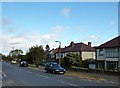
Photos of S5 9AZ


Area Information
Living in S5 9AZ offers a definition of settled residential life within a specifically defined cluster. This postcode covers an area measuring 2.7 hectares, housing a community of 1,351 residents. The density stands at 1,126 people per square kilometre, indicating a compact neighbourhood where neighbours are close but space remains personal. The area functions as a quiet residential hub rather than a commercial or industrial zone. You will find a population that has remained stable over time, creating a sense of permanence rather than the churn typical of student towns or transient developments. The sheer size of the postcode area means it represents a distinct slice of the wider Sheffield landscape. Daily life here revolves around local routines, with residents navigating a small footprint that connects directly to the wider city via nearby transport links. The character of S5 9AZ is defined by its exclusivity as a housing zone, separate from the bustling retail hearts of the city centre yet connected to them by reliable rail lines.
- Area Type
- Postcode
- Area Size
- 2.7 hectares
- Population
- 1351
- Population Density
- 1126 people/km²
The property market in S5 9AZ is overwhelmingly characterised by owner-occupation. With 95% of households owning their homes, you will find very few purpose-built rental flats available for purchase or lease in this specific cluster. The accommodation type is almost exclusively houses, creating a market skewed towards larger, detached or semi-detached properties suitable for families. This high ownership rate suggests a stable investment environment where values depend on local maintenance and school performance rather than speculative development. Buyers looking at S5 9AZ should treat this as a consolidation market where available stock is limited compared to larger urban centres. The 2.7 hectare footprint means new builds are unlikely, so inventory consists of established estates. If you are seeking a rental property, you will normally need to look beyond this specific S5 9AZ boundary. For those buying to live in, the houses dominate the landscape, offering privacy and garden space that high-density housing estates cannot provide.
House Prices in S5 9AZ
Showing 10 properties
| Address | Type | Beds | Baths | Last Sale Price | Last Sale Date | |
|---|---|---|---|---|---|---|
| 4 Creswick Greave Close, Sheffield, S5 9AZ | Semi-detached | 2 | 1 | £200,500 | Sep 2024 | |
| 8 Creswick Greave Close, Sheffield, S5 9AZ | house | - | - | £172,500 | Dec 2021 | |
| 6 Creswick Greave Close, Sheffield, S5 9AZ | Semi-detached | - | - | £125,000 | May 2008 | |
| 10 Creswick Greave Close, Sheffield, S5 9AZ | Semi-detached | - | - | - | - | |
| 7 Creswick Greave Close, Sheffield, S5 9AZ | Semi-detached | - | - | - | - | |
| 5 Creswick Greave Close, Sheffield, S5 9AZ | house | - | - | - | - | |
| 3 Creswick Greave Close, Sheffield, S5 9AZ | Semi-detached | - | - | - | - | |
| 9 Creswick Greave Close, Sheffield, S5 9AZ | Semi-detached | - | - | - | - | |
| 1 Creswick Greave Close, Sheffield, S5 9AZ | house | - | - | - | - | |
| 2 Creswick Greave Close, Sheffield, S5 9AZ | Semi-detached | 2 | 1 | - | - |
Energy Efficiency in S5 9AZ
The lifestyle in S5 9AZ centres on convenience, with amenities located within practical reach for daily errands. Retail options include Heron Parsons, Morrisons Daily, and Asda Sheffield, giving you the choice between a local greengrocer and major supermarket chains. Five retail venues lie nearby, allowing you to stock up on groceries or purchase clothing without long travel times. Transport hubs complement these shops, with five metro stops and five rail stations close to the 1,351 residents. Middlewood, Leppings Lane to Middlewood, and the various Sheffield railway stations ensure you can reach businesses or leisure spots quickly. The area balances self-sufficiency with easy access to the wider city. You do not need to travel far for essential goods, yet you remain connected to the broader job market. This mix of local shops and major transport nodes defines the daily rhythm of life in S5 9AZ.
Amenities
Schools
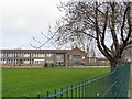
Families living in S5 9AZ have access to two primary schools within practical reach. St Thomas More Catholic Primary School serves the younger demographic, providing a faith-based education grounded in Catholic traditions. Nearby, St Thomas More Catholic Primary, A Voluntary Academy, offers an alternative educational route within the same religious ethos. Both institutions are primary level providers, meaning secondary education requires travel to schools outside the immediate vicinity of the postcode. The presence of named academies indicates alignment with national standards while maintaining a distinct community identity through their religious affiliation. For parents considering this area, the choice rests between these two established options, both sharing the St Thomas More brand. The concentration of schools near S5 9AZ supports the high homeownership rate, as families typically prioritise areas with dedicated educational facilities for their children. Local schools form a key anchor for the neighbourhood, influencing property choices and community engagement.
| Rank | School | Type | Entry gender | Ages |
|---|
Explore more schools in this area
Go to Schools tabDemographics
The community in S5 9AZ reflects a mature household composition with a median age of 47 years. Most residents fall into the 30 to 64 years age range, suggesting a population established in their careers and families rather than young singles or pensioners. This age profile stabilises the local economy and often correlates with lower transient housing markets. Home ownership stands at an exceptional 95% within this postcode, meaning almost every resident has a mortgage or owns their property outright. Rental pressure is minimal compared to other Sheffield areas. The primary accommodation type consists of houses, proving that flats or terraced units are not the dominant feature here. Ethnic diversity is predominantly white, which aligns with the surrounding postcodes in the suburban edges of Sheffield. You are likely to encounter homeowners who have lived in the area for decades, valuing long-term stability over rapid property flipping.
Household Size
Accommodation Type
Tenure
Ethnic Group
Religion
Household Composition
Age
Household Deprivation
NS-SEC
Explore more demographic insights in this area
Go to Demographics tabPlanning
Planning Constraints
- Flood RiskPremium
- Ramsar Wetland SitesPremium
- Area of Outstanding Natural BeautyPremium
- Protected Nature ReservePremium
- Protected WoodlandPremium