Area Overview for S5 9AQ
Photos of S5 9AQ


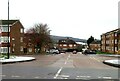
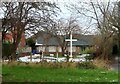


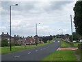

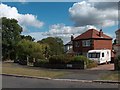

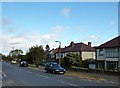

16 photos from this area
Area Information
Key information about the S5 9AQ including its size, population, and administrative classification.
- Area Type
- Postcode
- Area Size
- 4.1 hectares
- Population
- 1351
- Population Density
- 1126 people/km²
House Prices in S5 9AQ
16
Properties
£90,813
Average Sold Price
£43,000
Lowest Price
£145,000
Highest Price
Showing 16 properties
| Address | Type | Beds | Baths | Last Sale Price | Last Sale Date | |
|---|---|---|---|---|---|---|
| 218 Yew Lane, Sheffield, S5 9AQ | house | - | - | £145,000 | Dec 2020 | |
| 208 Yew Lane, Sheffield, S5 9AQ | Semi-detached | 2 | - | £122,500 | May 2018 | |
| 210 Yew Lane, Sheffield, S5 9AQ | Semi-detached | 2 | - | £122,500 | Jun 2017 | |
| 228 Yew Lane, Sheffield, S5 9AQ | house | 3 | - | £122,000 | Apr 2012 | |
| 204 Yew Lane, Sheffield, S5 9AQ | Semi-detached | - | - | £75,000 | Oct 2004 | |
| 206 Yew Lane, Sheffield, S5 9AQ | Semi-detached | - | - | £47,000 | Aug 2001 | |
| 230 Yew Lane, Sheffield, S5 9AQ | house | - | - | £49,500 | Jun 2001 | |
| 202 Yew Lane, Sheffield, S5 9AQ | Semi-detached | - | - | £43,000 | Dec 1996 | |
| 212 Yew Lane, Sheffield, S5 9AQ | house | - | - | - | - | |
| 216 Yew Lane, Sheffield, S5 9AQ | house | - | - | - | - |
Page 1 of 2
Energy Efficiency in S5 9AQ
Amenities
Schools
| Rank | School | Type | Entry gender | Ages |
|---|
Explore more schools in this area
Go to Schools tabDemographics
Household Size
Two person
most common
Accommodation Type
Houses
most common
Tenure
95
majority
Ethnic Group
White
most common
Religion
N/A
most common
Household Composition
N/A
most common
Age
47
median
Adults (30-64 years)
most common
Household Deprivation
N/A
with no deprivation
NS-SEC
45
in Lower managerial occupations
Explore more demographic insights in this area
Go to Demographics tabPlanning
Planning Constraints
- Flood RiskPremium
- Ramsar Wetland SitesPremium
- Area of Outstanding Natural BeautyPremium
- Protected Nature ReservePremium
- Protected WoodlandPremium