Area Overview for S5 8YA
Photos of S5 8YA
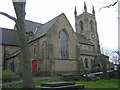

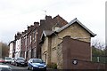
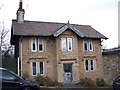
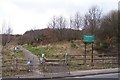

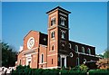

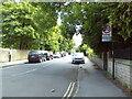
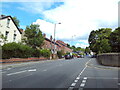
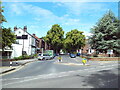
47 photos from this area
Area Information
Key information about the S5 8YA including its size, population, and administrative classification.
- Area Type
- Postcode
- Area Size
- 9581 m²
- Population
- 1786
- Population Density
- 3829 people/km²
House Prices in S5 8YA
12
Properties
£188,613
Average Sold Price
£108,000
Lowest Price
£322,000
Highest Price
Showing 12 properties
| Address | Type | Beds | Baths | Last Sale Price | Last Sale Date | |
|---|---|---|---|---|---|---|
| 10 Standish Way, Sheffield, S5 8YA | house | - | - | £322,000 | Dec 2024 | |
| 16 Standish Way, Sheffield, S5 8YA | house | - | - | £300,000 | Nov 2021 | |
| 18 Standish Way, Sheffield, S5 8YA | Detached | 4 | - | £185,000 | Jun 2015 | |
| 6 Standish Way, Sheffield, S5 8YA | house | - | - | £140,000 | Jun 2011 | |
| 5 Standish Way, Sheffield, S5 8YA | house | - | - | £254,400 | Jun 2010 | |
| 1 Standish Way, Sheffield, S5 8YA | Detached | - | - | £202,500 | Apr 2007 | |
| 14 Standish Way, Sheffield, S5 8YA | house | - | - | £189,950 | Mar 2007 | |
| 12 Standish Way, Sheffield, S5 8YA | house | - | - | £182,500 | Jan 2006 | |
| 8 Standish Way, Sheffield, S5 8YA | house | - | - | £148,000 | Apr 2004 | |
| 3 Standish Way, Sheffield, S5 8YA | house | - | - | £122,000 | Nov 2002 |
Page 1 of 2
Energy Efficiency in S5 8YA
Amenities
Schools
| Rank | School | Type | Entry gender | Ages |
|---|
Explore more schools in this area
Go to Schools tabDemographics
Household Size
One person
most common
Accommodation Type
Houses
most common
Tenure
41
majority
Ethnic Group
White
most common
Religion
N/A
most common
Household Composition
N/A
most common
Age
47
median
Adults (30-64 years)
most common
Household Deprivation
N/A
with no deprivation
NS-SEC
19
in Lower managerial occupations
Explore more demographic insights in this area
Go to Demographics tabPlanning
Planning Constraints
- Flood RiskPremium
- Ramsar Wetland SitesPremium
- Area of Outstanding Natural BeautyPremium
- Protected Nature ReservePremium
- Protected WoodlandPremium