Area Overview for S5 8LJ
Photos of S5 8LJ
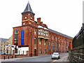
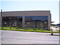
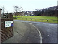
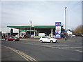
47 photos from this area
Area Information
Key information about the S5 8LJ including its size, population, and administrative classification.
- Area Type
- Postcode
- Area Size
- 4499 m²
- Population
- 1444
- Population Density
- 2178 people/km²
House Prices in S5 8LJ
28
Properties
£56,221
Average Sold Price
£45,000
Lowest Price
£74,950
Highest Price
Showing 28 properties
| Address | Type | Beds | Baths | Last Sale Price | Last Sale Date | |
|---|---|---|---|---|---|---|
| 48 Binsted Drive, Sheffield, S5 8LJ | Flat | - | - | £45,000 | Sep 2021 | |
| 16 Binsted Drive, Sheffield, S5 8LJ | Flat | - | - | £65,000 | Jul 2016 | |
| 40 Binsted Drive, Sheffield, S5 8LJ | Flat | - | - | £53,000 | Nov 2015 | |
| 26 Binsted Drive, Sheffield, S5 8LJ | Flat | - | - | £45,600 | Sep 2015 | |
| 50 Binsted Drive, Sheffield, S5 8LJ | Flat | - | - | £58,000 | Apr 2013 | |
| 46 Binsted Drive, Sheffield, S5 8LJ | Flat | 1 | 1 | £74,950 | Nov 2007 | |
| 2 Binsted Drive, Sheffield, S5 8LJ | Semi-detached | - | - | £52,000 | Jul 2002 | |
| 36 Binsted Drive, Sheffield, S5 8LJ | Flat | - | - | - | - | |
| 44 Binsted Drive, Sheffield, S5 8LJ | Flat | - | - | - | - | |
| 10 Binsted Drive, Sheffield, S5 8LJ | Flat | - | - | - | - |
Page 1 of 3
Energy Efficiency in S5 8LJ
Amenities
Schools
| Rank | School | Type | Entry gender | Ages |
|---|
Explore more schools in this area
Go to Schools tabDemographics
Household Size
One person
most common
Accommodation Type
Houses
most common
Tenure
28
majority
Ethnic Group
White
most common
Religion
N/A
most common
Household Composition
N/A
most common
Age
47
median
Adults (30-64 years)
most common
Household Deprivation
N/A
with no deprivation
NS-SEC
15
in Lower managerial occupations
Explore more demographic insights in this area
Go to Demographics tabPlanning
Planning Constraints
- Flood RiskPremium
- Ramsar Wetland SitesPremium
- Area of Outstanding Natural BeautyPremium
- Protected Nature ReservePremium
- Protected WoodlandPremium