Area Overview for S5 8GP
Photos of S5 8GP


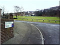
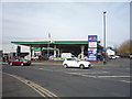

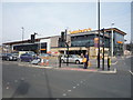

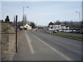

47 photos from this area
Area Information
Key information about the S5 8GP including its size, population, and administrative classification.
- Area Type
- Postcode
- Area Size
- 1.4 hectares
- Population
- 1635
- Population Density
- 5501 people/km²
House Prices in S5 8GP
40
Properties
£68,945
Average Sold Price
£29,950
Lowest Price
£105,000
Highest Price
Showing 40 properties
| Address | Type | Beds | Baths | Last Sale Price | Last Sale Date | |
|---|---|---|---|---|---|---|
| 47 Meynell Crescent, Sheffield, S5 8GP | house | - | - | £105,000 | Dec 2020 | |
| 21 Meynell Crescent, Sheffield, S5 8GP | Semi-detached | 3 | 1 | £91,000 | Nov 2020 | |
| 35 Meynell Crescent, Sheffield, S5 8GP | Terraced | 2 | 1 | £82,500 | Jul 2017 | |
| 2 Meynell Crescent, Sheffield, S5 8GP | Semi-detached | 2 | - | £72,000 | Apr 2014 | |
| 6 Meynell Crescent, Sheffield, S5 8GP | Semi-detached | 3 | - | £86,000 | Mar 2014 | |
| 3 Meynell Crescent, Sheffield, S5 8GP | Terraced | 2 | 1 | £65,000 | Mar 2013 | |
| 32 Meynell Crescent, Sheffield, S5 8GP | Semi-detached | - | - | £60,000 | May 2011 | |
| 39 Meynell Crescent, Sheffield, S5 8GP | Terraced | - | - | £76,000 | Feb 2007 | |
| 41 Meynell Crescent, Sheffield, S5 8GP | house | - | - | £61,000 | Jul 2006 | |
| 37 Meynell Crescent, Sheffield, S5 8GP | house | - | - | £29,950 | Nov 1995 |
Page 1 of 4
Energy Efficiency in S5 8GP
Amenities
Schools
| Rank | School | Type | Entry gender | Ages |
|---|
Explore more schools in this area
Go to Schools tabDemographics
Household Size
Family (3-5 people)
most common
Accommodation Type
Houses
most common
Tenure
38
majority
Ethnic Group
White
most common
Religion
N/A
most common
Household Composition
N/A
most common
Age
47
median
Adults (30-64 years)
most common
Household Deprivation
N/A
with no deprivation
NS-SEC
13
in Lower managerial occupations
Explore more demographic insights in this area
Go to Demographics tabPlanning
Planning Constraints
- Flood RiskPremium
- Ramsar Wetland SitesPremium
- Area of Outstanding Natural BeautyPremium
- Protected Nature ReservePremium
- Protected WoodlandPremium