Area Overview for S5 8BX
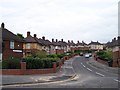
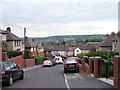
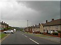
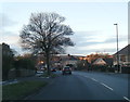
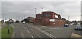
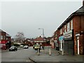
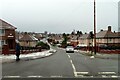
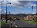
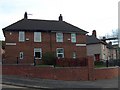
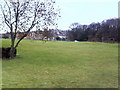
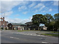
Photos of S5 8BX
Area Information
Living in S5 8BX means residing within a defined residential cluster covering 4,991 square metres. This specific postcode area accommodates a population of 2,987 individuals, creating a defined community boundary. The density figure translates to 598,430 people per square kilometre when calculated across this specific zone, indicating a tightly packed residential environment. Residents here enjoy immediate access to a network of five retail outlets, five metro links, and five railway stations. The surrounding infrastructure includes major retailers such as Co-op Southey, Farmfoods Parsons, and Asda Sheffield, alongside transport hubs at Medowhall Railway Station and Sheffield Railway Station. Life in S5 8BX is structured around practical connectivity rather than expansive open spaces, given the compact nature of the postcode. You find yourself part of a population dominated by adults aged 30 to 64 years. While the area offers strong digital connections with excellent fixed broadband and good mobile coverage, the character of the neighbourhood is defined by its proximity to established transport arteries and immediate retail services. Buying a home here places you in a zone where daily needs are within walking or short driving distance. The housing stock consists primarily of houses, which shapes the nature of ownership and upkeep in this small footprint. Although crime risk sits in the medium category, several safety and environmental assessments pass with zero constraints, ensuring no planning restrictions from protected sites like AONBs or Ramsar wetlands. The community in S5 8BX is characterised by a median age of 47 years. Adults between 30 and 64 years represent the most common age bracket, suggesting a neighbourhood with established residents rather than young singles or retirees. Home ownership stands at 39 per cent, meaning a majority of households likely rent or are first-time buyers rather than long-term owners. The predominant ethnic group is White, reflecting the demographic makeup of this specific postcode. Houses form the primary accommodation type within the 4,991 square metre area, distinguishing it from blocks of flats. With a total population of 2,987, you are not in an isolated pocket but within a recognisable cluster of neighbours. The high population density figure of 598,430 people per square kilometre applies to this specific data point, reflecting how tightly the population is distributed across this small residential footprint. This demographic profile suggests a stable community where families and mature adults form the backbone of local life. The mix of rented and owner-occupied homes indicates a transitional market, yet the housing stock remains focused on single-family dwellings. You do not find the diversity of rental blocks common in urban cores; instead, the area maintains a residential consistency typical of suburban clusters around Sheffield. S5 8BX presents a specific property profile centred entirely on houses. This accommodation type dominates the 4,991 square metre area, meaning you will not find purpose-built flats or high-rise apartments within this postcode. The home ownership rate sits at 39 per cent, which implies that over half of the 2,987 residents do not own their property outright. This metric suggests a area where renting remains a prevalent option, yet the architecture remains traditional with detached or semi-detached structures. When viewing homes in S5 8BX, you are looking at a stock defined by single-family units rather than shared buildings. This distinction affects both the value proposition and the maintenance responsibilities you would undertake as a buyer. With no data to suggest a predominance of new builds, the houses are likely established properties suited to the adults who form the bulk of the population. The compact size of the postcode means the housing supply is limited, so competition for available homes could be sharp if listings appear. You must consider whether the 39 per cent ownership rate indicates a good opportunity for investors looking for long-term tenants or owners seeking to climb the property ladder. The absence of flats simplifies the search but may reduce options for those requiring smaller units or communal facilities. Five schools operate in the vicinity of S5 8BX, offering specific educational routes for local families. The nearest primary option is Lindsay Nursery and Infant School. Beyond the primary stage, the area is served by Deerlands School, Holgate Meadows School, and Lotus Academy. All four of these named institutions are special schools, distinguishing this educational landscape from standard maintained schools. This composition means special educational resources are physically close to this residential cluster. If you are looking at homes in S5 8BX, you are prioritising access to specialist provision rather than comprehensive mainstream academies. The presence of Deerlands School, Holgate Meadows School, Lotus Academy, and Lindsay Nursery and Infant School ensures that diagnostic and specialised support is available without long travel times. However, the dominance of special school types indicates that standard primary and secondary schooling options are not located within this immediate vicinity. Families must plan their commuting based on where mainstream education is situated, as these specific schools cater to distinct learning needs. The mix reinforces the community's focus on inclusive education within a small geographical footprint. Digital connectivity in S5 8BX supports remote working and modern household needs effectively. Fixed broadband quality scores 100 out of 100, which represents the highest possible tier of performance for this service. In contrast, mobile coverage scores 85 out of 100, placing it in the 'good' to 'very good' range relative to national benchmarks. These figures ensure that staying connected for video calls or large file transfers is unlikely to be a problem. The nearby transport network integrates five metro options and five railway stations within practical reach. Key stations include Medowhall Railway Station, Meadowhall Railway Station, and Sheffield Railway Station. Metro services such as Leppings Lane to Middlewood and Leppings Lane provide frequent local transit. This infrastructure supports daily commutes without requiring a personal vehicle for every trip. The combination of excellent broadband and strong mobile networks means you can work securely from home while accessing general travel links for shopping or leisure. The transport score reflects a robust framework where digital and physical connectivity complement each other for residents of this postcode. Residents of S5 8BX benefit from a concentrated network of amenities around Sheffield. Five retail outlets serve the local community, including Co-op Southey, Farmfoods Parsons, and Asda Sheffield. These locations provide essential groceries and general goods without the need for lengthy travel. The area also offers five metro connections and five railway stations, with Leppings Lane to Middlewood and Leeds connections noted in the local service map. Transport hubs at Medowhall Railway Station, Meadowhall Railway Station, and Sheffield Railway Station allow you to access wider city centres. The mix of major supermarkets and specific local outlets ensures that daily shopping fits easily into your routine. Live music venues or large leisure centres are not listed in the immediate data, so your entertainment likely centres around the retail and transport nodes provided. The closeness of these facilities defines the pace of life in S5 8BX, where errands are tackled efficiently. You balance the convenience of nearby supermarkets with the connectivity of major rail lines. This lifestyle suits those who value practical access to goods and transport over large-scale cultural venues or expansive green spaces. Safety and environmental factors in S5 8BX present a balanced picture of risk and security. The crime risk assessment yields a score of 56 out of 100, placing the area in the 'WARNING' category. This medium crime risk indicates that rates are around average, necessitating standard security precautions such as secure门窗 and situational awareness. In contrast, the flood risk assessment passes with a score of 0, confirming low flood risk coverage. Environmental constraints are similarly minimal; the Ramsar Wetland Sites, Area of Outstanding Natural Beauty, Protected Nature Reserve, and Protected Woodland assessments all score 0 and pass. You will find no planning constraints associated with protected nature reserves or wetlands in this postcode. These zero scores mean development is not restricted by environmental designations, which can sometimes affect property value or extension possibilities. While the crime score suggests you should remain vigilant, the environmental safety is robust. The combination of average crime levels and zero environmental restrictions creates a stable setting for living. Residents should expect standard urban precautions but do not face the additional risks of flooding or protected land constraints found in other regions. Who typically lives in S5 8BX?The population of 2,987 residents consists primarily of adults aged 30 to 64 years. The median age is 47, reflecting a mature demographic. Housing is focused on houses rather than flats, and only 39 per cent of households own their properties, indicating a mix of renters and owners. How are schools near S5 8BX rated or what types are available?Four schools serve this area, all classified as special schools: Deerlands School, Holgate Meadows School, Lotus Academy, and Lindsay Nursery and Infant School. The local education provision focuses on specialist care rather than standard mainstream primary or secondary institutions. What is the crime situation like in this postcode?The crime risk assessment gives a score of 56, which is classified as a WARNING for medium risk. Crime rates are around average, meaning standard security precautions are advisable. However, there are no environmental risks such as flooding or protected land constraints.
- Area Type
- Postcode
- Area Size
- 4991 m²
- Population
- 2987
- Population Density
- 4097 people/km²
S5 8BX presents a specific property profile centred entirely on houses. This accommodation type dominates the 4,991 square metre area, meaning you will not find purpose-built flats or high-rise apartments within this postcode. The home ownership rate sits at 39 per cent, which implies that over half of the 2,987 residents do not own their property outright. This metric suggests a area where renting remains a prevalent option, yet the architecture remains traditional with detached or semi-detached structures. When viewing homes in S5 8BX, you are looking at a stock defined by single-family units rather than shared buildings. This distinction affects both the value proposition and the maintenance responsibilities you would undertake as a buyer. With no data to suggest a predominance of new builds, the houses are likely established properties suited to the adults who form the bulk of the population. The compact size of the postcode means the housing supply is limited, so competition for available homes could be sharp if listings appear. You must consider whether the 39 per cent ownership rate indicates a good opportunity for investors looking for long-term tenants or owners seeking to climb the property ladder. The absence of flats simplifies the search but may reduce options for those requiring smaller units or communal facilities. Five schools operate in the vicinity of S5 8BX, offering specific educational routes for local families. The nearest primary option is Lindsay Nursery and Infant School. Beyond the primary stage, the area is served by Deerlands School, Holgate Meadows School, and Lotus Academy. All four of these named institutions are special schools, distinguishing this educational landscape from standard maintained schools. This composition means special educational resources are physically close to this residential cluster. If you are looking at homes in S5 8BX, you are prioritising access to specialist provision rather than comprehensive mainstream academies. The presence of Deerlands School, Holgate Meadows School, Lotus Academy, and Lindsay Nursery and Infant School ensures that diagnostic and specialised support is available without long travel times. However, the dominance of special school types indicates that standard primary and secondary schooling options are not located within this immediate vicinity. Families must plan their commuting based on where mainstream education is situated, as these specific schools cater to distinct learning needs. The mix reinforces the community's focus on inclusive education within a small geographical footprint. Digital connectivity in S5 8BX supports remote working and modern household needs effectively. Fixed broadband quality scores 100 out of 100, which represents the highest possible tier of performance for this service. In contrast, mobile coverage scores 85 out of 100, placing it in the 'good' to 'very good' range relative to national benchmarks. These figures ensure that staying connected for video calls or large file transfers is unlikely to be a problem. The nearby transport network integrates five metro options and five railway stations within practical reach. Key stations include Medowhall Railway Station, Meadowhall Railway Station, and Sheffield Railway Station. Metro services such as Leppings Lane to Middlewood and Leppings Lane provide frequent local transit. This infrastructure supports daily commutes without requiring a personal vehicle for every trip. The combination of excellent broadband and strong mobile networks means you can work securely from home while accessing general travel links for shopping or leisure. The transport score reflects a robust framework where digital and physical connectivity complement each other for residents of this postcode. Residents of S5 8BX benefit from a concentrated network of amenities around Sheffield. Five retail outlets serve the local community, including Co-op Southey, Farmfoods Parsons, and Asda Sheffield. These locations provide essential groceries and general goods without the need for lengthy travel. The area also offers five metro connections and five railway stations, with Leppings Lane to Middlewood and Leeds connections noted in the local service map. Transport hubs at Medowhall Railway Station, Meadowhall Railway Station, and Sheffield Railway Station allow you to access wider city centres. The mix of major supermarkets and specific local outlets ensures that daily shopping fits easily into your routine. Live music venues or large leisure centres are not listed in the immediate data, so your entertainment likely centres around the retail and transport nodes provided. The closeness of these facilities defines the pace of life in S5 8BX, where errands are tackled efficiently. You balance the convenience of nearby supermarkets with the connectivity of major rail lines. This lifestyle suits those who value practical access to goods and transport over large-scale cultural venues or expansive green spaces. Safety and environmental factors in S5 8BX present a balanced picture of risk and security. The crime risk assessment yields a score of 56 out of 100, placing the area in the 'WARNING' category. This medium crime risk indicates that rates are around average, necessitating standard security precautions such as secure门窗 and situational awareness. In contrast, the flood risk assessment passes with a score of 0, confirming low flood risk coverage. Environmental constraints are similarly minimal; the Ramsar Wetland Sites, Area of Outstanding Natural Beauty, Protected Nature Reserve, and Protected Woodland assessments all score 0 and pass. You will find no planning constraints associated with protected nature reserves or wetlands in this postcode. These zero scores mean development is not restricted by environmental designations, which can sometimes affect property value or extension possibilities. While the crime score suggests you should remain vigilant, the environmental safety is robust. The combination of average crime levels and zero environmental restrictions creates a stable setting for living. Residents should expect standard urban precautions but do not face the additional risks of flooding or protected land constraints found in other regions. Who typically lives in S5 8BX?The population of 2,987 residents consists primarily of adults aged 30 to 64 years. The median age is 47, reflecting a mature demographic. Housing is focused on houses rather than flats, and only 39 per cent of households own their properties, indicating a mix of renters and owners. How are schools near S5 8BX rated or what types are available?Four schools serve this area, all classified as special schools: Deerlands School, Holgate Meadows School, Lotus Academy, and Lindsay Nursery and Infant School. The local education provision focuses on specialist care rather than standard mainstream primary or secondary institutions. What is the crime situation like in this postcode?The crime risk assessment gives a score of 56, which is classified as a WARNING for medium risk. Crime rates are around average, meaning standard security precautions are advisable. However, there are no environmental risks such as flooding or protected land constraints.
House Prices in S5 8BX
Showing 29 properties
| Address | Type | Beds | Baths | Last Sale Price | Last Sale Date | |
|---|---|---|---|---|---|---|
| 23 Bartlett Road, Sheffield, S5 8BX | Terraced | 2 | 1 | £150,000 | Dec 2024 | |
| 17 Bartlett Road, Sheffield, S5 8BX | Semi-detached | 2 | 2 | £202,000 | Oct 2024 | |
| 3 Bartlett Road, Sheffield, S5 8BX | Semi-detached | 2 | 1 | £115,000 | Apr 2024 | |
| 29 Bartlett Road, Sheffield, S5 8BX | Terraced | 2 | 1 | £155,000 | Mar 2023 | |
| 31 Bartlett Road, Sheffield, S5 8BX | Terraced | 2 | 1 | £120,000 | Oct 2020 | |
| 1 Bartlett Road, Sheffield, S5 8BX | Semi-detached | 3 | 1 | £70,000 | Jun 2020 | |
| 9 Bartlett Road, Sheffield, S5 8BX | house | - | - | £115,000 | Sep 2019 | |
| 27 Bartlett Road, Sheffield, S5 8BX | house | - | - | £133,995 | Oct 2015 | |
| 25 Bartlett Road, Sheffield, S5 8BX | house | - | - | £132,995 | Oct 2015 | |
| 33 Bartlett Road, Sheffield, S5 8BX | house | - | - | £133,995 | Oct 2015 |
Energy Efficiency in S5 8BX
Residents of S5 8BX benefit from a concentrated network of amenities around Sheffield. Five retail outlets serve the local community, including Co-op Southey, Farmfoods Parsons, and Asda Sheffield. These locations provide essential groceries and general goods without the need for lengthy travel. The area also offers five metro connections and five railway stations, with Leppings Lane to Middlewood and Leeds connections noted in the local service map. Transport hubs at Medowhall Railway Station, Meadowhall Railway Station, and Sheffield Railway Station allow you to access wider city centres. The mix of major supermarkets and specific local outlets ensures that daily shopping fits easily into your routine. Live music venues or large leisure centres are not listed in the immediate data, so your entertainment likely centres around the retail and transport nodes provided. The closeness of these facilities defines the pace of life in S5 8BX, where errands are tackled efficiently. You balance the convenience of nearby supermarkets with the connectivity of major rail lines. This lifestyle suits those who value practical access to goods and transport over large-scale cultural venues or expansive green spaces. Safety and environmental factors in S5 8BX present a balanced picture of risk and security. The crime risk assessment yields a score of 56 out of 100, placing the area in the 'WARNING' category. This medium crime risk indicates that rates are around average, necessitating standard security precautions such as secure门窗 and situational awareness. In contrast, the flood risk assessment passes with a score of 0, confirming low flood risk coverage. Environmental constraints are similarly minimal; the Ramsar Wetland Sites, Area of Outstanding Natural Beauty, Protected Nature Reserve, and Protected Woodland assessments all score 0 and pass. You will find no planning constraints associated with protected nature reserves or wetlands in this postcode. These zero scores mean development is not restricted by environmental designations, which can sometimes affect property value or extension possibilities. While the crime score suggests you should remain vigilant, the environmental safety is robust. The combination of average crime levels and zero environmental restrictions creates a stable setting for living. Residents should expect standard urban precautions but do not face the additional risks of flooding or protected land constraints found in other regions. Who typically lives in S5 8BX?The population of 2,987 residents consists primarily of adults aged 30 to 64 years. The median age is 47, reflecting a mature demographic. Housing is focused on houses rather than flats, and only 39 per cent of households own their properties, indicating a mix of renters and owners. How are schools near S5 8BX rated or what types are available?Four schools serve this area, all classified as special schools: Deerlands School, Holgate Meadows School, Lotus Academy, and Lindsay Nursery and Infant School. The local education provision focuses on specialist care rather than standard mainstream primary or secondary institutions. What is the crime situation like in this postcode?The crime risk assessment gives a score of 56, which is classified as a WARNING for medium risk. Crime rates are around average, meaning standard security precautions are advisable. However, there are no environmental risks such as flooding or protected land constraints.
Amenities
Schools
Five schools operate in the vicinity of S5 8BX, offering specific educational routes for local families. The nearest primary option is Lindsay Nursery and Infant School. Beyond the primary stage, the area is served by Deerlands School, Holgate Meadows School, and Lotus Academy. All four of these named institutions are special schools, distinguishing this educational landscape from standard maintained schools. This composition means special educational resources are physically close to this residential cluster. If you are looking at homes in S5 8BX, you are prioritising access to specialist provision rather than comprehensive mainstream academies. The presence of Deerlands School, Holgate Meadows School, Lotus Academy, and Lindsay Nursery and Infant School ensures that diagnostic and specialised support is available without long travel times. However, the dominance of special school types indicates that standard primary and secondary schooling options are not located within this immediate vicinity. Families must plan their commuting based on where mainstream education is situated, as these specific schools cater to distinct learning needs. The mix reinforces the community's focus on inclusive education within a small geographical footprint. Digital connectivity in S5 8BX supports remote working and modern household needs effectively. Fixed broadband quality scores 100 out of 100, which represents the highest possible tier of performance for this service. In contrast, mobile coverage scores 85 out of 100, placing it in the 'good' to 'very good' range relative to national benchmarks. These figures ensure that staying connected for video calls or large file transfers is unlikely to be a problem. The nearby transport network integrates five metro options and five railway stations within practical reach. Key stations include Medowhall Railway Station, Meadowhall Railway Station, and Sheffield Railway Station. Metro services such as Leppings Lane to Middlewood and Leppings Lane provide frequent local transit. This infrastructure supports daily commutes without requiring a personal vehicle for every trip. The combination of excellent broadband and strong mobile networks means you can work securely from home while accessing general travel links for shopping or leisure. The transport score reflects a robust framework where digital and physical connectivity complement each other for residents of this postcode. Residents of S5 8BX benefit from a concentrated network of amenities around Sheffield. Five retail outlets serve the local community, including Co-op Southey, Farmfoods Parsons, and Asda Sheffield. These locations provide essential groceries and general goods without the need for lengthy travel. The area also offers five metro connections and five railway stations, with Leppings Lane to Middlewood and Leeds connections noted in the local service map. Transport hubs at Medowhall Railway Station, Meadowhall Railway Station, and Sheffield Railway Station allow you to access wider city centres. The mix of major supermarkets and specific local outlets ensures that daily shopping fits easily into your routine. Live music venues or large leisure centres are not listed in the immediate data, so your entertainment likely centres around the retail and transport nodes provided. The closeness of these facilities defines the pace of life in S5 8BX, where errands are tackled efficiently. You balance the convenience of nearby supermarkets with the connectivity of major rail lines. This lifestyle suits those who value practical access to goods and transport over large-scale cultural venues or expansive green spaces. Safety and environmental factors in S5 8BX present a balanced picture of risk and security. The crime risk assessment yields a score of 56 out of 100, placing the area in the 'WARNING' category. This medium crime risk indicates that rates are around average, necessitating standard security precautions such as secure门窗 and situational awareness. In contrast, the flood risk assessment passes with a score of 0, confirming low flood risk coverage. Environmental constraints are similarly minimal; the Ramsar Wetland Sites, Area of Outstanding Natural Beauty, Protected Nature Reserve, and Protected Woodland assessments all score 0 and pass. You will find no planning constraints associated with protected nature reserves or wetlands in this postcode. These zero scores mean development is not restricted by environmental designations, which can sometimes affect property value or extension possibilities. While the crime score suggests you should remain vigilant, the environmental safety is robust. The combination of average crime levels and zero environmental restrictions creates a stable setting for living. Residents should expect standard urban precautions but do not face the additional risks of flooding or protected land constraints found in other regions. Who typically lives in S5 8BX?The population of 2,987 residents consists primarily of adults aged 30 to 64 years. The median age is 47, reflecting a mature demographic. Housing is focused on houses rather than flats, and only 39 per cent of households own their properties, indicating a mix of renters and owners. How are schools near S5 8BX rated or what types are available?Four schools serve this area, all classified as special schools: Deerlands School, Holgate Meadows School, Lotus Academy, and Lindsay Nursery and Infant School. The local education provision focuses on specialist care rather than standard mainstream primary or secondary institutions. What is the crime situation like in this postcode?The crime risk assessment gives a score of 56, which is classified as a WARNING for medium risk. Crime rates are around average, meaning standard security precautions are advisable. However, there are no environmental risks such as flooding or protected land constraints.
| Rank | School | Type | Entry gender | Ages |
|---|
Explore more schools in this area
Go to Schools tabDemographics
The community in S5 8BX is characterised by a median age of 47 years. Adults between 30 and 64 years represent the most common age bracket, suggesting a neighbourhood with established residents rather than young singles or retirees. Home ownership stands at 39 per cent, meaning a majority of households likely rent or are first-time buyers rather than long-term owners. The predominant ethnic group is White, reflecting the demographic makeup of this specific postcode. Houses form the primary accommodation type within the 4,991 square metre area, distinguishing it from blocks of flats. With a total population of 2,987, you are not in an isolated pocket but within a recognisable cluster of neighbours. The high population density figure of 598,430 people per square kilometre applies to this specific data point, reflecting how tightly the population is distributed across this small residential footprint. This demographic profile suggests a stable community where families and mature adults form the backbone of local life. The mix of rented and owner-occupied homes indicates a transitional market, yet the housing stock remains focused on single-family dwellings. You do not find the diversity of rental blocks common in urban cores; instead, the area maintains a residential consistency typical of suburban clusters around Sheffield. S5 8BX presents a specific property profile centred entirely on houses. This accommodation type dominates the 4,991 square metre area, meaning you will not find purpose-built flats or high-rise apartments within this postcode. The home ownership rate sits at 39 per cent, which implies that over half of the 2,987 residents do not own their property outright. This metric suggests a area where renting remains a prevalent option, yet the architecture remains traditional with detached or semi-detached structures. When viewing homes in S5 8BX, you are looking at a stock defined by single-family units rather than shared buildings. This distinction affects both the value proposition and the maintenance responsibilities you would undertake as a buyer. With no data to suggest a predominance of new builds, the houses are likely established properties suited to the adults who form the bulk of the population. The compact size of the postcode means the housing supply is limited, so competition for available homes could be sharp if listings appear. You must consider whether the 39 per cent ownership rate indicates a good opportunity for investors looking for long-term tenants or owners seeking to climb the property ladder. The absence of flats simplifies the search but may reduce options for those requiring smaller units or communal facilities. Five schools operate in the vicinity of S5 8BX, offering specific educational routes for local families. The nearest primary option is Lindsay Nursery and Infant School. Beyond the primary stage, the area is served by Deerlands School, Holgate Meadows School, and Lotus Academy. All four of these named institutions are special schools, distinguishing this educational landscape from standard maintained schools. This composition means special educational resources are physically close to this residential cluster. If you are looking at homes in S5 8BX, you are prioritising access to specialist provision rather than comprehensive mainstream academies. The presence of Deerlands School, Holgate Meadows School, Lotus Academy, and Lindsay Nursery and Infant School ensures that diagnostic and specialised support is available without long travel times. However, the dominance of special school types indicates that standard primary and secondary schooling options are not located within this immediate vicinity. Families must plan their commuting based on where mainstream education is situated, as these specific schools cater to distinct learning needs. The mix reinforces the community's focus on inclusive education within a small geographical footprint. Digital connectivity in S5 8BX supports remote working and modern household needs effectively. Fixed broadband quality scores 100 out of 100, which represents the highest possible tier of performance for this service. In contrast, mobile coverage scores 85 out of 100, placing it in the 'good' to 'very good' range relative to national benchmarks. These figures ensure that staying connected for video calls or large file transfers is unlikely to be a problem. The nearby transport network integrates five metro options and five railway stations within practical reach. Key stations include Medowhall Railway Station, Meadowhall Railway Station, and Sheffield Railway Station. Metro services such as Leppings Lane to Middlewood and Leppings Lane provide frequent local transit. This infrastructure supports daily commutes without requiring a personal vehicle for every trip. The combination of excellent broadband and strong mobile networks means you can work securely from home while accessing general travel links for shopping or leisure. The transport score reflects a robust framework where digital and physical connectivity complement each other for residents of this postcode. Residents of S5 8BX benefit from a concentrated network of amenities around Sheffield. Five retail outlets serve the local community, including Co-op Southey, Farmfoods Parsons, and Asda Sheffield. These locations provide essential groceries and general goods without the need for lengthy travel. The area also offers five metro connections and five railway stations, with Leppings Lane to Middlewood and Leeds connections noted in the local service map. Transport hubs at Medowhall Railway Station, Meadowhall Railway Station, and Sheffield Railway Station allow you to access wider city centres. The mix of major supermarkets and specific local outlets ensures that daily shopping fits easily into your routine. Live music venues or large leisure centres are not listed in the immediate data, so your entertainment likely centres around the retail and transport nodes provided. The closeness of these facilities defines the pace of life in S5 8BX, where errands are tackled efficiently. You balance the convenience of nearby supermarkets with the connectivity of major rail lines. This lifestyle suits those who value practical access to goods and transport over large-scale cultural venues or expansive green spaces. Safety and environmental factors in S5 8BX present a balanced picture of risk and security. The crime risk assessment yields a score of 56 out of 100, placing the area in the 'WARNING' category. This medium crime risk indicates that rates are around average, necessitating standard security precautions such as secure门窗 and situational awareness. In contrast, the flood risk assessment passes with a score of 0, confirming low flood risk coverage. Environmental constraints are similarly minimal; the Ramsar Wetland Sites, Area of Outstanding Natural Beauty, Protected Nature Reserve, and Protected Woodland assessments all score 0 and pass. You will find no planning constraints associated with protected nature reserves or wetlands in this postcode. These zero scores mean development is not restricted by environmental designations, which can sometimes affect property value or extension possibilities. While the crime score suggests you should remain vigilant, the environmental safety is robust. The combination of average crime levels and zero environmental restrictions creates a stable setting for living. Residents should expect standard urban precautions but do not face the additional risks of flooding or protected land constraints found in other regions. Who typically lives in S5 8BX?The population of 2,987 residents consists primarily of adults aged 30 to 64 years. The median age is 47, reflecting a mature demographic. Housing is focused on houses rather than flats, and only 39 per cent of households own their properties, indicating a mix of renters and owners. How are schools near S5 8BX rated or what types are available?Four schools serve this area, all classified as special schools: Deerlands School, Holgate Meadows School, Lotus Academy, and Lindsay Nursery and Infant School. The local education provision focuses on specialist care rather than standard mainstream primary or secondary institutions. What is the crime situation like in this postcode?The crime risk assessment gives a score of 56, which is classified as a WARNING for medium risk. Crime rates are around average, meaning standard security precautions are advisable. However, there are no environmental risks such as flooding or protected land constraints.
Household Size
Accommodation Type
Tenure
Ethnic Group
Religion
Household Composition
Age
Household Deprivation
NS-SEC
Explore more demographic insights in this area
Go to Demographics tabPlanning
Planning Constraints
- Flood RiskPremium
- Ramsar Wetland SitesPremium
- Area of Outstanding Natural BeautyPremium
- Protected Nature ReservePremium
- Protected WoodlandPremium