Area Overview for S5 7HH
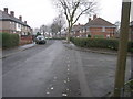
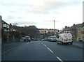
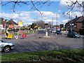
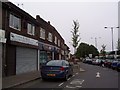
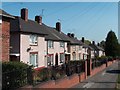
Photos of S5 7HH


Area Information
Living in S5 7HH means residing in a specific postcode area covering a small residential cluster. This distinct location occupies just 8842 square metres in England, creating a compact living environment. You are part of a community with a population of 1753 people. The density here is high, with 198255 people per square kilometre, indicating tightly packed housing and limited open space. This small footprint defines the character of the neighbourhood, offering direct access to wider Sheffield amenities while maintaining a defined residential boundary. Daily life revolves around this concentrated layout where convenience and space are balanced carefully. The area represents a specific slice of the city's housing market, ideal for those seeking a defined perimeter rather than sprawling suburbs. Your immediate surroundings are shaped by these concrete physical boundaries, ensuring that travel distances to nearby hubs remain short. The small size of the area means that things happen quickly and neighbours know one another, fostering a sense of familiarity within a very contained geographical zone.
- Area Type
- Postcode
- Area Size
- 8842 m²
- Population
- 1753
- Population Density
- 5853 people/km²
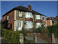
The property market in S5 7HH is defined by specific constraints and housing types. Houses form the predominant accommodation type, shaping the visual landscape and street layout of the postcode. Only 29% of residents achieve home ownership, implying a substantial portion of the 1753 population resides in rental properties. This split creates a mixed market where buyers encounter both freehold houses and long-term tenancies. Because the area covers only 8842 square metres, inventory is naturally limited, meaning competition for available homes can be immediate. Prospective buyers should expect a landscape dominated by detached or semi-detached dwellings rather than apartments or flats. The lower ownership rate suggests that many families rely on the rental sector, which can affect resale values and market stability. When looking at homes in S5 7HH, you are entering a niche market where supply is tightly controlled by the small geographical footprint. Understanding the 29% ownership figure helps you gauge the stability of the local housing stock and the potential for long-term investment.
House Prices in S5 7HH
Showing 32 properties
| Address | Type | Beds | Baths | Last Sale Price | Last Sale Date | |
|---|---|---|---|---|---|---|
| 2 Boynton Crescent, Sheffield, S5 7HH | house | - | - | £110,000 | May 2023 | |
| 34 Boynton Crescent, Sheffield, S5 7HH | Terraced | - | - | £62,000 | Jul 2020 | |
| 38 Boynton Crescent, Sheffield, S5 7HH | Terraced | 2 | 1 | £65,000 | Jun 2020 | |
| 19 Boynton Crescent, Sheffield, S5 7HH | house | - | - | £69,000 | Dec 2018 | |
| 1 Boynton Crescent, Sheffield, S5 7HH | Semi-detached | 3 | 1 | £91,000 | Nov 2017 | |
| 18 Boynton Crescent, Sheffield, S5 7HH | Terraced | 2 | - | £60,000 | Oct 2016 | |
| 12 Boynton Crescent, Sheffield, S5 7HH | Terraced | 2 | 1 | £60,000 | Jul 2016 | |
| 22 Boynton Crescent, Sheffield, S5 7HH | Semi-detached | 2 | - | £75,000 | Aug 2014 | |
| 30 Boynton Crescent, Sheffield, S5 7HH | Terraced | 2 | - | £70,000 | Nov 2013 | |
| 21 Boynton Crescent, Sheffield, S5 7HH | Terraced | - | - | £72,500 | Sep 2005 |
Energy Efficiency in S5 7HH
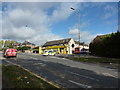
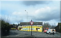
Residents of S5 7HH enjoy immediate access to essential retail and transport hubs. Within practical reach, you will find three notable Tesco shops and one Co-op Southey location. These supermarkets cover daily grocery needs without requiring a long drive. Transport links are equally convenient, with five key transport points nearby. Bamforth Street and the route from Bamforth St to Middlewood/Malin Br offer accessible routes for pedestrians and cyclists. The Leppings Lane Platform to City provides direct rail access. Rail connectivity is strengthened by Medowhall Railway Station, Sheffield Railway Station, and Meadowhall Railway Station, all within easy reach. You can commute to the wider Sheffield network or head towards the retail district with ease. These listed amenities ensure that nothing essential is far away. Shopping trips and start-of-work travel are short journeys, fitting the small footprint of your home environment. The concentration of these venues creates a convenient lifestyle where daily necessities are just minutes away from your front door.
Amenities
Schools
Schools near S5 7HH offer a mix of early years and primary education within walking distance. Busk Meadow Nursery Infant School operates as a primary institution serving young children. Just beyond, Watercliffe Meadow Community Primary School holds a good Ofsted rating, providing a solid academic foundation for students. This combination gives families direct access to phonics-based infant education and a well-regarded community primary school. The presence of these specific institutions means you do not need to travel far to ensure your children attend a regulated educational facility. For families living in this postcode, the proximity of Watercliffe Meadow Community Primary School is a key advantage, as its good rating offers reassurance regarding educational standards. The mix of nursery and primary options supports continuous schooling for young children without requiring relocation as they grow. Parents in S5 7HH benefit from having these named schools immediately accessible, reducing commute times to the classroom. These educational facilities form the core of the family infrastructure in this small residential cluster.
| Rank | School | Type | Entry gender | Ages |
|---|
Explore more schools in this area
Go to Schools tabDemographics
The community in S5 7HH reflects a mature and settled population. The median age stands at 47 years, placing the demographic centre firmly in mid-life. Adults between the ages of 30 and 64 years constitute the most common age range, suggesting a stable workforce and families in their peak years. Housing tenure shows that 29% of residents own their homes outright, meaning the majority likely rent or mortgage their properties. The predominant accommodation type consists of houses, fitting the profile of families rather than high-rise urban dwellers. The predominant ethnic group identified is White, indicating a homogenous cultural makeup for this specific postcode. These figures paint a picture of a family-oriented community where long-term residents outnumber transient populations. The age profile suggests schools remain relevant to daily life, while the lower home ownership rate compared to national averages indicates a significant rental sector exists here. You are likely interacting with neighbours who have established roots in these housing structures.
Household Size
Accommodation Type
Tenure
Ethnic Group
Religion
Household Composition
Age
Household Deprivation
NS-SEC
Explore more demographic insights in this area
Go to Demographics tabPlanning
Planning Constraints
- Flood RiskPremium
- Ramsar Wetland SitesPremium
- Area of Outstanding Natural BeautyPremium
- Protected Nature ReservePremium
- Protected WoodlandPremium