Area Overview for S5 7BD
Photos of S5 7BD
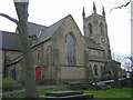
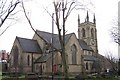
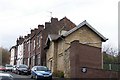
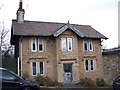

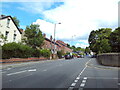
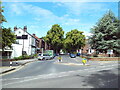
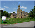
47 photos from this area
Area Information
Key information about the S5 7BD including its size, population, and administrative classification.
- Area Type
- Postcode
- Area Size
- 1.1 hectares
- Population
- 1599
- Population Density
- 4662 people/km²
House Prices in S5 7BD
18
Properties
£141,104
Average Sold Price
£44,000
Lowest Price
£280,000
Highest Price
Showing 18 properties
| Address | Type | Beds | Baths | Last Sale Price | Last Sale Date | |
|---|---|---|---|---|---|---|
| 16 Norwood Road, Sheffield, S5 7BD | Semi-detached | 4 | 1 | £247,000 | Mar 2017 | |
| 11 Norwood Road, Sheffield, S5 7BD | Semi-detached | 3 | - | £100,000 | Apr 2015 | |
| 3 Norwood Road, Sheffield, S5 7BD | house | - | - | £155,000 | Mar 2014 | |
| 14 Norwood Road, Sheffield, S5 7BD | house | 4 | - | £187,250 | Feb 2013 | |
| 12 Norwood Road, Sheffield, S5 7BD | house | - | - | £105,000 | Nov 2007 | |
| 10 Norwood Road, Sheffield, S5 7BD | house | - | - | £175,000 | Dec 2006 | |
| 2 Norwood Road, Sheffield, S5 7BD | Semi-detached | 3 | - | £280,000 | Nov 2005 | |
| 68 Norwood Road, Sheffield, S5 7BD | Detached | - | - | £200,000 | Aug 2005 | |
| 4 Norwood Road, Sheffield, S5 7BD | house | 3 | - | £44,000 | Jan 2001 | |
| 5 Norwood Road, Sheffield, S5 7BD | Semi-detached | 3 | 1 | £45,000 | Oct 2000 |
Page 1 of 2
Energy Efficiency in S5 7BD
Amenities
Schools
| Rank | School | Type | Entry gender | Ages |
|---|
Explore more schools in this area
Go to Schools tabDemographics
Household Size
Family (3-5 people)
most common
Accommodation Type
Houses
most common
Tenure
54
majority
Ethnic Group
asian_total
most common
Religion
N/A
most common
Household Composition
N/A
most common
Age
47
median
Adults (30-64 years)
most common
Household Deprivation
N/A
with no deprivation
NS-SEC
20
in Lower managerial occupations
Explore more demographic insights in this area
Go to Demographics tabPlanning
Planning Constraints
- Flood RiskPremium
- Ramsar Wetland SitesPremium
- Area of Outstanding Natural BeautyPremium
- Protected Nature ReservePremium
- Protected WoodlandPremium