Area Overview for S5 6WA
Photos of S5 6WA

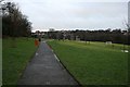

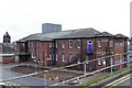


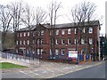

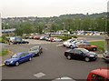
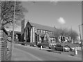
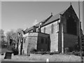

100 photos from this area
Area Information
Key information about the S5 6WA including its size, population, and administrative classification.
- Area Type
- Postcode
- Area Size
- 6989 m²
- Population
- 1653
- Population Density
- 6868 people/km²
House Prices in S5 6WA
30
Properties
£76,889
Average Sold Price
£450
Lowest Price
£140,000
Highest Price
Showing 30 properties
| Address | Type | Beds | Baths | Last Sale Price | Last Sale Date | |
|---|---|---|---|---|---|---|
| 103 Vickers Road, Firth Park, Sheffield, S5 6WA | Semi-detached | 3 | 1 | £121,500 | Nov 2023 | |
| 75 Vickers Road, Firth Park, Sheffield, S5 6WA | Terraced | 3 | 1 | £125,000 | Sep 2023 | |
| 129 Vickers Road, Firth Park, Sheffield, S5 6WA | Retail | 3 | - | £135,000 | Feb 2023 | |
| 113 Vickers Road, Firth Park, Sheffield, S5 6WA | Semi-detached | 3 | 1 | £100,000 | Jul 2022 | |
| 111 Vickers Road, Firth Park, Sheffield, S5 6WA | Retail | 3 | 1 | £120,000 | Jul 2022 | |
| 91 Vickers Road, Firth Park, Sheffield, S5 6WA | house | - | - | £77,000 | Aug 2021 | |
| 127 Vickers Road, Firth Park, Sheffield, S5 6WA | Semi-detached | 3 | 1 | £64,000 | Jul 2021 | |
| 77 Vickers Road, Firth Park, Sheffield, S5 6WA | house | - | - | £450 | Sep 2020 | |
| 83 Vickers Road, Firth Park, Sheffield, S5 6WA | Terraced | 3 | - | £50,000 | Mar 2019 | |
| 97 Vickers Road, Firth Park, Sheffield, S5 6WA | Semi-detached | 3 | 1 | £71,000 | Aug 2018 |
Page 1 of 3
Energy Efficiency in S5 6WA
Amenities
Schools
| Rank | School | Type | Entry gender | Ages |
|---|
Explore more schools in this area
Go to Schools tabDemographics
Household Size
Family (3-5 people)
most common
Accommodation Type
Houses
most common
Tenure
33
majority
Ethnic Group
White
most common
Religion
N/A
most common
Household Composition
N/A
most common
Age
47
median
Adults (30-64 years)
most common
Household Deprivation
N/A
with no deprivation
NS-SEC
12
in Lower managerial occupations
Explore more demographic insights in this area
Go to Demographics tabPlanning
Planning Constraints
- Flood RiskPremium
- Ramsar Wetland SitesPremium
- Area of Outstanding Natural BeautyPremium
- Protected Nature ReservePremium
- Protected WoodlandPremium