Area Overview for S5 6UP
Photos of S5 6UP
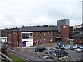
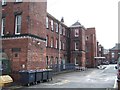
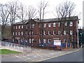

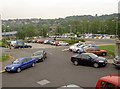
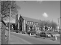
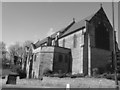
100 photos from this area
Area Information
Key information about the S5 6UP including its size, population, and administrative classification.
- Area Type
- Postcode
- Area Size
- 8494 m²
- Population
- 1880
- Population Density
- 4489 people/km²
House Prices in S5 6UP
40
Properties
£80,566
Average Sold Price
£15,000
Lowest Price
£205,000
Highest Price
Showing 40 properties
| Address | Type | Beds | Baths | Last Sale Price | Last Sale Date | |
|---|---|---|---|---|---|---|
| 10 Idsworth Road, Sheffield, S5 6UP | Terraced | 3 | 2 | £102,000 | Jul 2023 | |
| 110 Idsworth Road, Sheffield, S5 6UP | house | - | - | £95,000 | Mar 2022 | |
| 108 Idsworth Road, Sheffield, S5 6UP | Terraced | 3 | 2 | £128,500 | Feb 2022 | |
| 54 Idsworth Road, Sheffield, S5 6UP | house | 4 | 1 | £75,000 | Jan 2020 | |
| 42 Idsworth Road, Sheffield, S5 6UP | house | - | - | £75,000 | Jan 2019 | |
| 92 Idsworth Road, Sheffield, S5 6UP | house | - | - | £105,000 | Nov 2017 | |
| 34 Idsworth Road, Sheffield, S5 6UP | house | - | - | £85,000 | Mar 2013 | |
| 100 Idsworth Road, Sheffield, S5 6UP | Terraced | - | - | £100,000 | Mar 2012 | |
| 50 Idsworth Road, Sheffield, S5 6UP | house | - | - | £90,000 | May 2008 | |
| 86 Idsworth Road, Sheffield, S5 6UP | Terraced | 4 | 1 | £205,000 | Oct 2007 |
Page 1 of 4
Energy Efficiency in S5 6UP
Amenities
Schools
| Rank | School | Type | Entry gender | Ages |
|---|
Explore more schools in this area
Go to Schools tabDemographics
Household Size
Family (3-5 people)
most common
Accommodation Type
Houses
most common
Tenure
51
majority
Ethnic Group
asian_total
most common
Religion
N/A
most common
Household Composition
N/A
most common
Age
22
median
Adults (30-64 years)
most common
Household Deprivation
N/A
with no deprivation
NS-SEC
14
in Lower managerial occupations
Explore more demographic insights in this area
Go to Demographics tabPlanning
Planning Constraints
- Flood RiskPremium
- Ramsar Wetland SitesPremium
- Area of Outstanding Natural BeautyPremium
- Protected Nature ReservePremium
- Protected WoodlandPremium