Area Overview for S5 6SG
Photos of S5 6SG
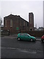
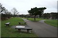
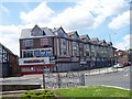
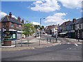
53 photos from this area
Area Information
Key information about the S5 6SG including its size, population, and administrative classification.
- Area Type
- Postcode
- Area Size
- 2.3 hectares
- Population
- 1653
- Population Density
- 6868 people/km²
House Prices in S5 6SG
50
Properties
£66,800
Average Sold Price
£25,500
Lowest Price
£100,000
Highest Price
Showing 50 properties
| Address | Type | Beds | Baths | Last Sale Price | Last Sale Date | |
|---|---|---|---|---|---|---|
| 203 Horninglow Road, Sheffield, S5 6SG | Terraced | 3 | 1 | £100,000 | Jun 2020 | |
| 205 Horninglow Road, Sheffield, S5 6SG | Terraced | 3 | 1 | £73,000 | May 2018 | |
| 182 Horninglow Road, Sheffield, S5 6SG | house | - | - | £52,200 | Oct 2014 | |
| 207 Horninglow Road, Sheffield, S5 6SG | house | 3 | - | £70,000 | Oct 2011 | |
| 206 Horninglow Road, Sheffield, S5 6SG | house | - | - | £69,000 | Apr 2009 | |
| 166 Horninglow Road, Sheffield, S5 6SG | Terraced | 2 | - | £84,000 | Apr 2008 | |
| 196 Horninglow Road, Sheffield, S5 6SG | Terraced | - | - | £94,000 | Aug 2006 | |
| 198 Horninglow Road, Sheffield, S5 6SG | Terraced | 3 | 1 | £33,500 | Nov 2002 | |
| 187 Horninglow Road, Sheffield, S5 6SG | house | - | - | £25,500 | Oct 2002 | |
| 195 Horninglow Road, Sheffield, S5 6SG | Terraced | 2 | - | - | - |
Page 1 of 5
Energy Efficiency in S5 6SG
Amenities
Schools
| Rank | School | Type | Entry gender | Ages |
|---|
Explore more schools in this area
Go to Schools tabDemographics
Household Size
Family (3-5 people)
most common
Accommodation Type
Houses
most common
Tenure
33
majority
Ethnic Group
White
most common
Religion
N/A
most common
Household Composition
N/A
most common
Age
47
median
Adults (30-64 years)
most common
Household Deprivation
N/A
with no deprivation
NS-SEC
12
in Lower managerial occupations
Explore more demographic insights in this area
Go to Demographics tabPlanning
Planning Constraints
- Flood RiskPremium
- Ramsar Wetland SitesPremium
- Area of Outstanding Natural BeautyPremium
- Protected Nature ReservePremium
- Protected WoodlandPremium