Area Overview for S5 6HH
Photos of S5 6HH
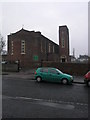
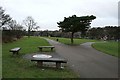
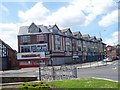
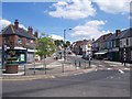


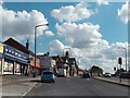

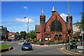
53 photos from this area
Area Information
Key information about the S5 6HH including its size, population, and administrative classification.
- Area Type
- Postcode
- Area Size
- 3.6 hectares
- Population
- 1653
- Population Density
- 6868 people/km²
House Prices in S5 6HH
35
Properties
£106,292
Average Sold Price
£19,000
Lowest Price
£200,000
Highest Price
Showing 35 properties
| Address | Type | Beds | Baths | Last Sale Price | Last Sale Date | |
|---|---|---|---|---|---|---|
| 396 Firth Park Road, Sheffield, S5 6HH | Semi-detached | 3 | 1 | £185,000 | Oct 2024 | |
| 376 Firth Park Road, Sheffield, S5 6HH | house | - | - | £200,000 | May 2023 | |
| 394 Firth Park Road, Sheffield, S5 6HH | Semi-detached | 4 | 1 | £200,000 | Mar 2023 | |
| 372 Firth Park Road, Sheffield, S5 6HH | house | - | - | £140,000 | Sep 2020 | |
| 406 Firth Park Road, Sheffield, S5 6HH | house | - | - | £81,000 | Jul 2019 | |
| 404 Firth Park Road, Sheffield, S5 6HH | house | 3 | - | £65,000 | Sep 2018 | |
| 414 Firth Park Road, Sheffield, S5 6HH | house | - | - | £104,000 | Apr 2018 | |
| 382 Firth Park Road, Sheffield, S5 6HH | Semi-detached | - | - | £122,000 | May 2012 | |
| 378 Firth Park Road, Sheffield, S5 6HH | house | - | - | £165,500 | Nov 2009 | |
| 386 Firth Park Road, Sheffield, S5 6HH | house | - | - | £128,000 | Sep 2009 |
Page 1 of 4
Energy Efficiency in S5 6HH
Amenities
Schools
| Rank | School | Type | Entry gender | Ages |
|---|
Explore more schools in this area
Go to Schools tabDemographics
Household Size
Family (3-5 people)
most common
Accommodation Type
Houses
most common
Tenure
33
majority
Ethnic Group
White
most common
Religion
N/A
most common
Household Composition
N/A
most common
Age
47
median
Adults (30-64 years)
most common
Household Deprivation
N/A
with no deprivation
NS-SEC
12
in Lower managerial occupations
Explore more demographic insights in this area
Go to Demographics tabPlanning
Planning Constraints
- Flood RiskPremium
- Ramsar Wetland SitesPremium
- Area of Outstanding Natural BeautyPremium
- Protected Nature ReservePremium
- Protected WoodlandPremium