Area Overview for S5 0PW
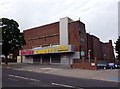
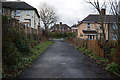
Photos of S5 0PW


Area Information
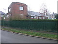
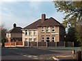
Living in postcodes such as S5 0PW invites you into a specific residential cluster within the wider Sheffield landscape. This particular area contains a population of 1670 residents, creating a neighbourhood that feels intimate yet is part of a larger urban fabric. You will find houses as the predominant form of accommodation, which shapes the street character for those buying homes in this location. The community is defined by its settled nature, with a significant portion of the population falling into the adult age bracket of 30 to 64 years. This demographic skew suggests an environment where families have established themselves and may eventually move towards later-life stages. The average resident is around 47 years old, indicating a mature community where long-term stability is likely high. Daily life for you revolves around practicality and local access. The site is described as covering a small residential cluster, meaning you do not travel far for most essentials. While it lacks the broad variety found in larger districts, the concentration of homes allows for a quiet existence. You are not looking at a sprawling development but a defined group of properties. The area holds a distinct identity separate from the broader postcode regions, offering a contained living experience. Prospective buyers looking for homes in S5 0PW are seeking something rooted and specific. The population size ensures you are not in an isolated settlement, yet the density remains low enough to avoid noise or congestion. Your daily routine likely involves walking to local shops or stepping into a short car journey.
- Area Type
- Postcode
- Area Size
- Not available
- Population
- 1670
- Population Density
- 6051 people/km²
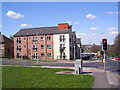
The property market in S5 0PW is defined by a steady presence of owner-occupiers alongside a substantial rental sector. With only 41% home ownership, the area remains popular with those looking to rent or live long-term without the immediate pressure of purchase. You will find houses as the main type of accommodation, catering to buyers who prefer detached or semi-detached living over flats or terraced units. This housing format is the standard for residents in this small cluster. The market dynamics here reflect a traditional pattern rather than a modern high-rise development. When searching for homes in S5 0PW, you are looking at a stock that prioritises space and privacy. The low level of home ownership indicates that a significant number of people are committed to the area without selling up quickly. This cohort often stays for decades, building deep roots in the locality. For you, a buyer or seller, this means a market where prices are set against a backdrop of stability. The accommodation type limits options, ensuring that what you see is largely a mix of family-sized houses. Understanding this 41% ownership rate helps you gauge whether the area is a neighbourhood of investment for young buyers or a sanctuary for those already established. The market does not revolve around luxury apartments or student accommodation but rather everyday houses.
House Prices in S5 0PW
No properties found in this postcode.
Energy Efficiency in S5 0PW
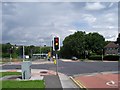
Living in S5 0PW gives you convenient access to a range of amenities without the need to travel far. Retail options are well represented, with five notable shops within the cluster. You will find major retailers such as Iceland Sheffield, Heron Firth, and Tesco Sheffield right on your doorstep. These five stores offer you daily essentials, from fresh groceries to household goods, ensuring you do not need to drive far for routine shopping. For residents who appreciate independence, having these high-street retailers close by is a major benefit. Transport and leisure facilities are also nearby, enhancing your lifestyle. You have five rail connections and five metro services accessible for travels beyond the immediate neighbourhood. These include connections at Medowhall Interchange Platform, Meadowhall South, and routes from Leppings Lane to Middlewood. While the data does not list parks or leisure centres specifically, the presence of extensive transport and retail networks suggests a built environment designed for accessibility. Your evenings and weekends can be spent exploring the broader Sheffield area with ease, or you can relax knowing your daily needs are met locally. The proximity to Iceland and Tesco means you can manage your budget and diet without leaving the area. This convenience defines the everyday experience for anyone living here.
Amenities
Schools
Families in S5 0PW have access to specific educational institutions nearby, though the choices are limited to primary and secondary providers. You will find St Patrick's Catholic Primary School, which serves children in the early years of their education. For secondary education, residents look towards St Patrick's Catholic Voluntary Academy. This academy carries an Ofsted rating of inadequate, a critical detail for any parent considering schools near S5 0PW. The mix of school types offers you a primary choice and a secondary option under the same trust umbrella, yet the rating requires careful consideration. The presence of an inadequate rating on the secondary academy means you cannot assume all education in the catchment area meets the highest standards without checking individual records. You must weigh the stability of the primary school against the performance rating of the secondary provider. The data lists only these two institutions, meaning you have a narrow choice for education within the immediate vicinity. If your priorities involve high-performing academic results at the secondary level, this specific location may require further research into transport to other schools outside the list. For young families, the proximity to St Patrick's Catholic Primary School is a positive factor, even if the secondary option presents a challenge. The educational landscape is straightforward but demanding of parental attention regarding the academy's rating.
| Rank | School | Type | Entry gender | Ages |
|---|
Explore more schools in this area
Go to Schools tabDemographics
The community in S5 0PW is characterised by a mature demographic profile, with a median age of 47 years. Most of the population consists of adults between the ages of 30 and 64, which paints a picture of a stable, established neighbourhood. This age range often correlates with families that have grown children or couples who have spent time in their careers before children. Only 41% of households own their homes outright, meaning that over half of the residents are likely tenants or still paying a mortgage. This mix influences the social fabric, as you will encounter both long-term owners and long-term renters within the same streets. The predominant ethnic group in S5 0PW identifies as White, contributing to the cultural uniformity of the local population. Accommodation types are primarily houses, which typically offer more internal space and outdoor gardens compared to apartments. This housing stock is suited to the lifestyle of the residents, who value living in a single-family unit rather than a block of flats. The lack of specific data on other social metrics means the demographic picture relies heavily on these clear figures. You can expect a neighbourhood where social networks are likely longstanding. The resistance to rapid demographic shifts suggests a residential market that prides itself on tradition. These facts define who lives here and shape the social interactions you might experience if you choose to move to this postcode.
Household Size
Accommodation Type
Tenure
Ethnic Group
Religion
Household Composition
Age
Household Deprivation
NS-SEC
Explore more demographic insights in this area
Go to Demographics tabPlanning
Planning Constraints
- Flood RiskPremium
- Ramsar Wetland SitesPremium
- Area of Outstanding Natural BeautyPremium
- Protected Nature ReservePremium
- Protected WoodlandPremium