Area Overview for S5 0JJ
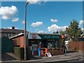
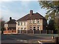
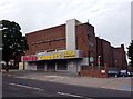
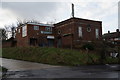
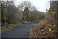
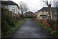
Photos of S5 0JJ


Area Information
The postcode area designated S5 0JJ represents a compact residential cluster covering just 1.3 hectares. Located within Greater Sheffield, this small footprint holds a community of 1,648 people. The high population density of 127,649 people per square kilometre indicates that residents live in close proximity to one another, creating a contained sense of neighbourhood. This specific area functions as a distinct pocket within the wider housing landscape of the region. Living in S5 0JJ means you are part of a tightly knit community where local interactions can be frequent due to the limited space. The area serves a specific demographic, predominantly consisting of adults between the ages of 30 and 64. While the sheer size of the postcode is modest, it provides direct access to the broader opportunities of Sheffield. You will find this location offers a straightforward living environment without the sprawl of larger municipalities. The area size suggests that everything from local amenities to transport links is within a short reach. Residents here benefit from being situated in a sector that balances residential comfort with connectivity to major hubs.
- Area Type
- Postcode
- Area Size
- 1.3 hectares
- Population
- 1648
- Population Density
- 7113 people/km²
The housing stock in S5 0JJ is characterised overwhelmingly by houses, offering traditional family accommodation rather than flats or apartments. With 44 percent of residents owning their homes, the area functions largely as an established residential zone rather than a transient rental market. This high proportion of homeowners suggests a stable environment where properties often stay in families for extended periods. Buyers looking at S5 0JJ should expect to find substantial properties suited to adult residents, given the area's focus on houses over other dwelling types. The limited land area of 1.3 hectares constrains the overall number of available properties within this specific postcode boundary. Prospective buyers interested in homes in S5 0JJ must act quickly, as the inventory of a 1,648-person area is finite. The market here caters to those seeking independence and space, aligning with the age profile of the 30-64 year old demographic. While specific price data is not available in the current records, the ownership rate implies a market where security of tenure is a significant factor for current residents.
House Prices in S5 0JJ
Showing 38 properties
| Address | Type | Beds | Baths | Last Sale Price | Last Sale Date | |
|---|---|---|---|---|---|---|
| 35 Renathorpe Road, Sheffield, S5 0JJ | Semi-detached | 2 | 1 | £100,000 | May 2023 | |
| 29 Renathorpe Road, Sheffield, S5 0JJ | Semi-detached | 2 | 1 | £81,500 | Dec 2018 | |
| 2 Renathorpe Road, Sheffield, S5 0JJ | Semi-detached | 3 | 1 | £80,000 | Oct 2018 | |
| 5 Renathorpe Road, Sheffield, S5 0JJ | Semi-detached | 2 | 1 | £63,000 | Jul 2018 | |
| 34 Renathorpe Road, Sheffield, S5 0JJ | Semi-detached | - | - | £76,000 | Nov 2006 | |
| 16 Renathorpe Road, Sheffield, S5 0JJ | house | - | - | £20,000 | Feb 2002 | |
| 23 Renathorpe Road, Sheffield, S5 0JJ | house | - | - | - | - | |
| 20 Renathorpe Road, Sheffield, S5 0JJ | house | - | - | - | - | |
| 27 Renathorpe Road, Sheffield, S5 0JJ | Semi-detached | - | - | - | - | |
| 39 Renathorpe Road, Sheffield, S5 0JJ | house | - | - | - | - |
Energy Efficiency in S5 0JJ
Residents of S5 0JJ enjoy convenient access to essential retail and transport hubs without needing to travel far. Within practical reach, there are five major retail options, including Iceland Sheffield, Heron Firth, and Co-op Ecclesfield. These venues provide daily necessities, groceries, and household essentials close to your doorstep. For commuting, five rail stations serve the area, most notably Medowhall Railway Station and Darnall Railway Station. The transport network also includes five metro points, such as the Meadowhall Interchange Platform and Carbrook Platform to Meadowhall. Living in S5 0JJ offers straightforward access to these facilities, ensuring your daily routine involves minimal travel time. The area does not include large parklands or protected nature reserves within its immediate 1.3 hectares, but the nearby amenities compensate for this. You can visit the listed supermarkets and railway stations to sustain your lifestyle with ease. The concentration of these five retail and five transport links creates a well-served environment for residents of the postcode.
Amenities
Schools
| Rank | School | Type | Entry gender | Ages |
|---|
Explore more schools in this area
Go to Schools tabDemographics
The community residing in S5 0JJ is defined by a clear age profile, with the vast majority of adults falling between the ages of 30 and 64 years. Consequently, the median age of the population sits at 47 years, reflecting a neighbourhood populated by established individuals rather than students or retirees. Houses make up the primary accommodation type, offering detached or semi-detached living arrangements rather than apartments. Regarding financial stability within households, 44 percent of residents own their homes outright. This figure leaves just under half of the population as tenants or those paying mortgages. The area shows no coastal or extreme deprivation indicators in the provided records. The predominant ethnic group is White, forming the core demographic makeup of the 1,648 residents. Living in S5 0JJ presents a picture of a settled community where households are likely stable. The lack of young children or pensioners in significant numbers suggests daily life revolves around working-age individuals or carers. Home ownership rates indicate a segment of the population with significant equity, while others seek flexibility in the local housing market.
Household Size
Accommodation Type
Tenure
Ethnic Group
Religion
Household Composition
Age
Household Deprivation
NS-SEC
Explore more demographic insights in this area
Go to Demographics tabPlanning
Planning Constraints
- Flood RiskPremium
- Ramsar Wetland SitesPremium
- Area of Outstanding Natural BeautyPremium
- Protected Nature ReservePremium
- Protected WoodlandPremium