Area Overview for S5 0EE
Photos of S5 0EE
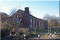


48 photos from this area
Area Information
Key information about the S5 0EE including its size, population, and administrative classification.
- Area Type
- Postcode
- Area Size
- 9285 m²
- Population
- 1387
- Population Density
- 7113 people/km²
House Prices in S5 0EE
28
Properties
£64,929
Average Sold Price
£32,000
Lowest Price
£84,500
Highest Price
Showing 28 properties
| Address | Type | Beds | Baths | Last Sale Price | Last Sale Date | |
|---|---|---|---|---|---|---|
| 321 Sicey Avenue, Sheffield, S5 0EE | Semi-detached | 3 | 1 | £84,500 | Dec 2020 | |
| 331 Sicey Avenue, Sheffield, S5 0EE | Terraced | 3 | 1 | £71,000 | May 2015 | |
| 313 Sicey Avenue, Sheffield, S5 0EE | house | 2 | 1 | £75,000 | Aug 2007 | |
| 333 Sicey Avenue, Sheffield, S5 0EE | Terraced | - | - | £67,000 | Jan 2006 | |
| 325 Sicey Avenue, Sheffield, S5 0EE | Semi-detached | - | - | £54,000 | Dec 2005 | |
| 301 Sicey Avenue, Sheffield, S5 0EE | Semi-detached | 3 | 1 | £71,000 | Jun 2004 | |
| 323 Sicey Avenue, Sheffield, S5 0EE | house | - | - | £32,000 | Dec 2001 | |
| 309 Sicey Avenue, Sheffield, S5 0EE | Terraced | - | - | - | - | |
| 315 Sicey Avenue, Sheffield, S5 0EE | Terraced | - | - | - | - | |
| 317 Sicey Avenue, Sheffield, S5 0EE | house | - | - | - | - |
Page 1 of 3
Energy Efficiency in S5 0EE
Amenities
Schools
| Rank | School | Type | Entry gender | Ages |
|---|
Explore more schools in this area
Go to Schools tabDemographics
Household Size
Family (3-5 people)
most common
Accommodation Type
Houses
most common
Tenure
40
majority
Ethnic Group
White
most common
Religion
N/A
most common
Household Composition
N/A
most common
Age
47
median
Adults (30-64 years)
most common
Household Deprivation
N/A
with no deprivation
NS-SEC
15
in Lower managerial occupations
Explore more demographic insights in this area
Go to Demographics tabPlanning
Planning Constraints
- Flood RiskPremium
- Ramsar Wetland SitesPremium
- Area of Outstanding Natural BeautyPremium
- Protected Nature ReservePremium
- Protected WoodlandPremium